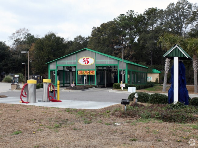
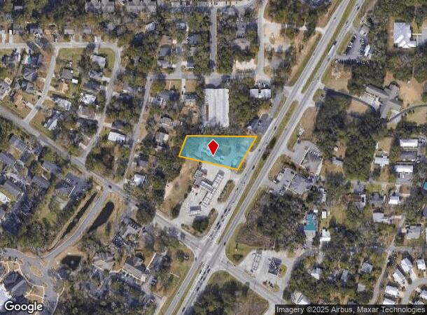
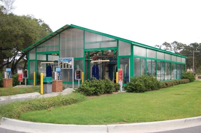
Property Record
4540 Highway 17, Murrells Inlet, SC 29576

NEARBY LISTINGS FOR SALE OR LEASE
-
-
View all Murrells Inlet listings for lease on LoopNet.com
Property Detail
4540 Highway 17
41-0119-023-02-02
US HWY #17 BYPASS MURRELLS INLET SLD 512-9A; SLD 799-8
Commercialnec
Georgetown
X
South Carolina
45043C0241G
0.90 AC
2024
Myrtle Beach South
2024
Other Market Areas
051608
Georgetown, SC
DEMOGRAPHICS near 4540 Highway 17
1 Mile
3 Mile
5 Mile
2024 Total Population
3,756
18,612
39,523
2029 Population
3,935
20,852
46,402
Pop Growth 2024-2029
+ 4.77%
+ 12.04%
+ 17.41%
Average Age
52
53
53
2024 Total Households
1,844
8,776
18,807
HH Growth 2024-2029
+ 4.45%
+ 11.14%
+ 16.44%
Median Household Inc
$53,541
$64,876
$63,297
Avg Household Size
2.00
2.10
2.00
2024 Avg HH Vehicles
2.00
2.00
2.00
Median Home Value
$263,145
$285,413
$262,519
Median Year Built
1997
2002
1998
Nearby Places
Map Layers
Map Styles
 Street
 Aerial
- Restaurants
- Banks
- Shops
- Fitness
- Groceries
PUBLIC TRANSPORTATION
AIRPORT
Myrtle Beach International
DRIVE
WALK
Distance
Myrtle Beach International
25 min
15.8 mi
Freight Ports
Wando Welch Terminal
DRIVE
WALK
Distance
Wando Welch Terminal
100 min
75.2 mi
SALE & LEASE HISTORY
LISTING DATE
SALE/LEASE

Dec 30, 2024
For Lease
Nearby Properties
Address
Land Use
TOTAL SIZE
Lot Size
Zoning
Address
Land Use
TOTAL SIZE
Lot Size
Zoning
20.55 AC
Address
Land Use
TOTAL SIZE
Lot Size
Zoning
8,169 SF
2.70 AC
Address
Land Use
TOTAL SIZE
Lot Size
Zoning
39,090 SF
3.76 AC
Address
Land Use
TOTAL SIZE
Lot Size
Zoning
Address
Land Use
TOTAL SIZE
Lot Size
Zoning
13,244 SF
3.50 AC
Address
Land Use
TOTAL SIZE
Lot Size
Zoning
Address
Land Use
TOTAL SIZE
Lot Size
Zoning
15,704 SF
1.97 AC
Address
Land Use
TOTAL SIZE
Lot Size
Zoning
4.60 AC
Address
Land Use
TOTAL SIZE
Lot Size
Zoning
10,532 SF
2.90 AC
Address
Land Use
TOTAL SIZE
Lot Size
Zoning
5,570 SF
21.44 AC
Address
Land Use
TOTAL SIZE
Lot Size
Zoning
Address
Land Use
TOTAL SIZE
Lot Size
Zoning
6,170 SF
2.50 AC
Address
Land Use
TOTAL SIZE
Lot Size
Zoning
Address
Land Use
TOTAL SIZE
Lot Size
Zoning
Address
Land Use
TOTAL SIZE
Lot Size
Zoning
Address
Land Use
TOTAL SIZE
Lot Size
Zoning
Address
Land Use
TOTAL SIZE
Lot Size
Zoning
4,800 SF
75.54 AC
Address
Land Use
TOTAL SIZE
Lot Size
Zoning
6,382 SF
19.39 AC
Address
Land Use
TOTAL SIZE
Lot Size
Zoning
Address
Land Use
TOTAL SIZE
Lot Size
Zoning
64,620 SF
7.90 AC
Address
Land Use
TOTAL SIZE
Lot Size
Zoning
3,052 SF
1 AC
Address
Land Use
TOTAL SIZE
Lot Size
Zoning
Address
Land Use
TOTAL SIZE
Lot Size
Zoning
108,250 SF
14.53 AC
Address
Land Use
TOTAL SIZE
Lot Size
Zoning
3,343 SF
0.41 AC
Address
Land Use
TOTAL SIZE
Lot Size
Zoning
Address
Land Use
TOTAL SIZE
Lot Size
Zoning
8,640 SF
5.47 AC
Address
Land Use
TOTAL SIZE
Lot Size
Zoning
80,797 SF
33.77 AC
Address
Land Use
TOTAL SIZE
Lot Size
Zoning
2,496 SF
40.08 AC
Address
Land Use
TOTAL SIZE
Lot Size
Zoning
3,339 SF
1 AC
The World's #1 Commercial Real Estate Marketplace
Connect with us
© 2025 CoStar Group
The information above has been obtained from sources believed reliable. While we do not doubt its accuracy we have not verified it and make no guarantee, warranty or representation about it. It is your responsibility to independently confirm its accuracy and completeness. Any projections, opinions, assumptions, or estimates used are for example only and do not represent the current or future performance of the property. The value of this transaction to you depends on tax and other factors which should be evaluated by your tax, financial, and legal advisors. You and your advisors should conduct a careful, independent investigation of the property to determine to your satisfaction the suitability of the property for your needs.