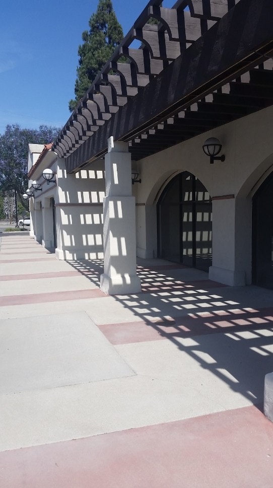
Property Record
4542 Las Posas Rd, Camarillo, CA 93010


Current Lease Availabilities
Property Detail
4542 Las Posas Rd
167-0-250-485
REF: 48 PM 77
Storebuilding
Ventura
C and X Area of minimal flood hazard, usually depicted on FIRMs as above the 500-year flood level.
California
2024
1.57 AC
2025
Camarillo/Point Mugu
005202
Los Angeles
13,710 SF
Oxnard-Thousand Oaks-Ventura, CA
NEARBY LISTINGS FOR SALE OR LEASE
-
-
View all Camarillo listings for lease on LoopNet.com
DEMOGRAPHICS near 4542 Las Posas Rd
1 mile
3 mile
5 mile
2025 Total Population
9,248
59,299
82,262
2030 Population
9,163
58,827
81,740
Pop Growth 2025-2030
(0.92%)
(0.80%)
(0.63%)
Average Age
41
44
43
2025 Total Households
3,146
21,718
30,549
HH Growth 2025-2030
(1.05%)
(0.93%)
(0.78%)
Median Household Inc
$137,687
$117,584
$118,078
Avg Household Size
2.90
2.70
2.60
2025 Avg HH Vehicles
3.00
2.00
2.00
Median Home Value
$853,083
$807,637
$834,109
Median Year Built
1989
1977
1979
Nearby Places
Map Layers
Map Styles
 Street
 Aerial
Layers
 Traffic
 Biking
Places
Listings with unknown addresses are not visible on the map
- Restaurants
- Banks
- Shops
- Fitness
- Groceries
PUBLIC TRANSPORTATION
COMMUTER RAIL
Camarillo (Ventura County Line - Southern California Regional Rail Authority (Metrolink))
Drive
Walk
Distance
Camarillo (Ventura County Line - Southern California Regional Rail Authority (Metrolink))
5 min
2.5 mi
Moorpark (Ventura County Line - Southern California Regional Rail Authority (Metrolink))
Drive
Walk
Distance
Moorpark (Ventura County Line - Southern California Regional Rail Authority (Metrolink))
16 min
9.0 mi
Freight Ports
The Port of Hueneme
Drive
Walk
Distance
The Port of Hueneme
24 min
14.3 mi
Nearby Properties
Address
Land Use
TOTAL SIZE
Lot Size
Zoning
Address
Land Use
TOTAL SIZE
Lot Size
Zoning
15.13 AC
Address
Land Use
TOTAL SIZE
Lot Size
Zoning
9.66 AC
PO
Address
Land Use
TOTAL SIZE
Lot Size
Zoning
67,766 SF
19.31 AC
M2
Address
Land Use
TOTAL SIZE
Lot Size
Zoning
45,587 SF
18.30 AC
Address
Land Use
TOTAL SIZE
Lot Size
Zoning
3.31 AC
Address
Land Use
TOTAL SIZE
Lot Size
Zoning
191,193 SF
31.89 AC
M1
Address
Land Use
TOTAL SIZE
Lot Size
Zoning
98,344 SF
7.40 AC
RPD3
Address
Land Use
TOTAL SIZE
Lot Size
Zoning
3.12 AC
Address
Land Use
TOTAL SIZE
Lot Size
Zoning
13.99 AC
Address
Land Use
TOTAL SIZE
Lot Size
Zoning
9.76 AC
Address
Land Use
TOTAL SIZE
Lot Size
Zoning
3.72 AC
CPD
Address
Land Use
TOTAL SIZE
Lot Size
Zoning
69,560 SF
3.47 AC
Address
Land Use
TOTAL SIZE
Lot Size
Zoning
19.69 AC
Address
Land Use
TOTAL SIZE
Lot Size
Zoning
48,546 SF
4.01 AC
M1
Address
Land Use
TOTAL SIZE
Lot Size
Zoning
77,837 SF
6.46 AC
Address
Land Use
TOTAL SIZE
Lot Size
Zoning
2.66 AC
Address
Land Use
TOTAL SIZE
Lot Size
Zoning
120,688 SF
6.44 AC
Address
Land Use
TOTAL SIZE
Lot Size
Zoning
66,716 SF
1.79 AC
Address
Land Use
TOTAL SIZE
Lot Size
Zoning
117,342 SF
7.20 AC
Address
Land Use
TOTAL SIZE
Lot Size
Zoning
1,568 SF
9.87 AC
CPD
Address
Land Use
TOTAL SIZE
Lot Size
Zoning
114,645 SF
5.29 AC
RPD
Address
Land Use
TOTAL SIZE
Lot Size
Zoning
134,311 SF
7.15 AC
M1
Address
Land Use
TOTAL SIZE
Lot Size
Zoning
4.76 AC
Address
Land Use
TOTAL SIZE
Lot Size
Zoning
76,037 SF
6 AC
M2
Address
Land Use
TOTAL SIZE
Lot Size
Zoning
117,112 SF
9.03 AC
M-1
Address
Land Use
TOTAL SIZE
Lot Size
Zoning
Address
Land Use
TOTAL SIZE
Lot Size
Zoning
8.49 AC
Address
Land Use
TOTAL SIZE
Lot Size
Zoning
58,169 SF
3.55 AC
Address
Land Use
TOTAL SIZE
Lot Size
Zoning
4.79 AC
Address
Land Use
TOTAL SIZE
Lot Size
Zoning
60,952 SF
15.59 AC
The World's #1 Commercial Real Estate Marketplace
Connect with us
© 2026 CoStar Group
The information above has been obtained from sources believed reliable. While we do not doubt its accuracy we have not verified it and make no guarantee, warranty or representation about it. It is your responsibility to independently confirm its accuracy and completeness. Any projections, opinions, assumptions, or estimates used are for example only and do not represent the current or future performance of the property. The value of this transaction to you depends on tax and other factors which should be evaluated by your tax, financial, and legal advisors. You and your advisors should conduct a careful, independent investigation of the property to determine to your satisfaction the suitability of the property for your needs.