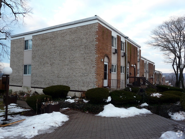
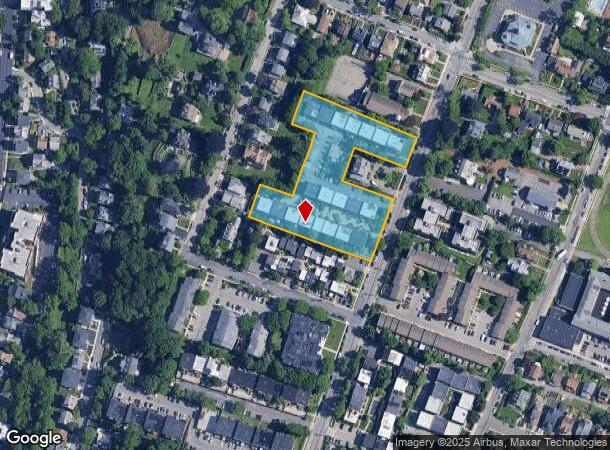
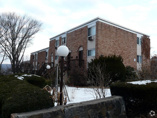
Property Record
455 N Broadway, Yonkers, NY 10701

NEARBY LISTINGS FOR SALE OR LEASE
Property Detail
455 N Broadway
1800-002-000-02141-000-0058-70
Weschestertowne Houses Condominium
Apartment
Westchester
X
New York
34003C0210H
58.070
2025
2.65 AC
2024
Northwest Yonkers
000701
Westchester/So Connecticut
26,208 SF
New York-Jersey City-White Plains, NY-NJ
DEMOGRAPHICS near 455 N Broadway
1 Mile
3 Mile
5 Mile
2024 Total Population
39,369
183,995
542,271
2029 Population
38,317
179,607
522,266
Pop Growth 2024-2029
(2.67%)
(2.38%)
(3.69%)
Average Age
39
40
41
2024 Total Households
15,016
68,497
202,974
HH Growth 2024-2029
(2.80%)
(2.53%)
(3.96%)
Median Household Inc
$61,663
$71,036
$82,543
Avg Household Size
2.50
2.50
2.50
2024 Avg HH Vehicles
1.00
1.00
1.00
Median Home Value
$391,593
$476,108
$573,110
Median Year Built
1959
1956
1953
Nearby Places
- Restaurants
- Banks
- Shops
- Fitness
- Groceries
PUBLIC TRANSPORTATION
COMMUTER RAIL
Glenwood Station (Hudson Line - Metro-North Commuter Railroad Company (Metro-North))
DRIVE
WALK
Distance
Glenwood Station (Hudson Line - Metro-North Commuter Railroad Company (Metro-North))
5 min
16 min
0.8 mi
Yonkers Station (Hudson Line - Metro-North Commuter Railroad Company (Metro-North))
DRIVE
WALK
Distance
Yonkers Station (Hudson Line - Metro-North Commuter Railroad Company (Metro-North))
3 min
1.5 mi
AIRPORT
LaGuardia
DRIVE
WALK
Distance
LaGuardia
30 min
16.9 mi
Westchester County
DRIVE
WALK
Distance
Westchester County
29 min
20.6 mi
John F Kennedy International
DRIVE
WALK
Distance
John F Kennedy International
40 min
26.6 mi
Freight Ports
NY - Red Hook Container Terminal
DRIVE
WALK
Distance
NY - Red Hook Container Terminal
43 min
25.0 mi
Nearby Properties
Address
Land Use
TOTAL SIZE
Lot Size
Zoning
Address
Land Use
TOTAL SIZE
Lot Size
Zoning
1,125 SF
542.62 AC
RA
Address
Land Use
TOTAL SIZE
Lot Size
Zoning
689 SF
423.72 AC
P
Address
Land Use
TOTAL SIZE
Lot Size
Zoning
289.02 AC
P
Address
Land Use
TOTAL SIZE
Lot Size
Zoning
201,590 SF
4.13 AC
BA
Address
Land Use
TOTAL SIZE
Lot Size
Zoning
229.55 AC
P
Address
Land Use
TOTAL SIZE
Lot Size
Zoning
185.35 AC
P
Address
Land Use
TOTAL SIZE
Lot Size
Zoning
166.61 AC
P
Address
Land Use
TOTAL SIZE
Lot Size
Zoning
23.97 AC
Address
Land Use
TOTAL SIZE
Lot Size
Zoning
135.51 AC
RR
Address
Land Use
TOTAL SIZE
Lot Size
Zoning
94.42 AC
P
Address
Land Use
TOTAL SIZE
Lot Size
Zoning
450,784 SF
42.36 AC
R4
Address
Land Use
TOTAL SIZE
Lot Size
Zoning
163.19 AC
Address
Land Use
TOTAL SIZE
Lot Size
Zoning
Address
Land Use
TOTAL SIZE
Lot Size
Zoning
58.78 AC
P
Address
Land Use
TOTAL SIZE
Lot Size
Zoning
193,520 SF
4.32 AC
R4
Address
Land Use
TOTAL SIZE
Lot Size
Zoning
54.65 AC
P
Address
Land Use
TOTAL SIZE
Lot Size
Zoning
Address
Land Use
TOTAL SIZE
Lot Size
Zoning
15,828 SF
17.71 AC
Address
Land Use
TOTAL SIZE
Lot Size
Zoning
47.14 AC
P
Address
Land Use
TOTAL SIZE
Lot Size
Zoning
159,260 SF
12.19 AC
R4
Address
Land Use
TOTAL SIZE
Lot Size
Zoning
192,939 SF
12.57 AC
R4
Address
Land Use
TOTAL SIZE
Lot Size
Zoning
Address
Land Use
TOTAL SIZE
Lot Size
Zoning
30.29 AC
P
Address
Land Use
TOTAL SIZE
Lot Size
Zoning
25.58 AC
P
Address
Land Use
TOTAL SIZE
Lot Size
Zoning
25 AC
P
Address
Land Use
TOTAL SIZE
Lot Size
Zoning
83,366 SF
5.92 AC
R4
Address
Land Use
TOTAL SIZE
Lot Size
Zoning
125,976 SF
1.42 AC
R4
Address
Land Use
TOTAL SIZE
Lot Size
Zoning
34,560 SF
0.28 AC
BA
Address
Land Use
TOTAL SIZE
Lot Size
Zoning
18.57 AC
P
Address
Land Use
TOTAL SIZE
Lot Size
Zoning
The World's #1 Commercial Real Estate Marketplace
Connect with us
© 2025 CoStar Group
The information above has been obtained from sources believed reliable. While we do not doubt its accuracy we have not verified it and make no guarantee, warranty or representation about it. It is your responsibility to independently confirm its accuracy and completeness. Any projections, opinions, assumptions, or estimates used are for example only and do not represent the current or future performance of the property. The value of this transaction to you depends on tax and other factors which should be evaluated by your tax, financial, and legal advisors. You and your advisors should conduct a careful, independent investigation of the property to determine to your satisfaction the suitability of the property for your needs.