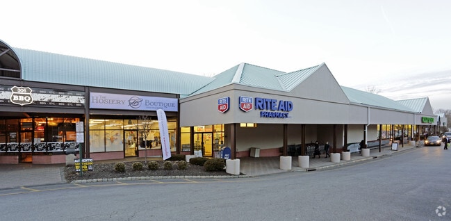
Property Record
455 Route 306, Monsey, NY 10952


NEARBY LISTINGS FOR SALE OR LEASE
Property Detail
455 Route 306
392611-041-011-0001-019-000-0000
+ 43G
Regionalshoppingcenterormallwithanchorstore
Rockland
AE
New York
36087C0089G
19.0
2023
5.75 AC
2024
Ramapo
011508
Northern New Jersey
54,216 SF
New York-Jersey City-White Plains, NY-NJ
DEMOGRAPHICS near 455 Route 306
1 Mile
3 Mile
5 Mile
2024 Total Population
7,767
84,311
195,308
2029 Population
7,792
83,940
194,507
Pop Growth 2024-2029
+ 0.32%
(0.44%)
(0.41%)
Average Age
33
30
34
2024 Total Households
1,810
19,437
53,419
HH Growth 2024-2029
+ 0.39%
(0.39%)
(0.36%)
Median Household Inc
$131,931
$78,754
$91,406
Avg Household Size
4.10
4.10
3.40
2024 Avg HH Vehicles
2.00
2.00
2.00
Median Home Value
$837,423
$694,821
$553,062
Median Year Built
1973
1976
1974
Nearby Places
Map Layers
Map Styles
 Street
 Aerial
- Restaurants
- Banks
- Shops
- Fitness
- Groceries
PUBLIC TRANSPORTATION
COMMUTER RAIL
Spring Valley (Pascack Valley Line - NJ Transit Commuter Rail (NJ Transit))
DRIVE
WALK
Distance
Spring Valley (Pascack Valley Line - NJ Transit Commuter Rail (NJ Transit))
9 min
4.2 mi
Suffern (Bergen County/Port Jervis Line - NJ Transit Commuter Rail (NJ Transit), Main/Port Jervis Line - NJ Transit Commuter Rail (NJ Transit))
DRIVE
WALK
Distance
Suffern (Bergen County/Port Jervis Line - NJ Transit Commuter Rail (NJ Transit), Main/Port Jervis Line - NJ Transit Commuter Rail (NJ Transit))
13 min
6.5 mi
AIRPORT
Westchester County
DRIVE
WALK
Distance
Westchester County
44 min
29.1 mi
New York Stewart International
DRIVE
WALK
Distance
New York Stewart International
53 min
34.7 mi
LaGuardia
DRIVE
WALK
Distance
LaGuardia
59 min
37.5 mi
Freight Ports
Maher Terminal
DRIVE
WALK
Distance
Maher Terminal
62 min
42.1 mi
Nearby Properties
Address
Land Use
TOTAL SIZE
Lot Size
Zoning
Address
Land Use
TOTAL SIZE
Lot Size
Zoning
609,540 SF
174.09 AC
R-50
Address
Land Use
TOTAL SIZE
Lot Size
Zoning
104,303 SF
71.26 AC
RR-50
Address
Land Use
TOTAL SIZE
Lot Size
Zoning
173,180 SF
40.10 AC
964
Address
Land Use
TOTAL SIZE
Lot Size
Zoning
38,056 SF
21.21 AC
R-15C
Address
Land Use
TOTAL SIZE
Lot Size
Zoning
282,001 SF
49.29 AC
RR50
Address
Land Use
TOTAL SIZE
Lot Size
Zoning
60,803 SF
6.70 AC
02 - SINGL
Address
Land Use
TOTAL SIZE
Lot Size
Zoning
243,977 SF
27.29 AC
R40
Address
Land Use
TOTAL SIZE
Lot Size
Zoning
56,546 SF
24.61 AC
RR-80
Address
Land Use
TOTAL SIZE
Lot Size
Zoning
152,070 SF
25.12 AC
1R50
Address
Land Use
TOTAL SIZE
Lot Size
Zoning
35,648 SF
10 AC
NS
Address
Land Use
TOTAL SIZE
Lot Size
Zoning
162,529 SF
2.67 AC
05
Address
Land Use
TOTAL SIZE
Lot Size
Zoning
91,625 SF
7.12 AC
R-15C
Address
Land Use
TOTAL SIZE
Lot Size
Zoning
690,321 SF
55.68 AC
IR50
Address
Land Use
TOTAL SIZE
Lot Size
Zoning
110,145 SF
7.16 AC
R-35
Address
Land Use
TOTAL SIZE
Lot Size
Zoning
82,192 SF
10.77 AC
05
Address
Land Use
TOTAL SIZE
Lot Size
Zoning
144,385 SF
20.68 AC
R-25
Address
Land Use
TOTAL SIZE
Lot Size
Zoning
21,332 SF
2.20 AC
962
Address
Land Use
TOTAL SIZE
Lot Size
Zoning
187,962 SF
8.05 AC
R-15
Address
Land Use
TOTAL SIZE
Lot Size
Zoning
365,217 SF
4.61 AC
RSH
Address
Land Use
TOTAL SIZE
Lot Size
Zoning
91,876 SF
4.52 AC
05
Address
Land Use
TOTAL SIZE
Lot Size
Zoning
18,433 SF
4.40 AC
501
Address
Land Use
TOTAL SIZE
Lot Size
Zoning
108,762 SF
4.42 AC
GB
Address
Land Use
TOTAL SIZE
Lot Size
Zoning
89,665 SF
7.57 AC
R-25
Address
Land Use
TOTAL SIZE
Lot Size
Zoning
29.48 AC
RR-80
Address
Land Use
TOTAL SIZE
Lot Size
Zoning
22.84 AC
LO
Address
Land Use
TOTAL SIZE
Lot Size
Zoning
33,141 SF
1.80 AC
R-15
Address
Land Use
TOTAL SIZE
Lot Size
Zoning
Address
Land Use
TOTAL SIZE
Lot Size
Zoning
49,624 SF
2.93 AC
03
Address
Land Use
TOTAL SIZE
Lot Size
Zoning
37,958 SF
2.27 AC
05
Address
Land Use
TOTAL SIZE
Lot Size
Zoning
50,448 SF
12 AC
The World's #1 Commercial Real Estate Marketplace
Connect with us
© 2026 CoStar Group
The information above has been obtained from sources believed reliable. While we do not doubt its accuracy we have not verified it and make no guarantee, warranty or representation about it. It is your responsibility to independently confirm its accuracy and completeness. Any projections, opinions, assumptions, or estimates used are for example only and do not represent the current or future performance of the property. The value of this transaction to you depends on tax and other factors which should be evaluated by your tax, financial, and legal advisors. You and your advisors should conduct a careful, independent investigation of the property to determine to your satisfaction the suitability of the property for your needs.