Property Record
455 Somerset Ave, North Dighton, MA 02764


NEARBY LISTINGS FOR SALE OR LEASE
-
-
View all North Dighton listings for sale on LoopNet.com
Property Detail
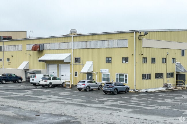
455 Somerset Ave
Manufacturinglight
Bristol
X
Massachusetts
25005C0251G
44 AC
2025
Attleboro/New Bedford
2025
Boston
615100
Providence-Warwick, RI-MA
35,717 SF
DIGH-000005-000002
DEMOGRAPHICS near 455 Somerset Ave
1 Mile
3 Mile
5 Mile
2024 Total Population
2,062
23,631
67,195
2029 Population
2,039
23,401
66,559
Pop Growth 2024-2029
(1.12%)
(0.97%)
(0.95%)
Average Age
41
40
41
2024 Total Households
744
9,086
26,034
HH Growth 2024-2029
(1.21%)
(1.02%)
(1.01%)
Median Household Inc
$100,600
$72,304
$74,036
Avg Household Size
2.70
2.60
2.50
2024 Avg HH Vehicles
2.00
2.00
2.00
Median Home Value
$388,932
$379,844
$380,002
Median Year Built
1980
1974
1970
Nearby Places
Map Layers
Map Styles
 Street
 Aerial
- Restaurants
- Banks
- Shops
- Fitness
- Groceries
PUBLIC TRANSPORTATION
AIRPORT
Rhode Island Tf Green International
DRIVE
WALK
Distance
Rhode Island Tf Green International
45 min
25.2 mi
Freight Ports
Port of New Bedford Harbor
DRIVE
WALK
Distance
Port of New Bedford Harbor
37 min
26.7 mi
Nearby Properties
Address
Land Use
TOTAL SIZE
Lot Size
Zoning
Address
Land Use
TOTAL SIZE
Lot Size
Zoning
174,000 SF
62.88 AC
R1
Address
Land Use
TOTAL SIZE
Lot Size
Zoning
351,320 SF
42 AC
INDUST
Address
Land Use
TOTAL SIZE
Lot Size
Zoning
5.20 AC
URBRES
Address
Land Use
TOTAL SIZE
Lot Size
Zoning
52,042 SF
59.53 AC
OPSPAC
Address
Land Use
TOTAL SIZE
Lot Size
Zoning
127,092 SF
9.37 AC
INDUST
Address
Land Use
TOTAL SIZE
Lot Size
Zoning
6.53 AC
URBRES
Address
Land Use
TOTAL SIZE
Lot Size
Zoning
76,960 SF
23.40 AC
C
Address
Land Use
TOTAL SIZE
Lot Size
Zoning
124,465 SF
15.08 AC
INDUST
Address
Land Use
TOTAL SIZE
Lot Size
Zoning
13 AC
HIWABZ
Address
Land Use
TOTAL SIZE
Lot Size
Zoning
108,692 SF
10.80 AC
R1
Address
Land Use
TOTAL SIZE
Lot Size
Zoning
3 AC
URBRES
Address
Land Use
TOTAL SIZE
Lot Size
Zoning
5.60 AC
INDUST
Address
Land Use
TOTAL SIZE
Lot Size
Zoning
24 AC
HIWABZ
Address
Land Use
TOTAL SIZE
Lot Size
Zoning
86,176 SF
7.14 AC
INDUST
Address
Land Use
TOTAL SIZE
Lot Size
Zoning
12.38 AC
INDUST
Address
Land Use
TOTAL SIZE
Lot Size
Zoning
29,400 SF
12.91 AC
I
Address
Land Use
TOTAL SIZE
Lot Size
Zoning
244,320 SF
13.66 AC
INDUST
Address
Land Use
TOTAL SIZE
Lot Size
Zoning
83,934 SF
7.39 AC
INDUST
Address
Land Use
TOTAL SIZE
Lot Size
Zoning
5,616 SF
10 AC
URBRES
Address
Land Use
TOTAL SIZE
Lot Size
Zoning
120 AC
OPSPAC
Address
Land Use
TOTAL SIZE
Lot Size
Zoning
58,078 SF
6.10 AC
HIWABZ
Address
Land Use
TOTAL SIZE
Lot Size
Zoning
50 AC
URBRES
Address
Land Use
TOTAL SIZE
Lot Size
Zoning
132,574 SF
7.70 AC
RURRES
Address
Land Use
TOTAL SIZE
Lot Size
Zoning
17.50 AC
I
Address
Land Use
TOTAL SIZE
Lot Size
Zoning
142,832 SF
6.57 AC
BIZDIS
Address
Land Use
TOTAL SIZE
Lot Size
Zoning
10,080 SF
6.70 AC
R1
Address
Land Use
TOTAL SIZE
Lot Size
Zoning
6,880 SF
53.30 AC
C
Address
Land Use
TOTAL SIZE
Lot Size
Zoning
19,401 SF
1.40 AC
URBRES
Address
Land Use
TOTAL SIZE
Lot Size
Zoning
23,127 SF
1.14 AC
URBRES
The World's #1 Commercial Real Estate Marketplace
Connect with us
© 2025 CoStar Group
The information above has been obtained from sources believed reliable. While we do not doubt its accuracy we have not verified it and make no guarantee, warranty or representation about it. It is your responsibility to independently confirm its accuracy and completeness. Any projections, opinions, assumptions, or estimates used are for example only and do not represent the current or future performance of the property. The value of this transaction to you depends on tax and other factors which should be evaluated by your tax, financial, and legal advisors. You and your advisors should conduct a careful, independent investigation of the property to determine to your satisfaction the suitability of the property for your needs.