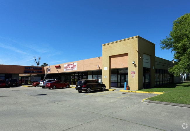
Property Record
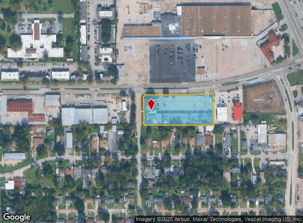
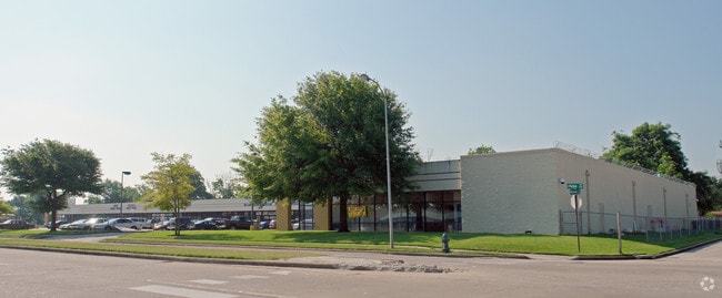
455 W Parker Rd, Houston, TX 77091

Current Lease Availabilities
NEARBY LISTINGS FOR SALE OR LEASE
Property Detail
455 W Parker Rd
0222460000115
Little York
Stripcommercialcenter
RES B PARKER ROAD BUSINESS CENTER LITTLE YORK ANNEX
AE
Harris
48201C0660M
Texas
2024
2.31 AC
2025
Near Northwest Oaks
530702
Houston
35,190 SF
Houston-The Woodlands-Sugar Land, TX
DEMOGRAPHICS near 455 W Parker Rd
1 Mile
3 Mile
5 Mile
2024 Total Population
17,238
126,907
358,854
2029 Population
17,637
129,889
367,431
Pop Growth 2024-2029
+ 2.31%
+ 2.35%
+ 2.39%
Average Age
34
36
36
2024 Total Households
5,661
41,899
125,713
HH Growth 2024-2029
+ 2.23%
+ 2.46%
+ 2.57%
Median Household Inc
$30,295
$42,655
$49,929
Avg Household Size
2.90
2.90
2.80
2024 Avg HH Vehicles
2.00
2.00
2.00
Median Home Value
$147,359
$188,274
$239,719
Median Year Built
1972
1968
1973
Nearby Places
Map Layers
Map Styles
 Street
 Aerial
- Restaurants
- Banks
- Shops
- Fitness
- Groceries
PUBLIC TRANSPORTATION
COMMUTER RAIL
Houston (Sunset Limited - Amtrak)
DRIVE
WALK
Distance
Houston (Sunset Limited - Amtrak)
12 min
7.4 mi
AIRPORT
George Bush Intcntl/Houston
DRIVE
WALK
Distance
George Bush Intcntl/Houston
19 min
13.8 mi
William P Hobby
DRIVE
WALK
Distance
William P Hobby
32 min
20.2 mi
Freight Ports
Port of Houston
DRIVE
WALK
Distance
Port of Houston
24 min
15.8 mi
Nearby Properties
Address
Land Use
TOTAL SIZE
Lot Size
Zoning
Address
Land Use
TOTAL SIZE
Lot Size
Zoning
563,626 SF
4.71 AC
Address
Land Use
TOTAL SIZE
Lot Size
Zoning
474,326 SF
43.16 AC
Address
Land Use
TOTAL SIZE
Lot Size
Zoning
432,691 SF
3.26 AC
Address
Land Use
TOTAL SIZE
Lot Size
Zoning
594,105 SF
43.68 AC
Address
Land Use
TOTAL SIZE
Lot Size
Zoning
402,433 SF
2.77 AC
Address
Land Use
TOTAL SIZE
Lot Size
Zoning
279,452 SF
5.69 AC
Address
Land Use
TOTAL SIZE
Lot Size
Zoning
531,786 SF
17.60 AC
Address
Land Use
TOTAL SIZE
Lot Size
Zoning
194,990 SF
16.36 AC
Address
Land Use
TOTAL SIZE
Lot Size
Zoning
105,268 SF
7.26 AC
Address
Land Use
TOTAL SIZE
Lot Size
Zoning
200,511 SF
9.48 AC
Address
Land Use
TOTAL SIZE
Lot Size
Zoning
139,886 SF
10.02 AC
Address
Land Use
TOTAL SIZE
Lot Size
Zoning
188,582 SF
17.94 AC
Address
Land Use
TOTAL SIZE
Lot Size
Zoning
138,968 SF
5.34 AC
Address
Land Use
TOTAL SIZE
Lot Size
Zoning
83,526 SF
5.98 AC
Address
Land Use
TOTAL SIZE
Lot Size
Zoning
43.68 AC
Address
Land Use
TOTAL SIZE
Lot Size
Zoning
179,804 SF
11.24 AC
Address
Land Use
TOTAL SIZE
Lot Size
Zoning
49,933 SF
8.35 AC
Address
Land Use
TOTAL SIZE
Lot Size
Zoning
169,075 SF
11.70 AC
Address
Land Use
TOTAL SIZE
Lot Size
Zoning
85,376 SF
4.35 AC
Address
Land Use
TOTAL SIZE
Lot Size
Zoning
66,588 SF
3.95 AC
Address
Land Use
TOTAL SIZE
Lot Size
Zoning
29,029 SF
17.85 AC
Address
Land Use
TOTAL SIZE
Lot Size
Zoning
257,748 SF
10.70 AC
Address
Land Use
TOTAL SIZE
Lot Size
Zoning
271,832 SF
14.93 AC
Address
Land Use
TOTAL SIZE
Lot Size
Zoning
69,257 SF
20.32 AC
Address
Land Use
TOTAL SIZE
Lot Size
Zoning
207,101 SF
6.99 AC
Address
Land Use
TOTAL SIZE
Lot Size
Zoning
190,085 SF
10.96 AC
Address
Land Use
TOTAL SIZE
Lot Size
Zoning
184,536 SF
10 AC
Address
Land Use
TOTAL SIZE
Lot Size
Zoning
108,155 SF
14.64 AC
Address
Land Use
TOTAL SIZE
Lot Size
Zoning
126,662 SF
4.77 AC
Address
Land Use
TOTAL SIZE
Lot Size
Zoning
112,212 SF
10.51 AC
The World's #1 Commercial Real Estate Marketplace
Connect with us
© 2026 CoStar Group
The information above has been obtained from sources believed reliable. While we do not doubt its accuracy we have not verified it and make no guarantee, warranty or representation about it. It is your responsibility to independently confirm its accuracy and completeness. Any projections, opinions, assumptions, or estimates used are for example only and do not represent the current or future performance of the property. The value of this transaction to you depends on tax and other factors which should be evaluated by your tax, financial, and legal advisors. You and your advisors should conduct a careful, independent investigation of the property to determine to your satisfaction the suitability of the property for your needs.