Property Record
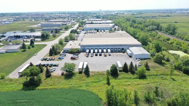
4550 70Th Ave, Kenosha, WI 53144


NEARBY LISTINGS FOR SALE OR LEASE
Property Detail
4550 70Th Ave
08-222-34-226-011
PT NW 1/4 SEC 34 & PT NE 1/4 SEC 33 T 2 R 22 BEG AT NW COR OF NW 1/4 SEC 34 TH E 413.99 FT TH S 05 DEG 10'03" W 836.225 FT TH
Commercialnec
Kenosha
X
Wisconsin
55059C0182D
0
2024
8.22 AC
2024
Kenosha East
000601
Chicago
80,688 SF
Chicago-Naperville-Elgin, IL-IN-WI
DEMOGRAPHICS near 4550 70Th Ave
1 Mile
3 Mile
5 Mile
2024 Total Population
1,550
49,343
115,035
2029 Population
1,530
48,970
114,017
Pop Growth 2024-2029
(1.29%)
(0.76%)
(0.88%)
Average Age
40
39
39
2024 Total Households
574
18,871
45,809
HH Growth 2024-2029
(1.22%)
(0.77%)
(0.87%)
Median Household Inc
$68,565
$70,535
$67,179
Avg Household Size
2.20
2.50
2.40
2024 Avg HH Vehicles
2.00
2.00
2.00
Median Home Value
$180,555
$217,881
$213,744
Median Year Built
2001
1978
1972
Nearby Places
Map Layers
Map Styles
 Street
 Aerial
- Restaurants
- Banks
- Shops
- Fitness
- Groceries
PUBLIC TRANSPORTATION
COMMUTER RAIL
Kenosha Station (Union Pacific North Line - Northeast Illinois Regional Commuter Railroad (Metra))
DRIVE
WALK
Distance
Kenosha Station (Union Pacific North Line - Northeast Illinois Regional Commuter Railroad (Metra))
12 min
4.3 mi
AIRPORT
General Mitchell International
DRIVE
WALK
Distance
General Mitchell International
40 min
30.4 mi
Freight Ports
Port Milwaukee
DRIVE
WALK
Distance
Port Milwaukee
44 min
34.3 mi
SALE & LEASE HISTORY
LISTING DATE
SALE/LEASE

Oct 18, 2021
For Sale
Oct 18, 2021
For Lease
Nearby Properties
Address
Land Use
TOTAL SIZE
Lot Size
Zoning
Address
Land Use
TOTAL SIZE
Lot Size
Zoning
2,565 SF
65.18 AC
Address
Land Use
TOTAL SIZE
Lot Size
Zoning
731,186 SF
81.94 AC
M2
Address
Land Use
TOTAL SIZE
Lot Size
Zoning
67.63 AC
FW
Address
Land Use
TOTAL SIZE
Lot Size
Zoning
3,886 SF
20.04 AC
Address
Land Use
TOTAL SIZE
Lot Size
Zoning
77.22 AC
Address
Land Use
TOTAL SIZE
Lot Size
Zoning
481,854 SF
84.10 AC
FW
Address
Land Use
TOTAL SIZE
Lot Size
Zoning
57.67 AC
Address
Land Use
TOTAL SIZE
Lot Size
Zoning
606,510 SF
36.02 AC
Address
Land Use
TOTAL SIZE
Lot Size
Zoning
606,510 SF
32.10 AC
Address
Land Use
TOTAL SIZE
Lot Size
Zoning
513,760 SF
48.61 AC
C1
Address
Land Use
TOTAL SIZE
Lot Size
Zoning
30.04 AC
Address
Land Use
TOTAL SIZE
Lot Size
Zoning
47.82 AC
Address
Land Use
TOTAL SIZE
Lot Size
Zoning
850,230 SF
39.46 AC
M2
Address
Land Use
TOTAL SIZE
Lot Size
Zoning
626,520 SF
35.19 AC
M2
Address
Land Use
TOTAL SIZE
Lot Size
Zoning
20.33 AC
M2
Address
Land Use
TOTAL SIZE
Lot Size
Zoning
35,092 SF
26.34 AC
B2
Address
Land Use
TOTAL SIZE
Lot Size
Zoning
50,145 SF
12.76 AC
Address
Land Use
TOTAL SIZE
Lot Size
Zoning
4,643 SF
60 AC
Address
Land Use
TOTAL SIZE
Lot Size
Zoning
55,140 SF
21 AC
FW
Address
Land Use
TOTAL SIZE
Lot Size
Zoning
48,284 SF
4.99 AC
Address
Land Use
TOTAL SIZE
Lot Size
Zoning
32,245 SF
22 AC
RM2
Address
Land Use
TOTAL SIZE
Lot Size
Zoning
31.07 AC
Address
Land Use
TOTAL SIZE
Lot Size
Zoning
26,016 SF
14.02 AC
FW
Address
Land Use
TOTAL SIZE
Lot Size
Zoning
2,963 SF
13.16 AC
Address
Land Use
TOTAL SIZE
Lot Size
Zoning
14.40 AC
Address
Land Use
TOTAL SIZE
Lot Size
Zoning
148,330 SF
17.55 AC
Address
Land Use
TOTAL SIZE
Lot Size
Zoning
194,281 SF
19.13 AC
B2
Address
Land Use
TOTAL SIZE
Lot Size
Zoning
25.40 AC
FW
Address
Land Use
TOTAL SIZE
Lot Size
Zoning
14.60 AC
Address
Land Use
TOTAL SIZE
Lot Size
Zoning
14.46 AC
M2
The World's #1 Commercial Real Estate Marketplace
Connect with us
© 2025 CoStar Group
The information above has been obtained from sources believed reliable. While we do not doubt its accuracy we have not verified it and make no guarantee, warranty or representation about it. It is your responsibility to independently confirm its accuracy and completeness. Any projections, opinions, assumptions, or estimates used are for example only and do not represent the current or future performance of the property. The value of this transaction to you depends on tax and other factors which should be evaluated by your tax, financial, and legal advisors. You and your advisors should conduct a careful, independent investigation of the property to determine to your satisfaction the suitability of the property for your needs.