Property Record
4550 E Lake Blvd, Birmingham, AL 35217


NEARBY LISTINGS FOR SALE OR LEASE
Property Detail
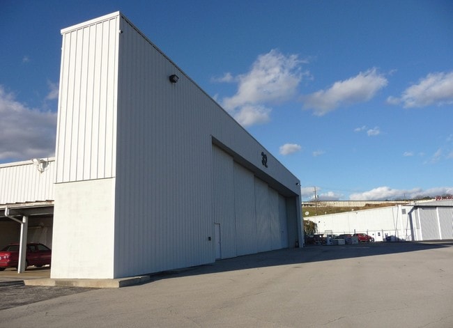
4550 E Lake Blvd
23-00-17-1-000-006.000
NE 1/4 SEC 17 TP 17 R 2W LYING SE OF EAST LAKE BLVD LESS & EXC COM SE COR OF SD SEC TH N 2550 FT TO W/L OF TAXI H TH SWLY 2305 FT TH NW 70 FT TO POB TH CONT NW 249.7 FT TH SW 200 FT TH SELY 276.6 FT TH NE 200 FT TO POB SECT 17 TWSP 17S RANGE 2W
Airport
Jefferson
AE
Alabama
01073C0392H
115 AC
0
Fultondale
2024
Birmingham
011904
Birmingham-Hoover, AL
113,147 SF
DEMOGRAPHICS near 4550 E Lake Blvd
1 Mile
3 Mile
5 Mile
2024 Total Population
4,338
44,822
128,343
2029 Population
4,447
45,131
127,798
Pop Growth 2024-2029
+ 2.51%
+ 0.69%
(0.42%)
Average Age
39
38
39
2024 Total Households
1,666
18,293
55,501
HH Growth 2024-2029
+ 2.52%
+ 0.58%
(0.41%)
Median Household Inc
$35,726
$32,472
$46,009
Avg Household Size
2.50
2.30
2.10
2024 Avg HH Vehicles
2.00
1.00
2.00
Median Home Value
$56,506
$102,561
$179,780
Median Year Built
1957
1960
1965
Nearby Places
Map Layers
Map Styles
 Street
 Aerial
- Restaurants
- Banks
- Shops
- Fitness
- Groceries
PUBLIC TRANSPORTATION
COMMUTER RAIL
Birmingham (Crescent - Amtrak)
DRIVE
WALK
Distance
Birmingham (Crescent - Amtrak)
9 min
4.5 mi
AIRPORT
Birmingham-Shuttlesworth International
DRIVE
WALK
Distance
Birmingham-Shuttlesworth International
5 min
2.0 mi
Freight Ports
Port of Mobile
DRIVE
WALK
Distance
Port of Mobile
289 min
261.8 mi
Nearby Properties
Address
Land Use
TOTAL SIZE
Lot Size
Zoning
Address
Land Use
TOTAL SIZE
Lot Size
Zoning
145,865 SF
142 AC
M1-M
Address
Land Use
TOTAL SIZE
Lot Size
Zoning
298,966 SF
73 AC
M1
Address
Land Use
TOTAL SIZE
Lot Size
Zoning
166,863 SF
21 AC
CB2
Address
Land Use
TOTAL SIZE
Lot Size
Zoning
237,826 SF
12 AC
B3
Address
Land Use
TOTAL SIZE
Lot Size
Zoning
Address
Land Use
TOTAL SIZE
Lot Size
Zoning
297,391 SF
27.10 AC
CR5
Address
Land Use
TOTAL SIZE
Lot Size
Zoning
225,000 SF
14 AC
B-2
Address
Land Use
TOTAL SIZE
Lot Size
Zoning
345,035 SF
39 AC
M1
Address
Land Use
TOTAL SIZE
Lot Size
Zoning
50,794 SF
1.62 AC
R6
Address
Land Use
TOTAL SIZE
Lot Size
Zoning
83,931 SF
5.90 AC
O&I
Address
Land Use
TOTAL SIZE
Lot Size
Zoning
456,619 SF
27.30 AC
M2
Address
Land Use
TOTAL SIZE
Lot Size
Zoning
52,407 SF
25.71 AC
R2
Address
Land Use
TOTAL SIZE
Lot Size
Zoning
83,776 SF
3.79 AC
B6
Address
Land Use
TOTAL SIZE
Lot Size
Zoning
22 AC
CB2
Address
Land Use
TOTAL SIZE
Lot Size
Zoning
127,131 SF
22.40 AC
QR7
Address
Land Use
TOTAL SIZE
Lot Size
Zoning
222,082 SF
46 AC
R3
Address
Land Use
TOTAL SIZE
Lot Size
Zoning
102,748 SF
8.50 AC
CB2
Address
Land Use
TOTAL SIZE
Lot Size
Zoning
108,813 SF
156 AC
M-1
Address
Land Use
TOTAL SIZE
Lot Size
Zoning
29,095 SF
2.64 AC
B2
Address
Land Use
TOTAL SIZE
Lot Size
Zoning
204,665 SF
8.70 AC
M2
Address
Land Use
TOTAL SIZE
Lot Size
Zoning
150,750 SF
12.60 AC
CR5
Address
Land Use
TOTAL SIZE
Lot Size
Zoning
59,914 SF
3.39 AC
O&I
Address
Land Use
TOTAL SIZE
Lot Size
Zoning
301,531 SF
41 AC
B5
Address
Land Use
TOTAL SIZE
Lot Size
Zoning
209,613 SF
4 AC
M1
Address
Land Use
TOTAL SIZE
Lot Size
Zoning
366,807 SF
25.30 AC
M2
Address
Land Use
TOTAL SIZE
Lot Size
Zoning
69,000 SF
2.76 AC
M1
Address
Land Use
TOTAL SIZE
Lot Size
Zoning
134,840 SF
7.80 AC
C1
Address
Land Use
TOTAL SIZE
Lot Size
Zoning
188,160 SF
14 AC
CB2
Address
Land Use
TOTAL SIZE
Lot Size
Zoning
195,573 SF
12 AC
M2
The World's #1 Commercial Real Estate Marketplace
Connect with us
© 2025 CoStar Group
The information above has been obtained from sources believed reliable. While we do not doubt its accuracy we have not verified it and make no guarantee, warranty or representation about it. It is your responsibility to independently confirm its accuracy and completeness. Any projections, opinions, assumptions, or estimates used are for example only and do not represent the current or future performance of the property. The value of this transaction to you depends on tax and other factors which should be evaluated by your tax, financial, and legal advisors. You and your advisors should conduct a careful, independent investigation of the property to determine to your satisfaction the suitability of the property for your needs.