Property Record
4550 N Valdosta Rd, Valdosta, GA 31602


NEARBY LISTINGS FOR SALE OR LEASE
Property Detail
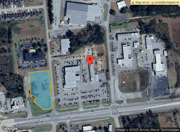
4550 N Valdosta Rd
Valdosta, GA
N Valdosta / I-75
0055-054
2.214 ACRES_N VALDOSTA RD/NORTHLAKE DR
Commercialacreage
Lowndes
X
Georgia
13027C0190D
2.21 AC
2024
Valdosta/Lake Park
2024
Other Market Areas
010204
DEMOGRAPHICS near 4550 N Valdosta Rd
1 Mile
3 Mile
5 Mile
2024 Total Population
2,185
11,275
39,710
2029 Population
2,232
11,554
40,877
Pop Growth 2024-2029
+ 2.15%
+ 2.47%
+ 2.94%
Average Age
36
38
36
2024 Total Households
732
3,963
15,628
HH Growth 2024-2029
+ 2.32%
+ 2.55%
+ 3.12%
Median Household Inc
$87,627
$91,488
$51,922
Avg Household Size
2.80
2.70
2.40
2024 Avg HH Vehicles
2.00
2.00
2.00
Median Home Value
$218,090
$242,298
$204,329
Median Year Built
2009
2001
1991
Nearby Places
Map Layers
Map Styles
 Street
 Aerial
- Restaurants
- Banks
- Shops
- Fitness
- Groceries
PUBLIC TRANSPORTATION
AIRPORT
Valdosta Regional
DRIVE
WALK
Distance
Valdosta Regional
17 min
11.4 mi
Freight Ports
Georgia Ports - Brunswick
DRIVE
WALK
Distance
Georgia Ports - Brunswick
163 min
122.0 mi
SALE & LEASE HISTORY
LISTING DATE
SALE/LEASE

Sep 24, 2016
For Sale
Nearby Properties
Address
Land Use
TOTAL SIZE
Lot Size
Zoning
Address
Land Use
TOTAL SIZE
Lot Size
Zoning
1,728 SF
24.30 AC
R-P, C-C
Address
Land Use
TOTAL SIZE
Lot Size
Zoning
68,592 SF
14.39 AC
C-H
Address
Land Use
TOTAL SIZE
Lot Size
Zoning
3,845 SF
14.13 AC
C-H
Address
Land Use
TOTAL SIZE
Lot Size
Zoning
5,247 SF
8.42 AC
R-10
Address
Land Use
TOTAL SIZE
Lot Size
Zoning
45,241 SF
13.16 AC
R-1
Address
Land Use
TOTAL SIZE
Lot Size
Zoning
63,676 SF
3.25 AC
C-H
Address
Land Use
TOTAL SIZE
Lot Size
Zoning
8,750 SF
8 AC
C-H
Address
Land Use
TOTAL SIZE
Lot Size
Zoning
7,524 SF
6.94 AC
C-G
Address
Land Use
TOTAL SIZE
Lot Size
Zoning
1,624 SF
337.94 AC
R-15
Address
Land Use
TOTAL SIZE
Lot Size
Zoning
74,989 SF
10.31 AC
P-D
Address
Land Use
TOTAL SIZE
Lot Size
Zoning
21,640 SF
6.33 AC
C-H
Address
Land Use
TOTAL SIZE
Lot Size
Zoning
11,815 SF
6.75 AC
C-H
Address
Land Use
TOTAL SIZE
Lot Size
Zoning
21,332 SF
2.83 AC
C-C
Address
Land Use
TOTAL SIZE
Lot Size
Zoning
25.69 AC
C-H
Address
Land Use
TOTAL SIZE
Lot Size
Zoning
4,000 SF
2.76 AC
C-H
Address
Land Use
TOTAL SIZE
Lot Size
Zoning
5,968 SF
3.24 AC
O-P
Address
Land Use
TOTAL SIZE
Lot Size
Zoning
11,740 SF
3.76 AC
Address
Land Use
TOTAL SIZE
Lot Size
Zoning
36,040 SF
5.27 AC
C-H
Address
Land Use
TOTAL SIZE
Lot Size
Zoning
6,232 SF
30.53 AC
M-1
Address
Land Use
TOTAL SIZE
Lot Size
Zoning
8,676 SF
262.30 AC
P-D
Address
Land Use
TOTAL SIZE
Lot Size
Zoning
18,350 SF
4.06 AC
E-A
Address
Land Use
TOTAL SIZE
Lot Size
Zoning
4,800 SF
2.66 AC
C-H
Address
Land Use
TOTAL SIZE
Lot Size
Zoning
21,413 SF
1.30 AC
C-H
Address
Land Use
TOTAL SIZE
Lot Size
Zoning
11,100 SF
3.17 AC
MXD-359
Address
Land Use
TOTAL SIZE
Lot Size
Zoning
10,056 SF
3 AC
C-H
Address
Land Use
TOTAL SIZE
Lot Size
Zoning
14,305 SF
3.50 AC
C-H
Address
Land Use
TOTAL SIZE
Lot Size
Zoning
3,696 SF
4 AC
C-H
Address
Land Use
TOTAL SIZE
Lot Size
Zoning
10,682 SF
1.61 AC
C-C
Address
Land Use
TOTAL SIZE
Lot Size
Zoning
10,407 SF
1.34 AC
C-H
Address
Land Use
TOTAL SIZE
Lot Size
Zoning
151.59 AC
C-H & E-A
The World's #1 Commercial Real Estate Marketplace
Connect with us
© 2026 CoStar Group
The information above has been obtained from sources believed reliable. While we do not doubt its accuracy we have not verified it and make no guarantee, warranty or representation about it. It is your responsibility to independently confirm its accuracy and completeness. Any projections, opinions, assumptions, or estimates used are for example only and do not represent the current or future performance of the property. The value of this transaction to you depends on tax and other factors which should be evaluated by your tax, financial, and legal advisors. You and your advisors should conduct a careful, independent investigation of the property to determine to your satisfaction the suitability of the property for your needs.