Property Record
4550 Rogue River Hwy, Grants Pass, OR 97527


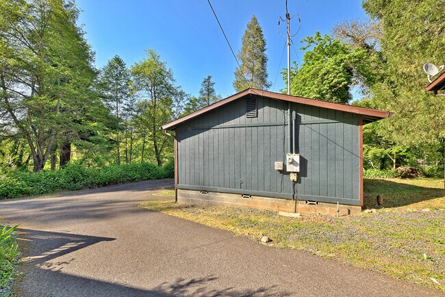
Property Detail
4550 Rogue River Hwy
R315703
ACRES 1.29
Multifamilydwelling
Josephine
RR1
Oregon
B and X Area of moderate flood hazard, usually the area between the limits of the 100-year and 500-year floods.
2190
2024
1.29 AC
2025
Medford/Grants Pass
361302
Other Market Areas
7,798 SF
Grants Pass, OR
NEARBY LISTINGS FOR SALE OR LEASE
-
-
View all Grants Pass listings for sale on LoopNet.com
DEMOGRAPHICS near 4550 Rogue River Hwy
1 mile
3 mile
5 mile
2025 Total Population
954
8,591
38,271
2030 Population
948
8,583
37,902
Pop Growth 2025-2030
(0.63%)
(0.09%)
(0.96%)
Average Age
50
44
43
2025 Total Households
420
3,519
15,800
HH Growth 2025-2030
(0.71%)
(0.17%)
(1.09%)
Median Household Inc
$59,134
$62,281
$61,529
Avg Household Size
2.20
2.30
2.30
2025 Avg HH Vehicles
2.00
2.00
2.00
Median Home Value
$477,777
$419,700
$385,209
Median Year Built
1976
1977
1977
Nearby Places
Map Layers
Map Styles
 Street
 Aerial
Transit
 Traffic
 Biking
Places
Listings with unknown addresses are not visible on the map
- Restaurants
- Banks
- Shops
- Fitness
- Groceries
PUBLIC TRANSPORTATION
AIRPORT
Rogue Valley International - Medford
Drive
Walk
Distance
Rogue Valley International - Medford
31 min
22.9 mi
Freight Ports
Port of Coos Bay, OR
Drive
Walk
Distance
Port of Coos Bay, OR
192 min
142.1 mi
SALE & LEASE HISTORY
LISTING DATE
SALE/LEASE

Apr 28, 2025
For Sale
Nearby Properties
Address
Land Use
TOTAL SIZE
Lot Size
Zoning
Address
Land Use
TOTAL SIZE
Lot Size
Zoning
2,952 SF
2.75 AC
RR1
Address
Land Use
TOTAL SIZE
Lot Size
Zoning
11.54 AC
I
Address
Land Use
TOTAL SIZE
Lot Size
Zoning
360 SF
18.68 AC
I
Address
Land Use
TOTAL SIZE
Lot Size
Zoning
8,706 SF
13.73 AC
GC
Address
Land Use
TOTAL SIZE
Lot Size
Zoning
Address
Land Use
TOTAL SIZE
Lot Size
Zoning
1,792 SF
6.15 AC
R-2
Address
Land Use
TOTAL SIZE
Lot Size
Zoning
66,148 SF
2.63 AC
I
Address
Land Use
TOTAL SIZE
Lot Size
Zoning
111,774 SF
6.93 AC
R-3
Address
Land Use
TOTAL SIZE
Lot Size
Zoning
48,520 SF
7.39 AC
R-1-8
Address
Land Use
TOTAL SIZE
Lot Size
Zoning
61,881 SF
7.49 AC
GC
Address
Land Use
TOTAL SIZE
Lot Size
Zoning
15.54 AC
GC
Address
Land Use
TOTAL SIZE
Lot Size
Zoning
15,000 SF
4.87 AC
GC
Address
Land Use
TOTAL SIZE
Lot Size
Zoning
41,944 SF
2.27 AC
GC
Address
Land Use
TOTAL SIZE
Lot Size
Zoning
12,656 SF
4.10 AC
GC
Address
Land Use
TOTAL SIZE
Lot Size
Zoning
6,300 SF
4.73 AC
I
Address
Land Use
TOTAL SIZE
Lot Size
Zoning
28,545 SF
1.78 AC
GC
Address
Land Use
TOTAL SIZE
Lot Size
Zoning
4.54 AC
I
Address
Land Use
TOTAL SIZE
Lot Size
Zoning
3.71 AC
RI
Address
Land Use
TOTAL SIZE
Lot Size
Zoning
10,000 SF
9.14 AC
BP
Address
Land Use
TOTAL SIZE
Lot Size
Zoning
27,411 SF
2.32 AC
GC
Address
Land Use
TOTAL SIZE
Lot Size
Zoning
5,681 SF
6.48 AC
R-3
Address
Land Use
TOTAL SIZE
Lot Size
Zoning
37,000 SF
3.50 AC
I
Address
Land Use
TOTAL SIZE
Lot Size
Zoning
16,673 SF
5.01 AC
RI
Address
Land Use
TOTAL SIZE
Lot Size
Zoning
3.71 AC
RI
Address
Land Use
TOTAL SIZE
Lot Size
Zoning
9,040 SF
2 AC
GC
Address
Land Use
TOTAL SIZE
Lot Size
Zoning
4,668 SF
1.08 AC
GC
Address
Land Use
TOTAL SIZE
Lot Size
Zoning
256 SF
1.47 AC
R-2
Address
Land Use
TOTAL SIZE
Lot Size
Zoning
1,378 SF
1.87 AC
BP
Address
Land Use
TOTAL SIZE
Lot Size
Zoning
1,450 SF
3.59 AC
BP
Address
Land Use
TOTAL SIZE
Lot Size
Zoning
22,500 SF
4.82 AC
BP
The World's #1 Commercial Real Estate Marketplace
Connect with us
© 2026 CoStar Group
The information above has been obtained from sources believed reliable. While we do not doubt its accuracy we have not verified it and make no guarantee, warranty or representation about it. It is your responsibility to independently confirm its accuracy and completeness. Any projections, opinions, assumptions, or estimates used are for example only and do not represent the current or future performance of the property. The value of this transaction to you depends on tax and other factors which should be evaluated by your tax, financial, and legal advisors. You and your advisors should conduct a careful, independent investigation of the property to determine to your satisfaction the suitability of the property for your needs.