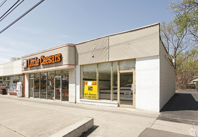
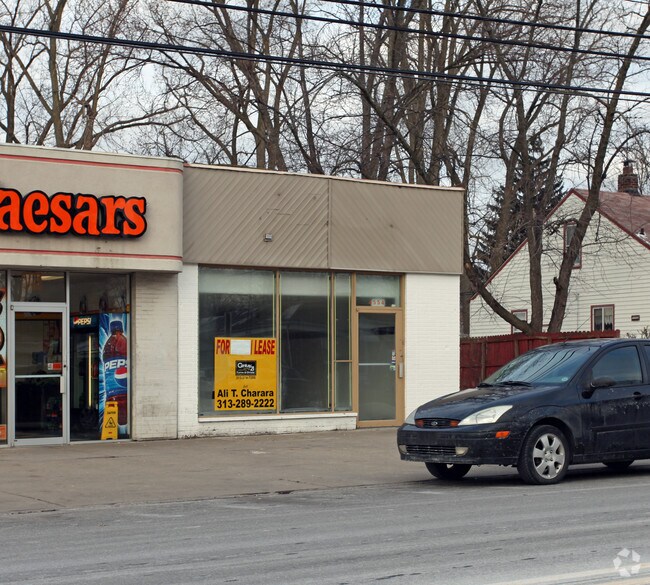
Property Record
4554 Howe Rd, Wayne, MI 48184
NEARBY LISTINGS FOR SALE OR LEASE
Property Detail
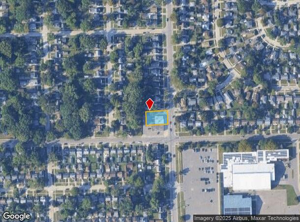
4554 Howe Rd
Detroit-Warren-Dearborn, MI
The South Add
55-017-06-0012-000
33D12B3 13B3 LOTS 12 AND 13 BLOCK 3 THE SOUTH ADD TO VILLAGE OF WAYNE BLOCK 3 T2S R9E L12 P31 WCR
Storebuilding
Wayne
X
Michigan
26163C0240F
12-13
2025
0.20 AC
2025
Airport District
566800
Detroit
2,250 SF
DEMOGRAPHICS near 4554 Howe Rd
1 Mile
3 Mile
5 Mile
2024 Total Population
11,293
69,243
180,449
2029 Population
10,849
66,810
173,675
Pop Growth 2024-2029
(3.93%)
(3.51%)
(3.75%)
Average Age
39
39
40
2024 Total Households
4,526
27,704
73,666
HH Growth 2024-2029
(4.04%)
(3.61%)
(3.83%)
Median Household Inc
$55,906
$57,161
$57,252
Avg Household Size
2.40
2.40
2.40
2024 Avg HH Vehicles
2.00
2.00
2.00
Median Home Value
$135,111
$144,295
$155,032
Median Year Built
1959
1961
1964
Nearby Places
Map Layers
Map Styles
 Street
 Aerial
- Restaurants
- Banks
- Shops
- Fitness
- Groceries
PUBLIC TRANSPORTATION
COMMUTER RAIL
Dearborn (Wolverine - Amtrak)
DRIVE
WALK
Distance
Dearborn (Wolverine - Amtrak)
17 min
7.9 mi
AIRPORT
Detroit Metro Wayne County
DRIVE
WALK
Distance
Detroit Metro Wayne County
15 min
7.6 mi
Windsor International
DRIVE
WALK
Distance
Windsor International
52 min
31.9 mi
Freight Ports
Port of Toledo
DRIVE
WALK
Distance
Port of Toledo
69 min
52.3 mi
Nearby Properties
Address
Land Use
TOTAL SIZE
Lot Size
Zoning
Address
Land Use
TOTAL SIZE
Lot Size
Zoning
857,173 SF
84.70 AC
M-1/COND
Address
Land Use
TOTAL SIZE
Lot Size
Zoning
393,948 SF
43.43 AC
M2-GEN
Address
Land Use
TOTAL SIZE
Lot Size
Zoning
354,968 SF
25.72 AC
RC/M-1
Address
Land Use
TOTAL SIZE
Lot Size
Zoning
435,648 SF
27.84 AC
M2-GEN
Address
Land Use
TOTAL SIZE
Lot Size
Zoning
366,820 SF
20.83 AC
RC/M-1
Address
Land Use
TOTAL SIZE
Lot Size
Zoning
366,820 SF
20.72 AC
RC/M-1
Address
Land Use
TOTAL SIZE
Lot Size
Zoning
1,789,755 SF
138.32 AC
IND-2 HVY
Address
Land Use
TOTAL SIZE
Lot Size
Zoning
920,139 SF
56.56 AC
M2-GEN
Address
Land Use
TOTAL SIZE
Lot Size
Zoning
285,080 SF
21.89 AC
M2-GEN
Address
Land Use
TOTAL SIZE
Lot Size
Zoning
186,738 SF
15.89 AC
RM-MLTI
Address
Land Use
TOTAL SIZE
Lot Size
Zoning
489,500 SF
58.51 AC
M2-GEN
Address
Land Use
TOTAL SIZE
Lot Size
Zoning
240,355 SF
26.05 AC
M2-GEN
Address
Land Use
TOTAL SIZE
Lot Size
Zoning
6,128 SF
50.14 AC
RC-REG
Address
Land Use
TOTAL SIZE
Lot Size
Zoning
5,382 SF
109.33 AC
RMH-MOB
Address
Land Use
TOTAL SIZE
Lot Size
Zoning
1,619,168 SF
150.49 AC
M2-GEN
Address
Land Use
TOTAL SIZE
Lot Size
Zoning
165,200 SF
14.85 AC
M-1/COND
Address
Land Use
TOTAL SIZE
Lot Size
Zoning
199,952 SF
13.06 AC
Address
Land Use
TOTAL SIZE
Lot Size
Zoning
249,090 SF
27.15 AC
M1-LIG
Address
Land Use
TOTAL SIZE
Lot Size
Zoning
960 SF
62.42 AC
RC-REG
Address
Land Use
TOTAL SIZE
Lot Size
Zoning
1,200,000 SF
71.38 AC
IND-2 HVY
Address
Land Use
TOTAL SIZE
Lot Size
Zoning
1,059,457 SF
23.05 AC
IND-2 HVY
Address
Land Use
TOTAL SIZE
Lot Size
Zoning
132,248 SF
5.96 AC
RC-REG
Address
Land Use
TOTAL SIZE
Lot Size
Zoning
413,000 SF
25 AC
M2-GEN
Address
Land Use
TOTAL SIZE
Lot Size
Zoning
150,000 SF
21.80 AC
M2-GEN
Address
Land Use
TOTAL SIZE
Lot Size
Zoning
261,835 SF
45.99 AC
M-T
Address
Land Use
TOTAL SIZE
Lot Size
Zoning
268,800 SF
17.47 AC
M1-LIG
Address
Land Use
TOTAL SIZE
Lot Size
Zoning
1,048,223 SF
34.01 AC
IND-2 HVY
Address
Land Use
TOTAL SIZE
Lot Size
Zoning
86,940 SF
25.54 AC
IND-2 HVY
Address
Land Use
TOTAL SIZE
Lot Size
Zoning
196,930 SF
9.93 AC
Address
Land Use
TOTAL SIZE
Lot Size
Zoning
169,382 SF
9.63 AC
The World's #1 Commercial Real Estate Marketplace
Connect with us
© 2026 CoStar Group
The information above has been obtained from sources believed reliable. While we do not doubt its accuracy we have not verified it and make no guarantee, warranty or representation about it. It is your responsibility to independently confirm its accuracy and completeness. Any projections, opinions, assumptions, or estimates used are for example only and do not represent the current or future performance of the property. The value of this transaction to you depends on tax and other factors which should be evaluated by your tax, financial, and legal advisors. You and your advisors should conduct a careful, independent investigation of the property to determine to your satisfaction the suitability of the property for your needs.