Property Record
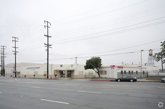
4585 Pacific Blvd, Los Angeles, CA 90058


NEARBY LISTINGS FOR SALE OR LEASE
Property Detail
4585 Pacific Blvd
6308-008-017
HUNTINGTON PARK EXTENSION # 2 LOT COM AT INTERSECTION OF W LINE OF PACIFIC BLVD WITH A LINE PARALLEL WITH AND DIST N AT R/A 0.26 FT FROM N LINE OF 17 FT SPUR TRACT R/W OF A T AND S F RY CO TH N ALL OF LOTS 1,2 AND LOT 3 BLK 45
Warehouse
Los Angeles
X
California
06037C1638G
3
2024
1.46 AC
2025
Vernon
980016
Los Angeles
85,526 SF
Los Angeles-Long Beach-Glendale, CA
DEMOGRAPHICS near 4585 Pacific Blvd
1 Mile
3 Mile
5 Mile
2024 Total Population
3,461
314,504
1,078,155
2029 Population
3,257
297,439
1,031,415
Pop Growth 2024-2029
(5.89%)
(5.43%)
(4.34%)
Average Age
35
35
36
2024 Total Households
976
78,982
309,339
HH Growth 2024-2029
(6.05%)
(5.77%)
(4.23%)
Median Household Inc
$38,806
$51,008
$50,153
Avg Household Size
3.40
3.70
3.20
2024 Avg HH Vehicles
2.00
2.00
2.00
Median Home Value
$585,714
$581,861
$593,580
Median Year Built
1961
1950
1955
Nearby Places
Map Layers
Map Styles
 Street
 Aerial
- Restaurants
- Banks
- Shops
- Fitness
- Groceries
PUBLIC TRANSPORTATION
COMMUTER RAIL
Los Angeles (Coast Starlight - Amtrak, Pacific Surfliner - Amtrak, Southwest Chief - Amtrak, Texas Eagle - Amtrak)
DRIVE
WALK
Distance
Los Angeles (Coast Starlight - Amtrak, Pacific Surfliner - Amtrak, Southwest Chief - Amtrak, Texas Eagle - Amtrak)
10 min
4.6 mi
Union Station (91 Line - Southern California Regional Rail Authority (Metrolink), Antelope Valley Line - Southern California Regional Rail Authority (Metrolink), Orange County Line - Southern California Regional Rail Authority (Metrolink), Riverside Line - Southern California Regional Rail Authority (Metrolink), San Bernardino Line - Southern California Regional Rail Authority (Metrolink), Ventura County Line - Southern California Regional Rail Authority (Metrolink))
DRIVE
WALK
Distance
Union Station (91 Line - Southern California Regional Rail Authority (Metrolink), Antelope Valley Line - Southern California Regional Rail Authority (Metrolink), Orange County Line - Southern California Regional Rail Authority (Metrolink), Riverside Line - Southern California Regional Rail Authority (Metrolink), San Bernardino Line - Southern California Regional Rail Authority (Metrolink), Ventura County Line - Southern California Regional Rail Authority (Metrolink))
12 min
4.9 mi
AIRPORT
Los Angeles International
DRIVE
WALK
Distance
Los Angeles International
25 min
13.8 mi
Long Beach (Daugherty Field)
DRIVE
WALK
Distance
Long Beach (Daugherty Field)
28 min
15.2 mi
Bob Hope
DRIVE
WALK
Distance
Bob Hope
30 min
20.6 mi
Freight Ports
Port of Long Beach
DRIVE
WALK
Distance
Port of Long Beach
30 min
17.6 mi
SALE & LEASE HISTORY
LISTING DATE
SALE/LEASE

Dec 09, 2016
For Lease
Nearby Properties
Address
Land Use
TOTAL SIZE
Lot Size
Zoning
Address
Land Use
TOTAL SIZE
Lot Size
Zoning
2,697,158 SF
20.18 AC
LAM2
Address
Land Use
TOTAL SIZE
Lot Size
Zoning
444,139 SF
3.63 AC
LAM3
Address
Land Use
TOTAL SIZE
Lot Size
Zoning
479,272 SF
16.14 AC
LAM3
Address
Land Use
TOTAL SIZE
Lot Size
Zoning
1,088,170 SF
15.98 AC
LAM3
Address
Land Use
TOTAL SIZE
Lot Size
Zoning
327,061 SF
2.18 AC
LAM3
Address
Land Use
TOTAL SIZE
Lot Size
Zoning
182,700 SF
8.29 AC
LAM3
Address
Land Use
TOTAL SIZE
Lot Size
Zoning
397,866 SF
3.51 AC
LAM3
Address
Land Use
TOTAL SIZE
Lot Size
Zoning
227,179 SF
10.46 AC
VEM*
Address
Land Use
TOTAL SIZE
Lot Size
Zoning
527,173 SF
12.36 AC
CMM2*
Address
Land Use
TOTAL SIZE
Lot Size
Zoning
276,452 SF
1.21 AC
LAM3
Address
Land Use
TOTAL SIZE
Lot Size
Zoning
326,472 SF
14.53 AC
VEM*
Address
Land Use
TOTAL SIZE
Lot Size
Zoning
188,319 SF
11.25 AC
VEM&MS1*
Address
Land Use
TOTAL SIZE
Lot Size
Zoning
108,598 SF
15.93 AC
LCC3*
Address
Land Use
TOTAL SIZE
Lot Size
Zoning
318,388 SF
11.07 AC
LAM2
Address
Land Use
TOTAL SIZE
Lot Size
Zoning
104,676 SF
4.32 AC
LAM3
Address
Land Use
TOTAL SIZE
Lot Size
Zoning
Address
Land Use
TOTAL SIZE
Lot Size
Zoning
251,338 SF
10.62 AC
LAM3
Address
Land Use
TOTAL SIZE
Lot Size
Zoning
330,904 SF
12.09 AC
VEM*
Address
Land Use
TOTAL SIZE
Lot Size
Zoning
260,714 SF
9.99 AC
VEM*
Address
Land Use
TOTAL SIZE
Lot Size
Zoning
7.02 AC
LAM3
Address
Land Use
TOTAL SIZE
Lot Size
Zoning
116,728 SF
0.86 AC
HPCP*
Address
Land Use
TOTAL SIZE
Lot Size
Zoning
372,634 SF
10.83 AC
VEM*
Address
Land Use
TOTAL SIZE
Lot Size
Zoning
303,030 SF
7.14 AC
CMM2-M1*
Address
Land Use
TOTAL SIZE
Lot Size
Zoning
369,554 SF
8.49 AC
VEM*
Address
Land Use
TOTAL SIZE
Lot Size
Zoning
112,242 SF
1.64 AC
LAM3
Address
Land Use
TOTAL SIZE
Lot Size
Zoning
65,252 SF
0.58 AC
LAM3
Address
Land Use
TOTAL SIZE
Lot Size
Zoning
234,264 SF
19.41 AC
LAM2
Address
Land Use
TOTAL SIZE
Lot Size
Zoning
261,540 SF
10.85 AC
VEM*
Address
Land Use
TOTAL SIZE
Lot Size
Zoning
100,515 SF
7.45 AC
VEM&MS1*
Address
Land Use
TOTAL SIZE
Lot Size
Zoning
342,940 SF
6.21 AC
LAM2
The World's #1 Commercial Real Estate Marketplace
Connect with us
© 2025 CoStar Group
The information above has been obtained from sources believed reliable. While we do not doubt its accuracy we have not verified it and make no guarantee, warranty or representation about it. It is your responsibility to independently confirm its accuracy and completeness. Any projections, opinions, assumptions, or estimates used are for example only and do not represent the current or future performance of the property. The value of this transaction to you depends on tax and other factors which should be evaluated by your tax, financial, and legal advisors. You and your advisors should conduct a careful, independent investigation of the property to determine to your satisfaction the suitability of the property for your needs.