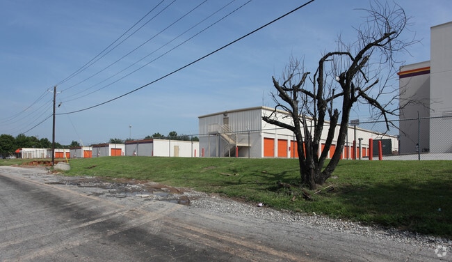
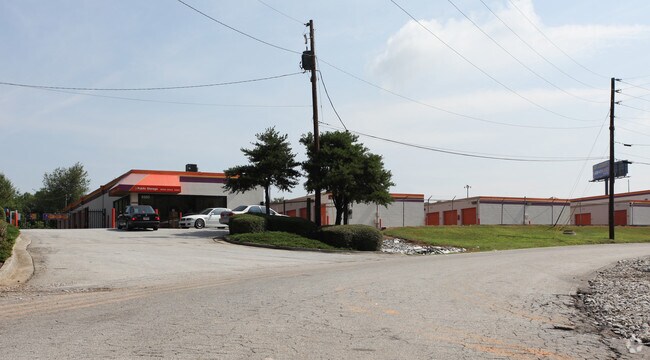
Property Record
4560 Frontage Rd, Forest Park, GA 30297

NEARBY LISTINGS FOR SALE OR LEASE
Property Detail
4560 Frontage Rd
Publicstorage
Clayton
A
Georgia
13063C0019F
7 AC
2025
North Clayton/Airport
2025
Atlanta
040308
Atlanta-Sandy Springs-Roswell, GA
2,560 SF
13-0044A-00A-008
DEMOGRAPHICS near 4560 Frontage Rd
1 Mile
3 Mile
5 Mile
2024 Total Population
4
49,500
173,132
2029 Population
4
49,800
176,120
Pop Growth 2024-2029
0.00%
+ 0.61%
+ 1.73%
Average Age
0
35
36
2024 Total Households
1
19,328
65,975
HH Growth 2024-2029
0.00%
+ 0.53%
+ 1.84%
Median Household Inc
$0
$40,600
$43,696
Avg Household Size
.00
2.50
2.50
2024 Avg HH Vehicles
1.00
1.00
1.00
Median Home Value
$0
$139,439
$158,555
Median Year Built
1974
1975
1975
Nearby Places
Map Layers
Map Styles
 Street
 Aerial
- Restaurants
- Banks
- Shops
- Fitness
- Groceries
PUBLIC TRANSPORTATION
AIRPORT
Hartsfield - Jackson Atlanta International
DRIVE
WALK
Distance
Hartsfield - Jackson Atlanta International
13 min
4.9 mi
Nearby Properties
Address
Land Use
TOTAL SIZE
Lot Size
Zoning
Address
Land Use
TOTAL SIZE
Lot Size
Zoning
116,750 SF
997.24 AC
HI
Address
Land Use
TOTAL SIZE
Lot Size
Zoning
880,465 SF
130.34 AC
C
Address
Land Use
TOTAL SIZE
Lot Size
Zoning
63,992 SF
174.80 AC
HI
Address
Land Use
TOTAL SIZE
Lot Size
Zoning
200,000 SF
34.20 AC
HI
Address
Land Use
TOTAL SIZE
Lot Size
Zoning
318.25 AC
HI
Address
Land Use
TOTAL SIZE
Lot Size
Zoning
274.75 AC
HI
Address
Land Use
TOTAL SIZE
Lot Size
Zoning
28,000 SF
246.83 AC
I
Address
Land Use
TOTAL SIZE
Lot Size
Zoning
104.17 AC
C
Address
Land Use
TOTAL SIZE
Lot Size
Zoning
965,840 SF
1.50 AC
C
Address
Land Use
TOTAL SIZE
Lot Size
Zoning
229.84 AC
HI
Address
Land Use
TOTAL SIZE
Lot Size
Zoning
198.66 AC
I
Address
Land Use
TOTAL SIZE
Lot Size
Zoning
65,458 SF
174.39 AC
C1
Address
Land Use
TOTAL SIZE
Lot Size
Zoning
1,113,792 SF
3.68 AC
CR
Address
Land Use
TOTAL SIZE
Lot Size
Zoning
368,274 SF
171.85 AC
I1
Address
Land Use
TOTAL SIZE
Lot Size
Zoning
386,354 SF
10.03 AC
CR
Address
Land Use
TOTAL SIZE
Lot Size
Zoning
113,364 SF
2.19 AC
I
Address
Land Use
TOTAL SIZE
Lot Size
Zoning
596 SF
57.40 AC
RM
Address
Land Use
TOTAL SIZE
Lot Size
Zoning
699 SF
44.34 AC
RM
Address
Land Use
TOTAL SIZE
Lot Size
Zoning
105.66 AC
HI
Address
Land Use
TOTAL SIZE
Lot Size
Zoning
513,124 SF
19.05 AC
I2
Address
Land Use
TOTAL SIZE
Lot Size
Zoning
278,866 SF
7.59 AC
CR
Address
Land Use
TOTAL SIZE
Lot Size
Zoning
298,264 SF
0.90 AC
C
Address
Land Use
TOTAL SIZE
Lot Size
Zoning
165,096 SF
137.54 AC
M1
Address
Land Use
TOTAL SIZE
Lot Size
Zoning
382,918 SF
13.04 AC
CR
Address
Land Use
TOTAL SIZE
Lot Size
Zoning
668,070 SF
0.49 AC
C1
Address
Land Use
TOTAL SIZE
Lot Size
Zoning
370 SF
36.20 AC
RM
Address
Land Use
TOTAL SIZE
Lot Size
Zoning
264 SF
24.92 AC
RM
Address
Land Use
TOTAL SIZE
Lot Size
Zoning
265,437 SF
4.74 AC
CL
Address
Land Use
TOTAL SIZE
Lot Size
Zoning
1,254,472 SF
0.49 AC
C1
Address
Land Use
TOTAL SIZE
Lot Size
Zoning
212,048 SF
110.06 AC
HI
The World's #1 Commercial Real Estate Marketplace
Connect with us
© 2026 CoStar Group
The information above has been obtained from sources believed reliable. While we do not doubt its accuracy we have not verified it and make no guarantee, warranty or representation about it. It is your responsibility to independently confirm its accuracy and completeness. Any projections, opinions, assumptions, or estimates used are for example only and do not represent the current or future performance of the property. The value of this transaction to you depends on tax and other factors which should be evaluated by your tax, financial, and legal advisors. You and your advisors should conduct a careful, independent investigation of the property to determine to your satisfaction the suitability of the property for your needs.