Property Record
45600 Oak Hill Blvd, Shelby Township, MI 48317


NEARBY LISTINGS FOR SALE OR LEASE
Property Detail
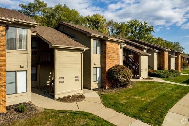
45600 Oak Hill Blvd
23-07-32-300-034
L 587B1B1 B2B2B1 B2C2A 590A1A & B2A 81 S & C 85 86 87 SPL T3N R12E SEC 32 BEG AT S 1/4 POST SEC 32, TH N 2 DEG 27' 7" W 100
Commercialnec
Macomb
X
Michigan
26099C0218G
46.56 AC
2025
Shelby Township-Utica
2025
Detroit
225701
Detroit-Warren-Dearborn, MI
DEMOGRAPHICS near 45600 Oak Hill Blvd
1 Mile
3 Mile
5 Mile
2024 Total Population
10,522
75,461
229,482
2029 Population
10,392
74,736
226,462
Pop Growth 2024-2029
(1.24%)
(0.96%)
(1.32%)
Average Age
40
41
42
2024 Total Households
5,050
30,260
89,304
HH Growth 2024-2029
(1.33%)
(1.00%)
(1.37%)
Median Household Inc
$65,365
$75,269
$83,126
Avg Household Size
2.10
2.40
2.50
2024 Avg HH Vehicles
2.00
2.00
2.00
Median Home Value
$250,542
$267,470
$269,267
Median Year Built
1990
1981
1980
Nearby Places
Map Layers
Map Styles
 Street
 Aerial
- Restaurants
- Banks
- Shops
- Fitness
- Groceries
PUBLIC TRANSPORTATION
AIRPORT
Windsor International
DRIVE
WALK
Distance
Windsor International
58 min
34.0 mi
Freight Ports
Port of Toledo
DRIVE
WALK
Distance
Port of Toledo
108 min
84.6 mi
Nearby Properties
Address
Land Use
TOTAL SIZE
Lot Size
Zoning
Address
Land Use
TOTAL SIZE
Lot Size
Zoning
998,316 SF
85.99 AC
CK MAP
Address
Land Use
TOTAL SIZE
Lot Size
Zoning
146.36 AC
MHP
Address
Land Use
TOTAL SIZE
Lot Size
Zoning
92.30 AC
MHP
Address
Land Use
TOTAL SIZE
Lot Size
Zoning
12.38 AC
R-10
Address
Land Use
TOTAL SIZE
Lot Size
Zoning
2,058,062 SF
141.65 AC
M-2
Address
Land Use
TOTAL SIZE
Lot Size
Zoning
283,249 SF
M-2
Address
Land Use
TOTAL SIZE
Lot Size
Zoning
1,150 SF
25.68 AC
CK MAP
Address
Land Use
TOTAL SIZE
Lot Size
Zoning
242,857 SF
9.61 AC
RM-3
Address
Land Use
TOTAL SIZE
Lot Size
Zoning
34.43 AC
CK MAP
Address
Land Use
TOTAL SIZE
Lot Size
Zoning
25.18 AC
RM-2
Address
Land Use
TOTAL SIZE
Lot Size
Zoning
41.09 AC
R-7
Address
Land Use
TOTAL SIZE
Lot Size
Zoning
27.89 AC
CK MAP
Address
Land Use
TOTAL SIZE
Lot Size
Zoning
28.58 AC
AI
Address
Land Use
TOTAL SIZE
Lot Size
Zoning
203,282 SF
17.13 AC
C-2
Address
Land Use
TOTAL SIZE
Lot Size
Zoning
255,070 SF
20.33 AC
RM-2
Address
Land Use
TOTAL SIZE
Lot Size
Zoning
29.93 AC
RM-2
Address
Land Use
TOTAL SIZE
Lot Size
Zoning
19.47 AC
R-8
Address
Land Use
TOTAL SIZE
Lot Size
Zoning
43.80 AC
Address
Land Use
TOTAL SIZE
Lot Size
Zoning
29.39 AC
CK MAP
Address
Land Use
TOTAL SIZE
Lot Size
Zoning
1,350 SF
21.90 AC
CK MAP
Address
Land Use
TOTAL SIZE
Lot Size
Zoning
106,130 SF
5.37 AC
O-2
Address
Land Use
TOTAL SIZE
Lot Size
Zoning
554,374 SF
22.15 AC
M-2
Address
Land Use
TOTAL SIZE
Lot Size
Zoning
19.30 AC
CK MAP
Address
Land Use
TOTAL SIZE
Lot Size
Zoning
128,364 SF
40.11 AC
C-4
Address
Land Use
TOTAL SIZE
Lot Size
Zoning
118,890 SF
2.51 AC
C-3
Address
Land Use
TOTAL SIZE
Lot Size
Zoning
51.98 AC
MHP
Address
Land Use
TOTAL SIZE
Lot Size
Zoning
368,466 SF
34.25 AC
M-2
Address
Land Use
TOTAL SIZE
Lot Size
Zoning
12.22 AC
RM-2
Address
Land Use
TOTAL SIZE
Lot Size
Zoning
470,535 SF
35.10 AC
M-1
The World's #1 Commercial Real Estate Marketplace
Connect with us
© 2026 CoStar Group
The information above has been obtained from sources believed reliable. While we do not doubt its accuracy we have not verified it and make no guarantee, warranty or representation about it. It is your responsibility to independently confirm its accuracy and completeness. Any projections, opinions, assumptions, or estimates used are for example only and do not represent the current or future performance of the property. The value of this transaction to you depends on tax and other factors which should be evaluated by your tax, financial, and legal advisors. You and your advisors should conduct a careful, independent investigation of the property to determine to your satisfaction the suitability of the property for your needs.