Property Record
4561 N Josey Ln, Carrollton, TX 75010
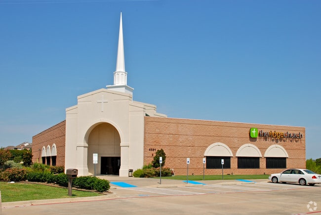


Property Detail
4561 N Josey Ln
Dallas-Fort Worth-Arlington, TX
CASTLE HILLS BAPTIST CHURCH ADDN BLK 1 LOT 1
R100296
DENTON
Commercialnec
Texas
B and X Area of moderate flood hazard, usually the area between the limits of the 100-year and 500-year floods.
1
0
4.56 AC
2025
North Carrollton
021644
Dallas/Ft Worth
13,832 SF
NEARBY LISTINGS FOR SALE OR LEASE
DEMOGRAPHICS near 4561 N Josey Ln
1 mile
3 mile
5 mile
2024 Total Population
17,148
138,184
300,866
2029 Population
19,224
154,884
334,291
Pop Growth 2024-2029
+ 12.11%
+ 12.09%
+ 11.11%
Average Age
40
39
39
2024 Total Households
6,642
57,132
127,385
HH Growth 2024-2029
+ 12.47%
+ 12.38%
+ 11.48%
Median Household Inc
$125,043
$102,425
$98,575
Avg Household Size
2.50
2.40
2.30
2024 Avg HH Vehicles
2.00
2.00
2.00
Median Home Value
$531,838
$478,728
$460,659
Median Year Built
2003
1999
1994
Nearby Places
Map Layers
Map Styles
 Street
 Aerial
Transit
 Traffic
 Biking
Places
Listings with unknown addresses are not visible on the map
- Restaurants
- Banks
- Shops
- Fitness
- Groceries
PUBLIC TRANSPORTATION
COMMUTER RAIL
Trinity Mills Station (Green Line - Dallas Area Rapid Transit (DART))
Drive
Walk
Distance
Trinity Mills Station (Green Line - Dallas Area Rapid Transit (DART))
13 min
6.4 mi
Drive
Walk
Distance
14 min
6.6 mi
AIRPORT
Dallas-Fort Worth International
Drive
Walk
Distance
Dallas-Fort Worth International
24 min
16.9 mi
Dallas Love Field
Drive
Walk
Distance
Dallas Love Field
32 min
20.2 mi
Nearby Properties
Address
Land Use
TOTAL SIZE
Lot Size
Zoning
Address
Land Use
TOTAL SIZE
Lot Size
Zoning
542,570 SF
75.67 AC
Address
Land Use
TOTAL SIZE
Lot Size
Zoning
719,177 SF
27.02 AC
O-2
Address
Land Use
TOTAL SIZE
Lot Size
Zoning
526,509 SF
135.02 AC
Address
Land Use
TOTAL SIZE
Lot Size
Zoning
526,369 SF
45.84 AC
Address
Land Use
TOTAL SIZE
Lot Size
Zoning
615,249 SF
16.17 AC
COMM
Address
Land Use
TOTAL SIZE
Lot Size
Zoning
1,817,951 SF
82 AC
Address
Land Use
TOTAL SIZE
Lot Size
Zoning
537,274 SF
20.91 AC
Address
Land Use
TOTAL SIZE
Lot Size
Zoning
578,457 SF
31.79 AC
Address
Land Use
TOTAL SIZE
Lot Size
Zoning
559,657 SF
30.49 AC
Address
Land Use
TOTAL SIZE
Lot Size
Zoning
554,780 SF
23.81 AC
Address
Land Use
TOTAL SIZE
Lot Size
Zoning
512,903 SF
18 AC
Address
Land Use
TOTAL SIZE
Lot Size
Zoning
500,844 SF
24.36 AC
2B
Address
Land Use
TOTAL SIZE
Lot Size
Zoning
460,403 SF
19.26 AC
Address
Land Use
TOTAL SIZE
Lot Size
Zoning
389,014 SF
20.91 AC
Address
Land Use
TOTAL SIZE
Lot Size
Zoning
479,145 SF
17.08 AC
Address
Land Use
TOTAL SIZE
Lot Size
Zoning
448,915 SF
20.37 AC
Address
Land Use
TOTAL SIZE
Lot Size
Zoning
452,164 SF
15.70 AC
2B
Address
Land Use
TOTAL SIZE
Lot Size
Zoning
376,139 SF
3.58 AC
Address
Land Use
TOTAL SIZE
Lot Size
Zoning
462,888 SF
20.17 AC
Address
Land Use
TOTAL SIZE
Lot Size
Zoning
346,269 SF
15.14 AC
Address
Land Use
TOTAL SIZE
Lot Size
Zoning
434,639 SF
16.20 AC
Address
Land Use
TOTAL SIZE
Lot Size
Zoning
343,234 SF
32.41 AC
Address
Land Use
TOTAL SIZE
Lot Size
Zoning
462,429 SF
5.70 AC
Address
Land Use
TOTAL SIZE
Lot Size
Zoning
291,446 SF
16.18 AC
Address
Land Use
TOTAL SIZE
Lot Size
Zoning
285,835 SF
15.61 AC
Address
Land Use
TOTAL SIZE
Lot Size
Zoning
580,201 SF
16.66 AC
Address
Land Use
TOTAL SIZE
Lot Size
Zoning
455,433 SF
14.25 AC
Address
Land Use
TOTAL SIZE
Lot Size
Zoning
364,000 SF
8.11 AC
Address
Land Use
TOTAL SIZE
Lot Size
Zoning
344,276 SF
23.02 AC
MF-M
Address
Land Use
TOTAL SIZE
Lot Size
Zoning
961,306 SF
44.52 AC
The World's #1 Commercial Real Estate Marketplace
Connect with us
© 2026 CoStar Group
The information above has been obtained from sources believed reliable. While we do not doubt its accuracy we have not verified it and make no guarantee, warranty or representation about it. It is your responsibility to independently confirm its accuracy and completeness. Any projections, opinions, assumptions, or estimates used are for example only and do not represent the current or future performance of the property. The value of this transaction to you depends on tax and other factors which should be evaluated by your tax, financial, and legal advisors. You and your advisors should conduct a careful, independent investigation of the property to determine to your satisfaction the suitability of the property for your needs.