Property Record
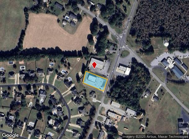
4561 Parris Bridge Rd, Boiling Springs, SC 29316

NEARBY LISTINGS FOR SALE OR LEASE
Property Detail
4561 Parris Bridge Rd
2-38-00-078.01
W SIDE PARRIS BRIDGE RD & S OF OLD FURNACE RD PB 164-834
Residentialacreage
Spartanburg
X
South Carolina
45083C0162D
0.68 AC
2024
North Side/Rt 9 Corr
2025
Greenville/Spartanburg
022410
Spartanburg, SC
DEMOGRAPHICS near 4561 Parris Bridge Rd
1 Mile
3 Mile
5 Mile
2024 Total Population
1,755
23,497
53,415
2029 Population
1,994
26,609
60,592
Pop Growth 2024-2029
+ 13.62%
+ 13.24%
+ 13.44%
Average Age
38
38
38
2024 Total Households
648
8,780
20,140
HH Growth 2024-2029
+ 13.73%
+ 13.44%
+ 13.76%
Median Household Inc
$69,974
$68,647
$66,021
Avg Household Size
2.70
2.60
2.60
2024 Avg HH Vehicles
2.00
2.00
2.00
Median Home Value
$197,707
$189,885
$190,099
Median Year Built
1996
1998
1996
Nearby Places
Map Layers
Map Styles
 Street
 Aerial
- Restaurants
- Banks
- Shops
- Fitness
- Groceries
PUBLIC TRANSPORTATION
COMMUTER RAIL
Spartanburg Amtrak Station (Crescent - Amtrak)
DRIVE
WALK
Distance
Spartanburg Amtrak Station (Crescent - Amtrak)
17 min
7.5 mi
AIRPORT
Greenville Spartanburg International
DRIVE
WALK
Distance
Greenville Spartanburg International
36 min
22.8 mi
Freight Ports
North Charleston Terminal
DRIVE
WALK
Distance
North Charleston Terminal
232 min
203.3 mi
Nearby Properties
Address
Land Use
TOTAL SIZE
Lot Size
Zoning
Address
Land Use
TOTAL SIZE
Lot Size
Zoning
22,955 SF
5.05 AC
Address
Land Use
TOTAL SIZE
Lot Size
Zoning
18,320 SF
6.70 AC
Address
Land Use
TOTAL SIZE
Lot Size
Zoning
3,406 SF
13.10 AC
Address
Land Use
TOTAL SIZE
Lot Size
Zoning
3,412 SF
21.60 AC
Address
Land Use
TOTAL SIZE
Lot Size
Zoning
5,034 SF
17.60 AC
Address
Land Use
TOTAL SIZE
Lot Size
Zoning
3,112 SF
20.17 AC
Address
Land Use
TOTAL SIZE
Lot Size
Zoning
9,649 SF
9.67 AC
Address
Land Use
TOTAL SIZE
Lot Size
Zoning
184,015 SF
19.23 AC
Address
Land Use
TOTAL SIZE
Lot Size
Zoning
4,081 SF
12 AC
Address
Land Use
TOTAL SIZE
Lot Size
Zoning
641,891 SF
16.26 AC
Address
Land Use
TOTAL SIZE
Lot Size
Zoning
108,060 SF
2.95 AC
Address
Land Use
TOTAL SIZE
Lot Size
Zoning
4,950 SF
6.93 AC
Address
Land Use
TOTAL SIZE
Lot Size
Zoning
Address
Land Use
TOTAL SIZE
Lot Size
Zoning
4,091 SF
0.28 AC
Address
Land Use
TOTAL SIZE
Lot Size
Zoning
Address
Land Use
TOTAL SIZE
Lot Size
Zoning
3,663 SF
11.40 AC
Address
Land Use
TOTAL SIZE
Lot Size
Zoning
44 SF
23.59 AC
Address
Land Use
TOTAL SIZE
Lot Size
Zoning
3,591 SF
0.78 AC
Address
Land Use
TOTAL SIZE
Lot Size
Zoning
3,548 SF
0.50 AC
Address
Land Use
TOTAL SIZE
Lot Size
Zoning
3,501 SF
0.25 AC
Address
Land Use
TOTAL SIZE
Lot Size
Zoning
4,172 SF
0.60 AC
Address
Land Use
TOTAL SIZE
Lot Size
Zoning
76,375 SF
13.83 AC
Address
Land Use
TOTAL SIZE
Lot Size
Zoning
126,789 SF
9.96 AC
Address
Land Use
TOTAL SIZE
Lot Size
Zoning
4,445 SF
Address
Land Use
TOTAL SIZE
Lot Size
Zoning
3,300 SF
0.38 AC
Address
Land Use
TOTAL SIZE
Lot Size
Zoning
2,918 SF
0.19 AC
Address
Land Use
TOTAL SIZE
Lot Size
Zoning
5,370 SF
0.96 AC
Address
Land Use
TOTAL SIZE
Lot Size
Zoning
3,148 SF
0.41 AC
Address
Land Use
TOTAL SIZE
Lot Size
Zoning
2,641 SF
Address
Land Use
TOTAL SIZE
Lot Size
Zoning
2,590 SF
0.46 AC
The World's #1 Commercial Real Estate Marketplace
Connect with us
© 2025 CoStar Group
The information above has been obtained from sources believed reliable. While we do not doubt its accuracy we have not verified it and make no guarantee, warranty or representation about it. It is your responsibility to independently confirm its accuracy and completeness. Any projections, opinions, assumptions, or estimates used are for example only and do not represent the current or future performance of the property. The value of this transaction to you depends on tax and other factors which should be evaluated by your tax, financial, and legal advisors. You and your advisors should conduct a careful, independent investigation of the property to determine to your satisfaction the suitability of the property for your needs.