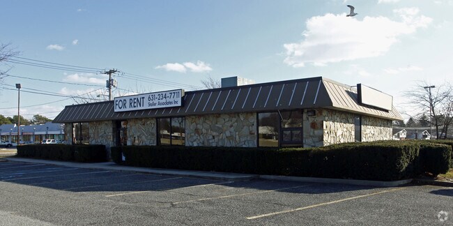
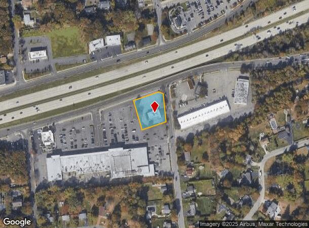
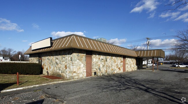
Property Record
4568 Sunrise Hwy, Oakdale, NY 11769
NEARBY LISTINGS FOR SALE OR LEASE
Property Detail
4568 Sunrise Hwy
Nassau County-Suffolk County, NY
N048N00000000
0500-278-00-02-00-038-000
Suffolk
Commercialbuilding
New York
X
200
36103C0690H
0.73 AC
0
Central Suffolk
2024
Long Island (New York)
147602
DEMOGRAPHICS near 4568 Sunrise Hwy
1 Mile
3 Mile
5 Mile
2024 Total Population
7,833
48,007
156,845
2029 Population
7,829
47,652
154,663
Pop Growth 2024-2029
(0.05%)
(0.74%)
(1.39%)
Average Age
46
44
42
2024 Total Households
3,062
17,824
54,654
HH Growth 2024-2029
+ 0.23%
(0.87%)
(1.43%)
Median Household Inc
$103,377
$126,594
$118,735
Avg Household Size
2.40
2.60
2.80
2024 Avg HH Vehicles
2.00
2.00
2.00
Median Home Value
$475,176
$493,880
$467,157
Median Year Built
1974
1968
1969
Nearby Places
- Restaurants
- Banks
- Shops
- Fitness
- Groceries
PUBLIC TRANSPORTATION
COMMUTER RAIL
Oakdale Station (Montauk Branch - Long Island Rail Road)
DRIVE
WALK
Distance
Oakdale Station (Montauk Branch - Long Island Rail Road)
5 min
1.8 mi
Sayville Station (Montauk Branch - Long Island Rail Road)
DRIVE
WALK
Distance
Sayville Station (Montauk Branch - Long Island Rail Road)
6 min
2.5 mi
AIRPORT
Long Island MacArthur
DRIVE
WALK
Distance
Long Island MacArthur
9 min
3.9 mi
Freight Ports
Port of New Haven
DRIVE
WALK
Distance
Port of New Haven
137 min
55.0 mi
Nearby Properties
Address
Land Use
TOTAL SIZE
Lot Size
Zoning
Address
Land Use
TOTAL SIZE
Lot Size
Zoning
1,207.60 AC
Address
Land Use
TOTAL SIZE
Lot Size
Zoning
2,057.30 AC
AAA
Address
Land Use
TOTAL SIZE
Lot Size
Zoning
69.90 AC
AA
Address
Land Use
TOTAL SIZE
Lot Size
Zoning
334.30 AC
AAA
Address
Land Use
TOTAL SIZE
Lot Size
Zoning
27.90 AC
AA
Address
Land Use
TOTAL SIZE
Lot Size
Zoning
465.70 AC
AAA
Address
Land Use
TOTAL SIZE
Lot Size
Zoning
13 AC
OSC
Address
Land Use
TOTAL SIZE
Lot Size
Zoning
10,930 SF
175.30 AC
AAA
Address
Land Use
TOTAL SIZE
Lot Size
Zoning
26.28 AC
CA
Address
Land Use
TOTAL SIZE
Lot Size
Zoning
27.63 AC
C
Address
Land Use
TOTAL SIZE
Lot Size
Zoning
218 AC
AAA
Address
Land Use
TOTAL SIZE
Lot Size
Zoning
26,811 SF
43.20 AC
CA
Address
Land Use
TOTAL SIZE
Lot Size
Zoning
339.70 AC
AAA
Address
Land Use
TOTAL SIZE
Lot Size
Zoning
41 AC
PDDGROI
Address
Land Use
TOTAL SIZE
Lot Size
Zoning
31.30 AC
IND1
Address
Land Use
TOTAL SIZE
Lot Size
Zoning
18.68 AC
IND1
Address
Land Use
TOTAL SIZE
Lot Size
Zoning
23.80 AC
AAA
Address
Land Use
TOTAL SIZE
Lot Size
Zoning
8.65 AC
GSC
Address
Land Use
TOTAL SIZE
Lot Size
Zoning
3.16 AC
A
Address
Land Use
TOTAL SIZE
Lot Size
Zoning
17.51 AC
Address
Land Use
TOTAL SIZE
Lot Size
Zoning
20.29 AC
CA
Address
Land Use
TOTAL SIZE
Lot Size
Zoning
252.70 AC
AAA
Address
Land Use
TOTAL SIZE
Lot Size
Zoning
16 AC
AA
Address
Land Use
TOTAL SIZE
Lot Size
Zoning
27.10 AC
AAA
Address
Land Use
TOTAL SIZE
Lot Size
Zoning
3,025 SF
5.60 AC
AA
Address
Land Use
TOTAL SIZE
Lot Size
Zoning
722 SF
24.39 AC
BUS3
Address
Land Use
TOTAL SIZE
Lot Size
Zoning
25 AC
AA
Address
Land Use
TOTAL SIZE
Lot Size
Zoning
19.86 AC
C
Address
Land Use
TOTAL SIZE
Lot Size
Zoning
12.70 AC
IND1
Address
Land Use
TOTAL SIZE
Lot Size
Zoning
5.01 AC
AA278
The World's #1 Commercial Real Estate Marketplace
Connect with us
© 2025 CoStar Group
The information above has been obtained from sources believed reliable. While we do not doubt its accuracy we have not verified it and make no guarantee, warranty or representation about it. It is your responsibility to independently confirm its accuracy and completeness. Any projections, opinions, assumptions, or estimates used are for example only and do not represent the current or future performance of the property. The value of this transaction to you depends on tax and other factors which should be evaluated by your tax, financial, and legal advisors. You and your advisors should conduct a careful, independent investigation of the property to determine to your satisfaction the suitability of the property for your needs.