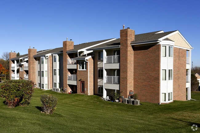
Property Record
4569 Slater Rd, Saint Paul, MN 55122

NEARBY LISTINGS FOR SALE OR LEASE
Property Detail
4569 Slater Rd
Minneapolis-St. Paul-Bloomington, MN-WI
Cinnamon Ridge 7Th Add
10-17406-01-070
CINNAMON RIDGE 7TH ADD 5 1
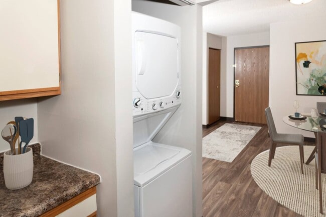
Apartment
Dakota
X
Minnesota
27053C0500F
50
2024
2.28 AC
2024
Eagan/Burnsvle/Inner Gr Hts/W St Paul
060743
Minneapolis/St Paul
286,972 SF
DEMOGRAPHICS near 4569 Slater Rd
1 Mile
3 Mile
5 Mile
2024 Total Population
10,598
67,836
194,588
2029 Population
10,781
69,040
197,236
Pop Growth 2024-2029
+ 1.73%
+ 1.77%
+ 1.36%
Average Age
40
41
40
2024 Total Households
4,245
27,551
78,372
HH Growth 2024-2029
+ 1.79%
+ 1.89%
+ 1.44%
Median Household Inc
$88,908
$88,806
$85,521
Avg Household Size
2.40
2.40
2.40
2024 Avg HH Vehicles
2.00
2.00
2.00
Median Home Value
$303,249
$315,843
$314,205
Median Year Built
1983
1983
1982
Nearby Places
Map Layers
Map Styles
 Street
 Aerial
- Restaurants
- Banks
- Shops
- Fitness
- Groceries
PUBLIC TRANSPORTATION
AIRPORT
Minneapolis-St Paul International/Wold-Chamberlain
DRIVE
WALK
Distance
Minneapolis-St Paul International/Wold-Chamberlain
14 min
8.0 mi
Freight Ports
Port Milwaukee
DRIVE
WALK
Distance
Port Milwaukee
378 min
341.9 mi
Nearby Properties
Address
Land Use
TOTAL SIZE
Lot Size
Zoning
Address
Land Use
TOTAL SIZE
Lot Size
Zoning
1,341.19 AC
Address
Land Use
TOTAL SIZE
Lot Size
Zoning
752,064 SF
24.03 AC
Address
Land Use
TOTAL SIZE
Lot Size
Zoning
300,663 SF
4.81 AC
Address
Land Use
TOTAL SIZE
Lot Size
Zoning
168,729 SF
19.02 AC
Address
Land Use
TOTAL SIZE
Lot Size
Zoning
282,095 SF
2.71 AC
Address
Land Use
TOTAL SIZE
Lot Size
Zoning
230,883 SF
2.49 AC
Address
Land Use
TOTAL SIZE
Lot Size
Zoning
263,460 SF
3.08 AC
Address
Land Use
TOTAL SIZE
Lot Size
Zoning
383,495 SF
15.41 AC
Address
Land Use
TOTAL SIZE
Lot Size
Zoning
192,843 SF
13.32 AC
Address
Land Use
TOTAL SIZE
Lot Size
Zoning
299,435 SF
7.65 AC
Address
Land Use
TOTAL SIZE
Lot Size
Zoning
374,415 SF
20.10 AC
Address
Land Use
TOTAL SIZE
Lot Size
Zoning
177,489 SF
1.75 AC
Address
Land Use
TOTAL SIZE
Lot Size
Zoning
201,481 SF
6.69 AC
Address
Land Use
TOTAL SIZE
Lot Size
Zoning
287,255 SF
14.69 AC
Address
Land Use
TOTAL SIZE
Lot Size
Zoning
134,298 SF
16.70 AC
Address
Land Use
TOTAL SIZE
Lot Size
Zoning
256,907 SF
7.43 AC
Address
Land Use
TOTAL SIZE
Lot Size
Zoning
260,290 SF
13.28 AC
Address
Land Use
TOTAL SIZE
Lot Size
Zoning
112.48 AC
Address
Land Use
TOTAL SIZE
Lot Size
Zoning
158,620 SF
1.80 AC
Address
Land Use
TOTAL SIZE
Lot Size
Zoning
134,140 SF
6.39 AC
Address
Land Use
TOTAL SIZE
Lot Size
Zoning
62,165 SF
13.21 AC
Address
Land Use
TOTAL SIZE
Lot Size
Zoning
281,133 SF
23.21 AC
Address
Land Use
TOTAL SIZE
Lot Size
Zoning
178,425 SF
9.18 AC
Address
Land Use
TOTAL SIZE
Lot Size
Zoning
173,095 SF
9.43 AC
Address
Land Use
TOTAL SIZE
Lot Size
Zoning
239,396 SF
9.68 AC
Address
Land Use
TOTAL SIZE
Lot Size
Zoning
553,312 SF
57.08 AC
Address
Land Use
TOTAL SIZE
Lot Size
Zoning
172,137 SF
2.02 AC
Address
Land Use
TOTAL SIZE
Lot Size
Zoning
175,678 SF
7.38 AC
Address
Land Use
TOTAL SIZE
Lot Size
Zoning
191,307 SF
2.31 AC
The World's #1 Commercial Real Estate Marketplace
Connect with us
© 2025 CoStar Group
The information above has been obtained from sources believed reliable. While we do not doubt its accuracy we have not verified it and make no guarantee, warranty or representation about it. It is your responsibility to independently confirm its accuracy and completeness. Any projections, opinions, assumptions, or estimates used are for example only and do not represent the current or future performance of the property. The value of this transaction to you depends on tax and other factors which should be evaluated by your tax, financial, and legal advisors. You and your advisors should conduct a careful, independent investigation of the property to determine to your satisfaction the suitability of the property for your needs.