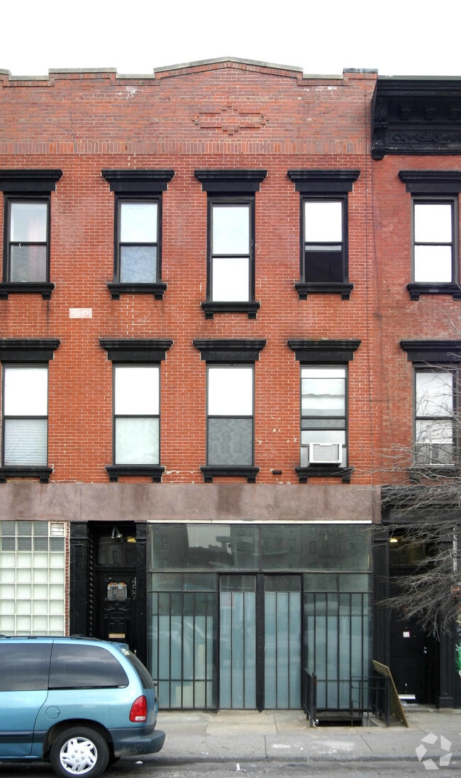
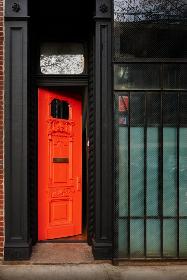
Property Record
457 Grand St, Brooklyn, NY 11211
NEARBY LISTINGS FOR SALE OR LEASE
Property Detail
457 Grand St
02387-0035
ID2005092801108001
Commercialofficeresidentialmixeduse
Kings
X
New York
3604970204F
35
2024
0.04 AC
2025
North Brooklyn
051300
Long Island (New York)
3,567 SF
New York-Jersey City-White Plains, NY-NJ
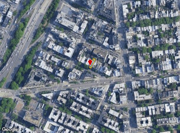
DEMOGRAPHICS near 457 Grand St
1 Mile
3 Mile
5 Mile
2024 Total Population
189,406
1,330,167
3,113,269
2029 Population
182,383
1,255,987
2,927,566
Pop Growth 2024-2029
(3.71%)
(5.58%)
(5.96%)
Average Age
34
38
39
2024 Total Households
73,070
579,344
1,341,421
HH Growth 2024-2029
(4.20%)
(5.96%)
(6.27%)
Median Household Inc
$80,047
$91,337
$89,385
Avg Household Size
2.50
2.20
2.20
2024 Avg HH Vehicles
.00
.00
.00
Median Home Value
$1,015,281
$972,214
$893,768
Median Year Built
1966
1949
1951
Nearby Places
Map Layers
Map Styles
 Street
 Aerial
- Restaurants
- Banks
- Shops
- Fitness
- Groceries
PUBLIC TRANSPORTATION
TRANSIT/SUBWAY
Metropolitan Avenue (G - New York MTA Subway (The Subway))
DRIVE
WALK
Distance
Metropolitan Avenue (G - New York MTA Subway (The Subway))
1 min
4 min
0.2 mi
Lorimer Street (L Line) (L - New York MTA Subway (The Subway))
DRIVE
WALK
Distance
Lorimer Street (L Line) (L - New York MTA Subway (The Subway))
1 min
7 min
0.4 mi
Marcy Avenue (J - New York MTA Subway (The Subway), M - New York MTA Subway (The Subway), Z - New York MTA Subway (The Subway))
DRIVE
WALK
Distance
Marcy Avenue (J - New York MTA Subway (The Subway), M - New York MTA Subway (The Subway), Z - New York MTA Subway (The Subway))
1 min
8 min
0.4 mi
Hewes Street (J - New York MTA Subway (The Subway), M - New York MTA Subway (The Subway))
DRIVE
WALK
Distance
Hewes Street (J - New York MTA Subway (The Subway), M - New York MTA Subway (The Subway))
2 min
8 min
0.4 mi
Broadway (G Line) (G - New York MTA Subway (The Subway))
DRIVE
WALK
Distance
Broadway (G Line) (G - New York MTA Subway (The Subway))
2 min
9 min
0.5 mi
COMMUTER RAIL
Nostrand Avenue Station (Far Rockaway Branch - Long Island Rail Road, Hempstead Branch - Long Island Rail Road, Long Beach Branch - Long Island Rail Road, West Hempstead Branch - Long Island Rail Road)
DRIVE
WALK
Distance
Nostrand Avenue Station (Far Rockaway Branch - Long Island Rail Road, Hempstead Branch - Long Island Rail Road, Long Beach Branch - Long Island Rail Road, West Hempstead Branch - Long Island Rail Road)
8 min
2.7 mi
Hunterspoint Avenue Station (Hempstead Branch - Long Island Rail Road, Oyster Bay Branch - Long Island Rail Road)
DRIVE
WALK
Distance
Hunterspoint Avenue Station (Hempstead Branch - Long Island Rail Road, Oyster Bay Branch - Long Island Rail Road)
9 min
2.8 mi
AIRPORT
LaGuardia
DRIVE
WALK
Distance
LaGuardia
16 min
7.1 mi
Newark Liberty International
DRIVE
WALK
Distance
Newark Liberty International
25 min
14.7 mi
John F Kennedy International
DRIVE
WALK
Distance
John F Kennedy International
26 min
15.1 mi
Freight Ports
NY - Red Hook Container Terminal
DRIVE
WALK
Distance
NY - Red Hook Container Terminal
11 min
4.5 mi
SALE & LEASE HISTORY
LISTING DATE
SALE/LEASE

Jun 20, 2024
For Lease
Jul 24, 2018
For Lease
Apr 18, 2019
For Lease
Nearby Properties
Address
Land Use
TOTAL SIZE
Lot Size
Zoning
Address
Land Use
TOTAL SIZE
Lot Size
Zoning
8,462,176 SF
61.41 AC
R7-2
Address
Land Use
TOTAL SIZE
Lot Size
Zoning
2,812,739 SF
2.10 AC
C5-3
Address
Land Use
TOTAL SIZE
Lot Size
Zoning
2,400,000 SF
15.14 AC
C5-2
Address
Land Use
TOTAL SIZE
Lot Size
Zoning
2,124,441 SF
17.29 AC
R8
Address
Land Use
TOTAL SIZE
Lot Size
Zoning
1,233,394 SF
1.78 AC
C5-3
Address
Land Use
TOTAL SIZE
Lot Size
Zoning
1,104,505 SF
2.32 AC
C4-7
Address
Land Use
TOTAL SIZE
Lot Size
Zoning
940,000 SF
1.44 AC
C6-2
Address
Land Use
TOTAL SIZE
Lot Size
Zoning
7,058,736 SF
147.61 AC
M3-1
Address
Land Use
TOTAL SIZE
Lot Size
Zoning
869,038 SF
1.53 AC
M1-1
Address
Land Use
TOTAL SIZE
Lot Size
Zoning
1,260,362 SF
4.32 AC
C1-7
Address
Land Use
TOTAL SIZE
Lot Size
Zoning
802,000 SF
1.20 AC
C62A
Address
Land Use
TOTAL SIZE
Lot Size
Zoning
3,122,165 SF
19.02 AC
R7-2
Address
Land Use
TOTAL SIZE
Lot Size
Zoning
2,210,200 SF
2.58 AC
C5-5
Address
Land Use
TOTAL SIZE
Lot Size
Zoning
1,653,794 SF
3.15 AC
C6-4
Address
Land Use
TOTAL SIZE
Lot Size
Zoning
704,950 SF
1.19 AC
C5-2
Address
Land Use
TOTAL SIZE
Lot Size
Zoning
1,065,915 SF
2.13 AC
M16R10
Address
Land Use
TOTAL SIZE
Lot Size
Zoning
1,385,425 SF
6.43 AC
R8
Address
Land Use
TOTAL SIZE
Lot Size
Zoning
1,617,206 SF
1.23 AC
C5-5
Address
Land Use
TOTAL SIZE
Lot Size
Zoning
553,725 SF
0.84 AC
C5-2
Address
Land Use
TOTAL SIZE
Lot Size
Zoning
1,092,665 SF
1.06 AC
C62A
Address
Land Use
TOTAL SIZE
Lot Size
Zoning
840,000 SF
1.04 AC
C4-6
Address
Land Use
TOTAL SIZE
Lot Size
Zoning
1,075,808 SF
1.12 AC
C5-5
Address
Land Use
TOTAL SIZE
Lot Size
Zoning
1,503,235 SF
5.28 AC
C2-7
Address
Land Use
TOTAL SIZE
Lot Size
Zoning
805,287 SF
1 AC
R10
Address
Land Use
TOTAL SIZE
Lot Size
Zoning
1,000,746 SF
1.44 AC
M1-6
Address
Land Use
TOTAL SIZE
Lot Size
Zoning
986,431 SF
1.06 AC
C52.5
Address
Land Use
TOTAL SIZE
Lot Size
Zoning
1,159,795 SF
1.93 AC
C5-3
Address
Land Use
TOTAL SIZE
Lot Size
Zoning
666,376 SF
0.80 AC
C5-3
Address
Land Use
TOTAL SIZE
Lot Size
Zoning
2,948,300 SF
27.71 AC
R7-2
Address
Land Use
TOTAL SIZE
Lot Size
Zoning
984,760 SF
2.04 AC
M3-1
The World's #1 Commercial Real Estate Marketplace
Connect with us
© 2025 CoStar Group
The information above has been obtained from sources believed reliable. While we do not doubt its accuracy we have not verified it and make no guarantee, warranty or representation about it. It is your responsibility to independently confirm its accuracy and completeness. Any projections, opinions, assumptions, or estimates used are for example only and do not represent the current or future performance of the property. The value of this transaction to you depends on tax and other factors which should be evaluated by your tax, financial, and legal advisors. You and your advisors should conduct a careful, independent investigation of the property to determine to your satisfaction the suitability of the property for your needs.