Property Record
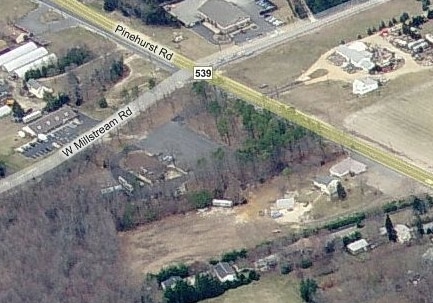
457 Pinehurst Rd, Plumsted, NJ 08533

Property Detail
457 Pinehurst Rd
Lakewood-New Brunswick, NJ
3.992AC 21
24-00043-0000-00023
OCEAN
Commercialnec
New Jersey
C2
23
B and X Area of moderate flood hazard, usually the area between the limits of the 100-year and 500-year floods.
3.99 AC
2025
Ocean County
2025
Northern New Jersey
718000
NEARBY LISTINGS FOR SALE OR LEASE
DEMOGRAPHICS near 457 Pinehurst Rd
1 mile
3 mile
5 mile
2025 Total Population
1,380
9,003
14,888
2030 Population
1,380
9,145
15,155
Pop Growth 2025-2030
0.00%
+ 1.58%
+ 1.79%
Average Age
42
41
41
2025 Total Households
483
3,168
5,357
HH Growth 2025-2030
(0.83%)
+ 0.85%
+ 1.36%
Median Household Inc
$115,931
$99,861
$100,499
Avg Household Size
2.80
2.80
2.70
2025 Avg HH Vehicles
2.00
2.00
2.00
Median Home Value
$478,804
$469,620
$481,736
Median Year Built
1989
1986
1984
Nearby Places
Map Layers
Map Styles
 Street
 Aerial
Layers
 Traffic
 Biking
Places
Listings with unknown addresses are not visible on the map
- Restaurants
- Banks
- Shops
- Fitness
- Groceries
PUBLIC TRANSPORTATION
AIRPORT
Trenton Mercer
Drive
Walk
Distance
Trenton Mercer
42 min
26.8 mi
Freight Ports
South Jersey Port
Drive
Walk
Distance
South Jersey Port
63 min
37.3 mi
Nearby Properties
Address
Land Use
TOTAL SIZE
Lot Size
Zoning
Address
Land Use
TOTAL SIZE
Lot Size
Zoning
131.54 AC
L1
Address
Land Use
TOTAL SIZE
Lot Size
Zoning
9,277.54 AC
RD
Address
Land Use
TOTAL SIZE
Lot Size
Zoning
1,115.09 AC
ROS
Address
Land Use
TOTAL SIZE
Lot Size
Zoning
861.77 AC
ROS
Address
Land Use
TOTAL SIZE
Lot Size
Zoning
2,618 SF
50.30 AC
R3
Address
Land Use
TOTAL SIZE
Lot Size
Zoning
680 SF
10 AC
C4
Address
Land Use
TOTAL SIZE
Lot Size
Zoning
14,136 SF
42.79 AC
AR
Address
Land Use
TOTAL SIZE
Lot Size
Zoning
2,160 SF
23.10 AC
HD
Address
Land Use
TOTAL SIZE
Lot Size
Zoning
15.01 AC
L1
Address
Land Use
TOTAL SIZE
Lot Size
Zoning
14,186 SF
131.05 AC
AR
Address
Land Use
TOTAL SIZE
Lot Size
Zoning
7,155 SF
11.71 AC
AR
Address
Land Use
TOTAL SIZE
Lot Size
Zoning
7,742 SF
106.86 AC
PEC
Address
Land Use
TOTAL SIZE
Lot Size
Zoning
24.11 AC
L1
Address
Land Use
TOTAL SIZE
Lot Size
Zoning
2,610 SF
7.04 AC
LI
Address
Land Use
TOTAL SIZE
Lot Size
Zoning
3,482 SF
43.16 AC
AR
Address
Land Use
TOTAL SIZE
Lot Size
Zoning
138.10 AC
PEC
Address
Land Use
TOTAL SIZE
Lot Size
Zoning
20,703 SF
0.43 AC
VB
Address
Land Use
TOTAL SIZE
Lot Size
Zoning
7,764 SF
1 AC
AR
Address
Land Use
TOTAL SIZE
Lot Size
Zoning
36.21 AC
MHP
Address
Land Use
TOTAL SIZE
Lot Size
Zoning
1.88 AC
C2
Address
Land Use
TOTAL SIZE
Lot Size
Zoning
4,334 SF
2 AC
AR
Address
Land Use
TOTAL SIZE
Lot Size
Zoning
89.96 AC
AR
Address
Land Use
TOTAL SIZE
Lot Size
Zoning
2,862 SF
63.02 AC
AR
Address
Land Use
TOTAL SIZE
Lot Size
Zoning
1.01 AC
C4
Address
Land Use
TOTAL SIZE
Lot Size
Zoning
2,428 SF
1.80 AC
C4
Address
Land Use
TOTAL SIZE
Lot Size
Zoning
9,144 SF
1 AC
AR
Address
Land Use
TOTAL SIZE
Lot Size
Zoning
40.49 AC
MHP
Address
Land Use
TOTAL SIZE
Lot Size
Zoning
5,032 SF
2 AC
AR
Address
Land Use
TOTAL SIZE
Lot Size
Zoning
75.12 AC
PEC
Address
Land Use
TOTAL SIZE
Lot Size
Zoning
12,171 SF
1.99 AC
HD
The World's #1 Commercial Real Estate Marketplace
Connect with us
© 2026 CoStar Group
The information above has been obtained from sources believed reliable. While we do not doubt its accuracy we have not verified it and make no guarantee, warranty or representation about it. It is your responsibility to independently confirm its accuracy and completeness. Any projections, opinions, assumptions, or estimates used are for example only and do not represent the current or future performance of the property. The value of this transaction to you depends on tax and other factors which should be evaluated by your tax, financial, and legal advisors. You and your advisors should conduct a careful, independent investigation of the property to determine to your satisfaction the suitability of the property for your needs.