Property Record
4574 19Th Ave N, Fargo, ND 58102
This Property Is For Sale
NEARBY LISTINGS FOR SALE OR LEASE
Property Detail
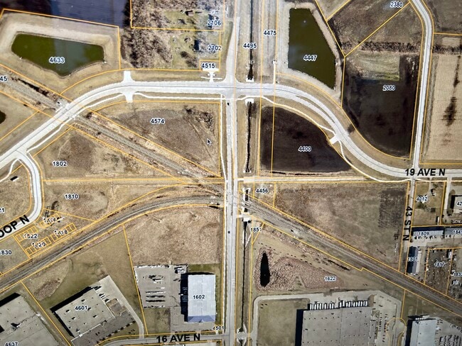
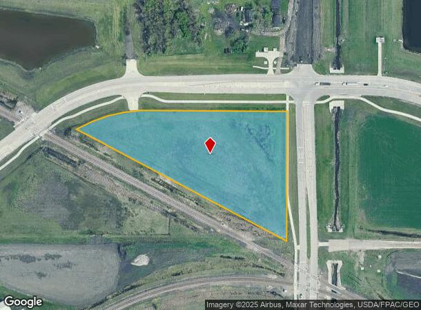
4574 19Th Ave N
Fargo, ND-MN
Orth
01-8691-00300-000
LOT: 1 BLOCK: 3 ADDITION: 19TH AVENUE NORTHEAST POND ADDITION ADDITIONAL: 19TH AVENUE NORTHEAST POND ADDN LT 1 BLK 3 **9-20-18 SPL FRM 01-3526-00100-000 PER PLAT DOC#1544894 FOR 2018
Agriculturalland
Cass
AE
North Dakota
38017C0588G
1
2024
5.26 AC
2024
Fargo
000300
Other Market Areas
DEMOGRAPHICS near 4574 19Th Ave N
1 Mile
3 Mile
5 Mile
2024 Total Population
92
20,168
110,786
2029 Population
99
21,440
118,065
Pop Growth 2024-2029
+ 7.61%
+ 6.31%
+ 6.57%
Average Age
35
34
37
2024 Total Households
34
8,094
49,394
HH Growth 2024-2029
+ 8.82%
+ 7.67%
+ 7.38%
Median Household Inc
$103,125
$53,318
$56,590
Avg Household Size
2.60
2.10
2.00
2024 Avg HH Vehicles
2.00
2.00
2.00
Median Home Value
$335,714
$182,128
$229,708
Median Year Built
2010
1988
1982
Nearby Places
- Restaurants
- Banks
- Shops
- Fitness
- Groceries
PUBLIC TRANSPORTATION
COMMUTER RAIL
Fargo Amtrak Station (Empire Builder - Amtrak)
DRIVE
WALK
Distance
Fargo Amtrak Station (Empire Builder - Amtrak)
10 min
5.4 mi
AIRPORT
Hector International
DRIVE
WALK
Distance
Hector International
10 min
4.8 mi
Freight Ports
Port Milwaukee
DRIVE
WALK
Distance
Port Milwaukee
635 min
578.2 mi
Nearby Properties
Address
Land Use
TOTAL SIZE
Lot Size
Zoning
Address
Land Use
TOTAL SIZE
Lot Size
Zoning
Address
Land Use
TOTAL SIZE
Lot Size
Zoning
122,006 SF
24.45 AC
GI
Address
Land Use
TOTAL SIZE
Lot Size
Zoning
175,969 SF
35.10 AC
GI
Address
Land Use
TOTAL SIZE
Lot Size
Zoning
621,097 SF
49.49 AC
LI
Address
Land Use
TOTAL SIZE
Lot Size
Zoning
109,174 SF
1.25 AC
UMU
Address
Land Use
TOTAL SIZE
Lot Size
Zoning
12.33 AC
PAC
Address
Land Use
TOTAL SIZE
Lot Size
Zoning
303,970 SF
49.72 AC
GI
Address
Land Use
TOTAL SIZE
Lot Size
Zoning
Address
Land Use
TOTAL SIZE
Lot Size
Zoning
37.39 AC
Address
Land Use
TOTAL SIZE
Lot Size
Zoning
206,540 SF
16.68 AC
GI
Address
Land Use
TOTAL SIZE
Lot Size
Zoning
75 AC
MHP
Address
Land Use
TOTAL SIZE
Lot Size
Zoning
218,579 SF
21.28 AC
GC
Address
Land Use
TOTAL SIZE
Lot Size
Zoning
49.50 AC
Address
Land Use
TOTAL SIZE
Lot Size
Zoning
152,508 SF
13.85 AC
GI
Address
Land Use
TOTAL SIZE
Lot Size
Zoning
155,989 SF
11.62 AC
GC
Address
Land Use
TOTAL SIZE
Lot Size
Zoning
15,895 SF
41.76 AC
Address
Land Use
TOTAL SIZE
Lot Size
Zoning
184,560 SF
17.11 AC
Address
Land Use
TOTAL SIZE
Lot Size
Zoning
135,235 SF
6.01 AC
GC
Address
Land Use
TOTAL SIZE
Lot Size
Zoning
242,032 SF
14.23 AC
GI
Address
Land Use
TOTAL SIZE
Lot Size
Zoning
99,300 SF
12.72 AC
Address
Land Use
TOTAL SIZE
Lot Size
Zoning
Address
Land Use
TOTAL SIZE
Lot Size
Zoning
207,189 SF
23.72 AC
Address
Land Use
TOTAL SIZE
Lot Size
Zoning
12.97 AC
GI
Address
Land Use
TOTAL SIZE
Lot Size
Zoning
Address
Land Use
TOTAL SIZE
Lot Size
Zoning
79,310 SF
17.79 AC
Address
Land Use
TOTAL SIZE
Lot Size
Zoning
60,125 SF
25.37 AC
LI
Address
Land Use
TOTAL SIZE
Lot Size
Zoning
271,139 SF
14.28 AC
LI
Address
Land Use
TOTAL SIZE
Lot Size
Zoning
122,750 SF
14.27 AC
GI
Address
Land Use
TOTAL SIZE
Lot Size
Zoning
101,324 SF
7.12 AC
LI
Address
Land Use
TOTAL SIZE
Lot Size
Zoning
The World's #1 Commercial Real Estate Marketplace
Connect with us
© 2025 CoStar Group
The information above has been obtained from sources believed reliable. While we do not doubt its accuracy we have not verified it and make no guarantee, warranty or representation about it. It is your responsibility to independently confirm its accuracy and completeness. Any projections, opinions, assumptions, or estimates used are for example only and do not represent the current or future performance of the property. The value of this transaction to you depends on tax and other factors which should be evaluated by your tax, financial, and legal advisors. You and your advisors should conduct a careful, independent investigation of the property to determine to your satisfaction the suitability of the property for your needs.