Property Record
4575 Sw Research Way, Corvallis, OR 97333
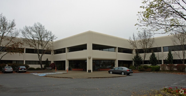


Property Detail
4575 Sw Research Way
284921
SRP LOT 1 BLK 2
Publicschool
Benton
RTC
Oregon
B and X Area of moderate flood hazard, usually the area between the limits of the 100-year and 500-year floods.
1
2025
9.16 AC
2025
Oregon West Area
000202
Other Market Areas
107,412 SF
Corvallis, OR
NEARBY LISTINGS FOR SALE OR LEASE
-
-
View all Corvallis listings for lease on LoopNet.com
DEMOGRAPHICS near 4575 Sw Research Way
1 mile
3 mile
5 mile
2025 Total Population
6,497
58,562
76,879
2030 Population
6,688
61,272
79,826
Pop Growth 2025-2030
+ 2.94%
+ 4.63%
+ 3.83%
Average Age
41
36
37
2025 Total Households
2,819
23,017
30,779
HH Growth 2025-2030
+ 2.98%
+ 5.06%
+ 4.10%
Median Household Inc
$90,204
$61,413
$66,290
Avg Household Size
2.30
2.20
2.20
2025 Avg HH Vehicles
2.00
2.00
2.00
Median Home Value
$634,593
$526,673
$512,751
Median Year Built
1997
1983
1980
Nearby Places
Map Layers
Map Styles
 Street
 Aerial
Layers
 Traffic
 Biking
Places
Listings with unknown addresses are not visible on the map
- Restaurants
- Banks
- Shops
- Fitness
- Groceries
PUBLIC TRANSPORTATION
AIRPORT
Mahlon Sweet Field
Drive
Walk
Distance
Mahlon Sweet Field
60 min
37.4 mi
Freight Ports
Port of Portland
Drive
Walk
Distance
Port of Portland
113 min
89.1 mi
SALE & LEASE HISTORY
LISTING DATE
SALE/LEASE

Sep 25, 2016
For Lease
Sep 25, 2016
For Lease
Nearby Properties
Address
Land Use
TOTAL SIZE
Lot Size
Zoning
Address
Land Use
TOTAL SIZE
Lot Size
Zoning
524,658 SF
25.99 AC
RS-12
Address
Land Use
TOTAL SIZE
Lot Size
Zoning
Address
Land Use
TOTAL SIZE
Lot Size
Zoning
169,502 SF
0.69 AC
RF
Address
Land Use
TOTAL SIZE
Lot Size
Zoning
330,690 SF
1.25 AC
MUE
Address
Land Use
TOTAL SIZE
Lot Size
Zoning
104,538 SF
4.38 AC
RS-12
Address
Land Use
TOTAL SIZE
Lot Size
Zoning
208,727 SF
16.20 AC
RS-20
Address
Land Use
TOTAL SIZE
Lot Size
Zoning
166,411 SF
3.04 AC
OSU
Address
Land Use
TOTAL SIZE
Lot Size
Zoning
81,112 SF
1.81 AC
PD(RS-20)
Address
Land Use
TOTAL SIZE
Lot Size
Zoning
Address
Land Use
TOTAL SIZE
Lot Size
Zoning
241,599 SF
14.33 AC
R-3
Address
Land Use
TOTAL SIZE
Lot Size
Zoning
146,932 SF
6.41 AC
MUCS
Address
Land Use
TOTAL SIZE
Lot Size
Zoning
235,104 SF
9.96 AC
PD(RS-20)
Address
Land Use
TOTAL SIZE
Lot Size
Zoning
67,923 SF
4.84 AC
RTC
Address
Land Use
TOTAL SIZE
Lot Size
Zoning
139,766 SF
6.41 AC
PD(RS-9)
Address
Land Use
TOTAL SIZE
Lot Size
Zoning
121,330 SF
10.62 AC
PD(RS-12)
Address
Land Use
TOTAL SIZE
Lot Size
Zoning
218,015 SF
11.69 AC
PD(RS-12)
Address
Land Use
TOTAL SIZE
Lot Size
Zoning
122,984 SF
2.56 AC
RS-20
Address
Land Use
TOTAL SIZE
Lot Size
Zoning
159,058 SF
13.92 AC
RS-20
Address
Land Use
TOTAL SIZE
Lot Size
Zoning
15.04 AC
RI
Address
Land Use
TOTAL SIZE
Lot Size
Zoning
94,542 SF
10.96 AC
PD(NC-MAJO
Address
Land Use
TOTAL SIZE
Lot Size
Zoning
117,960 SF
5.41 AC
RS-20
Address
Land Use
TOTAL SIZE
Lot Size
Zoning
224,384 SF
2.41 AC
MUCS
Address
Land Use
TOTAL SIZE
Lot Size
Zoning
136,117 SF
6.40 AC
PD(RS-9)
Address
Land Use
TOTAL SIZE
Lot Size
Zoning
63,978 SF
3.06 AC
PD(MUGC)
Address
Land Use
TOTAL SIZE
Lot Size
Zoning
123,198 SF
6.12 AC
PD(RS-20)
Address
Land Use
TOTAL SIZE
Lot Size
Zoning
109,984 SF
3.51 AC
RS-20
Address
Land Use
TOTAL SIZE
Lot Size
Zoning
53,602 SF
4.83 AC
RTC
Address
Land Use
TOTAL SIZE
Lot Size
Zoning
87,255 SF
3.62 AC
OSU
Address
Land Use
TOTAL SIZE
Lot Size
Zoning
84,170 SF
1.34 AC
RS-20
The World's #1 Commercial Real Estate Marketplace
Connect with us
© 2026 CoStar Group
The information above has been obtained from sources believed reliable. While we do not doubt its accuracy we have not verified it and make no guarantee, warranty or representation about it. It is your responsibility to independently confirm its accuracy and completeness. Any projections, opinions, assumptions, or estimates used are for example only and do not represent the current or future performance of the property. The value of this transaction to you depends on tax and other factors which should be evaluated by your tax, financial, and legal advisors. You and your advisors should conduct a careful, independent investigation of the property to determine to your satisfaction the suitability of the property for your needs.