Property Record
4580 Sunset Blvd, Lexington, SC 29072


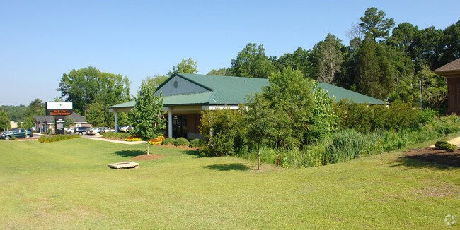
Property Detail
4580 Sunset Blvd
Columbia, SC
DARBY AMBROSE SD LOT 2 .72 AC
003500-03-137
Lexington
Multipleuses
South Carolina
B and X Area of moderate flood hazard, usually the area between the limits of the 100-year and 500-year floods.
2
2025
0.72 AC
2024
Lexington
021038
Columbia
6,052 SF
NEARBY LISTINGS FOR SALE OR LEASE
DEMOGRAPHICS near 4580 Sunset Blvd
1 mile
3 mile
5 mile
2025 Total Population
3,357
32,630
120,560
2030 Population
3,531
34,009
125,176
Pop Growth 2025-2030
+ 5.18%
+ 4.23%
+ 3.83%
Average Age
36
41
40
2025 Total Households
1,126
13,012
49,600
HH Growth 2025-2030
+ 5.33%
+ 4.39%
+ 4.13%
Median Household Inc
$118,622
$90,350
$69,967
Avg Household Size
3.00
2.50
2.30
2025 Avg HH Vehicles
2.00
2.00
2.00
Median Home Value
$356,337
$283,071
$238,238
Median Year Built
2007
1992
1986
Nearby Places
Map Layers
Map Styles
 Street
 Aerial
Layers
 Traffic
 Biking
Places
Listings with unknown addresses are not visible on the map
- Restaurants
- Banks
- Shops
- Fitness
- Groceries
PUBLIC TRANSPORTATION
COMMUTER RAIL
Drive
Walk
Distance
14 min
7.7 mi
AIRPORT
Columbia Metro
Drive
Walk
Distance
Columbia Metro
23 min
11.0 mi
Nearby Properties
Address
Land Use
TOTAL SIZE
Lot Size
Zoning
Address
Land Use
TOTAL SIZE
Lot Size
Zoning
58,664 SF
6.01 AC
Address
Land Use
TOTAL SIZE
Lot Size
Zoning
8,330 SF
19.10 AC
ID
Address
Land Use
TOTAL SIZE
Lot Size
Zoning
63,658 SF
17.56 AC
GC
Address
Land Use
TOTAL SIZE
Lot Size
Zoning
183,776 SF
18.23 AC
C2
Address
Land Use
TOTAL SIZE
Lot Size
Zoning
3,447 SF
10.03 AC
R3
Address
Land Use
TOTAL SIZE
Lot Size
Zoning
6,794 SF
6.17 AC
R1
Address
Land Use
TOTAL SIZE
Lot Size
Zoning
190,570 SF
10.01 AC
C2
Address
Land Use
TOTAL SIZE
Lot Size
Zoning
78,131 SF
24 AC
GC
Address
Land Use
TOTAL SIZE
Lot Size
Zoning
86,935 SF
9.91 AC
ID
Address
Land Use
TOTAL SIZE
Lot Size
Zoning
99,628 SF
13.09 AC
RD
Address
Land Use
TOTAL SIZE
Lot Size
Zoning
153,351 SF
13.33 AC
RD
Address
Land Use
TOTAL SIZE
Lot Size
Zoning
2,065 SF
19.73 AC
HDR
Address
Land Use
TOTAL SIZE
Lot Size
Zoning
85,600 SF
22.08 AC
Address
Land Use
TOTAL SIZE
Lot Size
Zoning
136,940 SF
20.36 AC
GC
Address
Land Use
TOTAL SIZE
Lot Size
Zoning
126,000 SF
8.89 AC
Address
Land Use
TOTAL SIZE
Lot Size
Zoning
8,876 SF
15.06 AC
R3
Address
Land Use
TOTAL SIZE
Lot Size
Zoning
10,616 SF
9.63 AC
R3
Address
Land Use
TOTAL SIZE
Lot Size
Zoning
3,825 SF
18.45 AC
RD
Address
Land Use
TOTAL SIZE
Lot Size
Zoning
127,329 SF
10.91 AC
Address
Land Use
TOTAL SIZE
Lot Size
Zoning
79,951 SF
3.31 AC
RD
Address
Land Use
TOTAL SIZE
Lot Size
Zoning
39,700 SF
73.29 AC
ID
Address
Land Use
TOTAL SIZE
Lot Size
Zoning
66,043 SF
2.70 AC
ID
Address
Land Use
TOTAL SIZE
Lot Size
Zoning
185,375 SF
10.76 AC
ID
Address
Land Use
TOTAL SIZE
Lot Size
Zoning
14,169 SF
6.46 AC
ID
Address
Land Use
TOTAL SIZE
Lot Size
Zoning
44,958 SF
9 AC
C
Address
Land Use
TOTAL SIZE
Lot Size
Zoning
162,500 SF
12.36 AC
ID
Address
Land Use
TOTAL SIZE
Lot Size
Zoning
37,404 SF
9.32 AC
Address
Land Use
TOTAL SIZE
Lot Size
Zoning
51,657 SF
3.48 AC
ID
Address
Land Use
TOTAL SIZE
Lot Size
Zoning
44,710 SF
4.26 AC
ID
Address
Land Use
TOTAL SIZE
Lot Size
Zoning
14,820 SF
2.56 AC
The World's #1 Commercial Real Estate Marketplace
Connect with us
© 2026 CoStar Group
The information above has been obtained from sources believed reliable. While we do not doubt its accuracy we have not verified it and make no guarantee, warranty or representation about it. It is your responsibility to independently confirm its accuracy and completeness. Any projections, opinions, assumptions, or estimates used are for example only and do not represent the current or future performance of the property. The value of this transaction to you depends on tax and other factors which should be evaluated by your tax, financial, and legal advisors. You and your advisors should conduct a careful, independent investigation of the property to determine to your satisfaction the suitability of the property for your needs.