Property Record
4583 Cochran St, Simi Valley, CA 93063
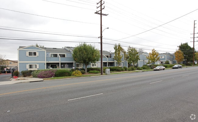

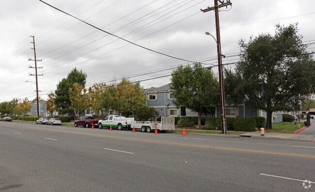
Property Detail
4583 Cochran St
625-0-081-165
REF: 17 MR 52
Apartment
Ventura
RVH-
California
AO River or stream flood hazard areas, and areas with a 1% or greater chance of shallow flooding each year. These areas have a 26% chance of flooding over the life of a 30-year mortgage.
2.84 AC
2024
Simi Valley
2025
Los Angeles
008201
Oxnard-Thousand Oaks-Ventura, CA
58,856 SF
NEARBY LISTINGS FOR SALE OR LEASE
-
-
View all Simi Valley listings for sale on LoopNet.com
DEMOGRAPHICS near 4583 Cochran St
1 mile
3 mile
5 mile
2025 Total Population
15,706
75,178
111,593
2030 Population
15,566
74,597
110,636
Pop Growth 2025-2030
(0.89%)
(0.77%)
(0.86%)
Average Age
42
42
42
2025 Total Households
5,462
25,327
37,183
HH Growth 2025-2030
(1.10%)
(1.00%)
(1.05%)
Median Household Inc
$126,213
$121,935
$117,632
Avg Household Size
2.80
2.90
2.90
2025 Avg HH Vehicles
2.00
2.00
2.00
Median Home Value
$754,991
$766,496
$775,387
Median Year Built
1977
1976
1977
Nearby Places
Map Layers
Map Styles
 Street
 Aerial
Layers
 Traffic
 Biking
Places
Listings with unknown addresses are not visible on the map
- Restaurants
- Banks
- Shops
- Fitness
- Groceries
PUBLIC TRANSPORTATION
TRANSIT/SUBWAY
Simi Valley (Ventura County Line - Southern California Regional Rail Authority (Metrolink))
Drive
Walk
Distance
Simi Valley (Ventura County Line - Southern California Regional Rail Authority (Metrolink))
4 min
20 min
1.1 mi
COMMUTER RAIL
Simi Valley (Ventura County Line - Southern California Regional Rail Authority (Metrolink))
Drive
Walk
Distance
Simi Valley (Ventura County Line - Southern California Regional Rail Authority (Metrolink))
4 min
20 min
1.1 mi
Chatsworth (Ventura County Line - Southern California Regional Rail Authority (Metrolink))
Drive
Walk
Distance
Chatsworth (Ventura County Line - Southern California Regional Rail Authority (Metrolink))
14 min
8.7 mi
AIRPORT
Bob Hope
Drive
Walk
Distance
Bob Hope
31 min
23.6 mi
Los Angeles International
Drive
Walk
Distance
Los Angeles International
51 min
39.4 mi
Freight Ports
The Port of Hueneme
Drive
Walk
Distance
The Port of Hueneme
52 min
34.1 mi
Nearby Properties
Address
Land Use
TOTAL SIZE
Lot Size
Zoning
Address
Land Use
TOTAL SIZE
Lot Size
Zoning
4.77 AC
CO
Address
Land Use
TOTAL SIZE
Lot Size
Zoning
57,707 SF
14.76 AC
L-I
Address
Land Use
TOTAL SIZE
Lot Size
Zoning
18,057 SF
10.23 AC
L-I
Address
Land Use
TOTAL SIZE
Lot Size
Zoning
135,768 SF
5.27 AC
Address
Land Use
TOTAL SIZE
Lot Size
Zoning
25,277 SF
14.64 AC
RM-3
Address
Land Use
TOTAL SIZE
Lot Size
Zoning
20,461 SF
2.92 AC
Address
Land Use
TOTAL SIZE
Lot Size
Zoning
96.68 AC
RE-A
Address
Land Use
TOTAL SIZE
Lot Size
Zoning
115.15 AC
RL-0
Address
Land Use
TOTAL SIZE
Lot Size
Zoning
3.15 AC
RL-1
Address
Land Use
TOTAL SIZE
Lot Size
Zoning
157,745 SF
7.53 AC
L-I
Address
Land Use
TOTAL SIZE
Lot Size
Zoning
112,130 SF
3.62 AC
Address
Land Use
TOTAL SIZE
Lot Size
Zoning
4.81 AC
Address
Land Use
TOTAL SIZE
Lot Size
Zoning
159,664 SF
7.50 AC
L-I
Address
Land Use
TOTAL SIZE
Lot Size
Zoning
61,020 SF
3.21 AC
Address
Land Use
TOTAL SIZE
Lot Size
Zoning
11,242 SF
13.70 AC
Address
Land Use
TOTAL SIZE
Lot Size
Zoning
13,585 SF
8.28 AC
BP-S
Address
Land Use
TOTAL SIZE
Lot Size
Zoning
157,065 SF
4.30 AC
Address
Land Use
TOTAL SIZE
Lot Size
Zoning
Address
Land Use
TOTAL SIZE
Lot Size
Zoning
1,051.63 AC
OS160AC
Address
Land Use
TOTAL SIZE
Lot Size
Zoning
53,730 SF
2.21 AC
Address
Land Use
TOTAL SIZE
Lot Size
Zoning
2.24 AC
Address
Land Use
TOTAL SIZE
Lot Size
Zoning
Address
Land Use
TOTAL SIZE
Lot Size
Zoning
78,540 SF
3.75 AC
RH-15
Address
Land Use
TOTAL SIZE
Lot Size
Zoning
15,743 SF
8.12 AC
CPD
Address
Land Use
TOTAL SIZE
Lot Size
Zoning
101,728 SF
5.72 AC
RH-1
Address
Land Use
TOTAL SIZE
Lot Size
Zoning
96,132 SF
4.20 AC
L-I
Address
Land Use
TOTAL SIZE
Lot Size
Zoning
41,130 SF
1.49 AC
Address
Land Use
TOTAL SIZE
Lot Size
Zoning
46,458 SF
3.88 AC
The World's #1 Commercial Real Estate Marketplace
Connect with us
© 2026 CoStar Group
The information above has been obtained from sources believed reliable. While we do not doubt its accuracy we have not verified it and make no guarantee, warranty or representation about it. It is your responsibility to independently confirm its accuracy and completeness. Any projections, opinions, assumptions, or estimates used are for example only and do not represent the current or future performance of the property. The value of this transaction to you depends on tax and other factors which should be evaluated by your tax, financial, and legal advisors. You and your advisors should conduct a careful, independent investigation of the property to determine to your satisfaction the suitability of the property for your needs.