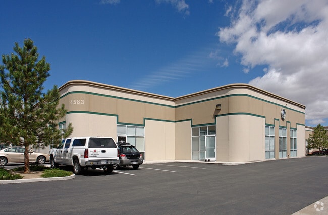
Property Record
4583 Longley Ln, Reno, NV 89502


Current Lease Availabilities
NEARBY LISTINGS FOR SALE OR LEASE
Property Detail
4583 Longley Ln
Reno, NV
_Unspecified
021-890-05
PM 3986 LT D
Multipleuses
Washoe
X
Nevada
32031C3232G
d
2025
0.15 AC
2026
Airport
980000
Reno/Sparks
6,642 SF
DEMOGRAPHICS near 4583 Longley Ln
1 mile
3 mile
5 mile
2024 Total Population
8,670
64,447
213,276
2029 Population
9,089
67,925
224,446
Pop Growth 2024-2029
+ 4.83%
+ 5.40%
+ 5.24%
Average Age
40
39
40
2024 Total Households
3,519
26,909
89,970
HH Growth 2024-2029
+ 5.14%
+ 5.60%
+ 5.43%
Median Household Inc
$74,078
$59,621
$62,621
Avg Household Size
2.40
2.30
2.30
2024 Avg HH Vehicles
2.00
2.00
2.00
Median Home Value
$381,920
$398,184
$445,601
Median Year Built
1978
1978
1980
Nearby Places
Map Layers
Map Styles
 Street
 Aerial
Transit
 Traffic
 Biking
Places
Listings with unknown addresses are not visible on the map
- Restaurants
- Banks
- Shops
- Fitness
- Groceries
PUBLIC TRANSPORTATION
AIRPORT
Reno/Tahoe International
Drive
Walk
Distance
Reno/Tahoe International
26 min
6.9 mi
Nearby Properties
Address
Land Use
TOTAL SIZE
Lot Size
Zoning
Address
Land Use
TOTAL SIZE
Lot Size
Zoning
1,638,272 SF
17.11 AC
MU
Address
Land Use
TOTAL SIZE
Lot Size
Zoning
762,384 SF
1,131.28 AC
MA
Address
Land Use
TOTAL SIZE
Lot Size
Zoning
1,103,124 SF
138.61 AC
MU
Address
Land Use
TOTAL SIZE
Lot Size
Zoning
799,762 SF
13.30 AC
MU
Address
Land Use
TOTAL SIZE
Lot Size
Zoning
390,743 SF
22.20 AC
IC
Address
Land Use
TOTAL SIZE
Lot Size
Zoning
1,048,514 SF
1.30 AC
MU
Address
Land Use
TOTAL SIZE
Lot Size
Zoning
1,051,043 SF
78.81 AC
PD
Address
Land Use
TOTAL SIZE
Lot Size
Zoning
425,118 SF
30.37 AC
IC
Address
Land Use
TOTAL SIZE
Lot Size
Zoning
759,161 SF
37.37 AC
MU
Address
Land Use
TOTAL SIZE
Lot Size
Zoning
991,800 SF
51.03 AC
PD
Address
Land Use
TOTAL SIZE
Lot Size
Zoning
893,055 SF
52.71 AC
MA
Address
Land Use
TOTAL SIZE
Lot Size
Zoning
451,635 SF
15 AC
PD
Address
Land Use
TOTAL SIZE
Lot Size
Zoning
497,928 SF
3.52 AC
MU
Address
Land Use
TOTAL SIZE
Lot Size
Zoning
645,699 SF
4.53 AC
MU
Address
Land Use
TOTAL SIZE
Lot Size
Zoning
421,744 SF
12.07 AC
MS
Address
Land Use
TOTAL SIZE
Lot Size
Zoning
296,048 SF
93.65 AC
PF
Address
Land Use
TOTAL SIZE
Lot Size
Zoning
500,079 SF
45.66 AC
SPD
Address
Land Use
TOTAL SIZE
Lot Size
Zoning
617,081 SF
2.62 AC
MUD
Address
Land Use
TOTAL SIZE
Lot Size
Zoning
335,490 SF
19.54 AC
PD
Address
Land Use
TOTAL SIZE
Lot Size
Zoning
342,019 SF
23.32 AC
MF14
Address
Land Use
TOTAL SIZE
Lot Size
Zoning
366,641 SF
37.91 AC
MA
Address
Land Use
TOTAL SIZE
Lot Size
Zoning
622,628 SF
2.91 AC
MUD
Address
Land Use
TOTAL SIZE
Lot Size
Zoning
231,329 SF
8.37 AC
GC
Address
Land Use
TOTAL SIZE
Lot Size
Zoning
591,000 SF
5.46 AC
MU
Address
Land Use
TOTAL SIZE
Lot Size
Zoning
34,503 SF
30.82 AC
PF
Address
Land Use
TOTAL SIZE
Lot Size
Zoning
322,180 SF
2.87 AC
MU
Address
Land Use
TOTAL SIZE
Lot Size
Zoning
149,324 SF
4.34 AC
PD
Address
Land Use
TOTAL SIZE
Lot Size
Zoning
184,240 SF
22.65 AC
I
Address
Land Use
TOTAL SIZE
Lot Size
Zoning
270,950 SF
14.86 AC
IC
Address
Land Use
TOTAL SIZE
Lot Size
Zoning
170,507 SF
17.24 AC
GC
The World's #1 Commercial Real Estate Marketplace
Connect with us
© 2026 CoStar Group
The information above has been obtained from sources believed reliable. While we do not doubt its accuracy we have not verified it and make no guarantee, warranty or representation about it. It is your responsibility to independently confirm its accuracy and completeness. Any projections, opinions, assumptions, or estimates used are for example only and do not represent the current or future performance of the property. The value of this transaction to you depends on tax and other factors which should be evaluated by your tax, financial, and legal advisors. You and your advisors should conduct a careful, independent investigation of the property to determine to your satisfaction the suitability of the property for your needs.