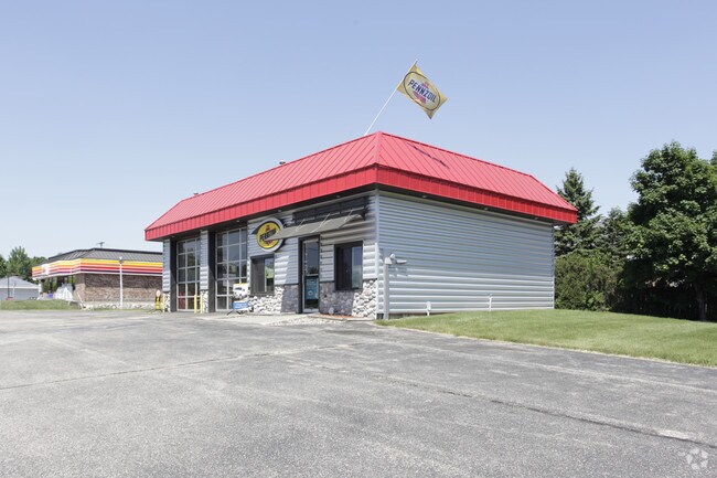
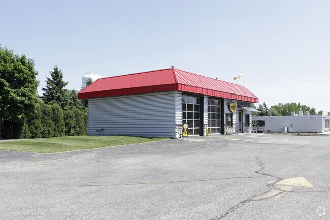
Property Record
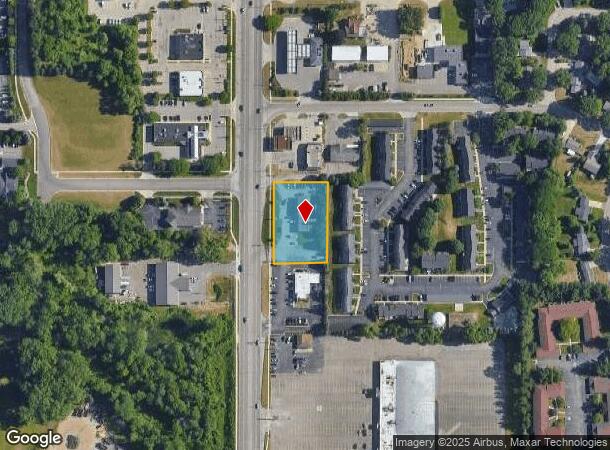
4586 Alpine Ave Nw, Comstock Park, MI 49321
NEARBY LISTINGS FOR SALE OR LEASE
Property Detail
4586 Alpine Ave Nw
41-09-25-351-017
PART SW 1/4 COM AT INT OF W SEC LINE & S LINE OF WESTSHIRE DR / 60 FT WIDE/ EXT W TH S ALONG W SEC LINE 620.0 FT TO S LINE OF
Autorepair
Kent
X
Michigan
26081C0287D
1.13 AC
2024
Comstock/Alpine
2025
West Michigan
011405
Grand Rapids-Wyoming, MI
3,168 SF
DEMOGRAPHICS near 4586 Alpine Ave Nw
1 Mile
3 Mile
5 Mile
2024 Total Population
7,292
25,904
101,352
2029 Population
7,343
26,005
101,649
Pop Growth 2024-2029
+ 0.70%
+ 0.39%
+ 0.29%
Average Age
37
39
38
2024 Total Households
3,129
11,005
41,688
HH Growth 2024-2029
+ 0.74%
+ 0.42%
+ 0.33%
Median Household Inc
$56,481
$61,756
$66,604
Avg Household Size
2.30
2.30
2.40
2024 Avg HH Vehicles
2.00
2.00
2.00
Median Home Value
$195,563
$226,558
$222,726
Median Year Built
1985
1978
1967
Nearby Places
Map Layers
Map Styles
 Street
 Aerial
- Restaurants
- Banks
- Shops
- Fitness
- Groceries
PUBLIC TRANSPORTATION
COMMUTER RAIL
DRIVE
WALK
Distance
11 min
7.3 mi
AIRPORT
Gerald R Ford International
DRIVE
WALK
Distance
Gerald R Ford International
29 min
19.9 mi
Nearby Properties
Address
Land Use
TOTAL SIZE
Lot Size
Zoning
Address
Land Use
TOTAL SIZE
Lot Size
Zoning
537,080 SF
46.61 AC
RPUD - 2
Address
Land Use
TOTAL SIZE
Lot Size
Zoning
352,362 SF
61.33 AC
IPUD
Address
Land Use
TOTAL SIZE
Lot Size
Zoning
451,792 SF
32.60 AC
ARM - MULT
Address
Land Use
TOTAL SIZE
Lot Size
Zoning
337,324 SF
10.15 AC
C-3
Address
Land Use
TOTAL SIZE
Lot Size
Zoning
169,898 SF
Address
Land Use
TOTAL SIZE
Lot Size
Zoning
Address
Land Use
TOTAL SIZE
Lot Size
Zoning
33.06 AC
R-3
Address
Land Use
TOTAL SIZE
Lot Size
Zoning
183,517 SF
44.93 AC
ML
Address
Land Use
TOTAL SIZE
Lot Size
Zoning
Address
Land Use
TOTAL SIZE
Lot Size
Zoning
136,468 SF
13.34 AC
CPUD
Address
Land Use
TOTAL SIZE
Lot Size
Zoning
165,184 SF
14.85 AC
CPUD
Address
Land Use
TOTAL SIZE
Lot Size
Zoning
32.63 AC
R-3
Address
Land Use
TOTAL SIZE
Lot Size
Zoning
214,046 SF
31.31 AC
C-2
Address
Land Use
TOTAL SIZE
Lot Size
Zoning
118,085 SF
10.94 AC
CPUD
Address
Land Use
TOTAL SIZE
Lot Size
Zoning
Address
Land Use
TOTAL SIZE
Lot Size
Zoning
169,926 SF
8.52 AC
C-2
Address
Land Use
TOTAL SIZE
Lot Size
Zoning
Address
Land Use
TOTAL SIZE
Lot Size
Zoning
239,172 SF
25.79 AC
C-2
Address
Land Use
TOTAL SIZE
Lot Size
Zoning
9.11 AC
R-3
Address
Land Use
TOTAL SIZE
Lot Size
Zoning
8.77 AC
R-3
Address
Land Use
TOTAL SIZE
Lot Size
Zoning
160,097 SF
11.58 AC
C-3
Address
Land Use
TOTAL SIZE
Lot Size
Zoning
221,081 SF
22.91 AC
C-2
Address
Land Use
TOTAL SIZE
Lot Size
Zoning
11.86 AC
R-3
Address
Land Use
TOTAL SIZE
Lot Size
Zoning
278,088 SF
22.75 AC
MP
Address
Land Use
TOTAL SIZE
Lot Size
Zoning
91,434 SF
14.22 AC
CPUD
Address
Land Use
TOTAL SIZE
Lot Size
Zoning
196,250 SF
12.67 AC
MP
Address
Land Use
TOTAL SIZE
Lot Size
Zoning
209,404 SF
13.20 AC
MH
Address
Land Use
TOTAL SIZE
Lot Size
Zoning
54,177 SF
1.54 AC
CPUD
Address
Land Use
TOTAL SIZE
Lot Size
Zoning
94,920 SF
3.46 AC
CPUD
Address
Land Use
TOTAL SIZE
Lot Size
Zoning
182,200 SF
15.52 AC
IPUD
The World's #1 Commercial Real Estate Marketplace
Connect with us
© 2025 CoStar Group
The information above has been obtained from sources believed reliable. While we do not doubt its accuracy we have not verified it and make no guarantee, warranty or representation about it. It is your responsibility to independently confirm its accuracy and completeness. Any projections, opinions, assumptions, or estimates used are for example only and do not represent the current or future performance of the property. The value of this transaction to you depends on tax and other factors which should be evaluated by your tax, financial, and legal advisors. You and your advisors should conduct a careful, independent investigation of the property to determine to your satisfaction the suitability of the property for your needs.