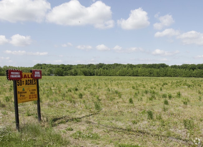
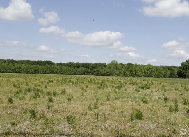
Property Record
459 Armstrong Corner Rd, Middletown, DE 19709

Property Detail
459 Armstrong Corner Rd
13-017.00-007
NEW CASTLE
Farms
Delaware
S
a
B and X Area of moderate flood hazard, usually the area between the limits of the 100-year and 500-year floods.
18.57 AC
2025
South New Castle County
2025
Philadelphia
016609
Philadelphia-Camden-Wilmington, PA-NJ-DE-MD
NEARBY LISTINGS FOR SALE OR LEASE
DEMOGRAPHICS near 459 Armstrong Corner Rd
1 mile
3 mile
5 mile
2025 Total Population
9,293
28,108
49,036
2030 Population
9,551
29,198
51,295
Pop Growth 2025-2030
+ 2.78%
+ 3.88%
+ 4.61%
Average Age
40
39
39
2025 Total Households
3,541
9,767
16,439
HH Growth 2025-2030
+ 2.80%
+ 3.98%
+ 4.74%
Median Household Inc
$81,047
$114,525
$129,534
Avg Household Size
2.60
2.90
2.90
2025 Avg HH Vehicles
2.00
2.00
2.00
Median Home Value
$342,075
$433,727
$463,861
Median Year Built
2004
2004
2004
Nearby Places
Map Layers
Map Styles
 Street
 Aerial
Layers
 Traffic
 Biking
Places
Listings with unknown addresses are not visible on the map
- Restaurants
- Banks
- Shops
- Fitness
- Groceries
SALE & LEASE HISTORY
LISTING DATE
SALE/LEASE

Sep 25, 2016
For Lease
Nearby Properties
Address
Land Use
TOTAL SIZE
Lot Size
Zoning
Address
Land Use
TOTAL SIZE
Lot Size
Zoning
Address
Land Use
TOTAL SIZE
Lot Size
Zoning
Address
Land Use
TOTAL SIZE
Lot Size
Zoning
9,936 SF
61.99 AC
S
Address
Land Use
TOTAL SIZE
Lot Size
Zoning
135,477 SF
19.69 AC
23R-1A
Address
Land Use
TOTAL SIZE
Lot Size
Zoning
207,080 SF
25.03 AC
23C-3
Address
Land Use
TOTAL SIZE
Lot Size
Zoning
106.43 AC
23C-3
Address
Land Use
TOTAL SIZE
Lot Size
Zoning
190,704 SF
8.76 AC
23C-3
Address
Land Use
TOTAL SIZE
Lot Size
Zoning
Address
Land Use
TOTAL SIZE
Lot Size
Zoning
14,640 SF
10.32 AC
23R-3
Address
Land Use
TOTAL SIZE
Lot Size
Zoning
14,640 SF
9.05 AC
23R-3
Address
Land Use
TOTAL SIZE
Lot Size
Zoning
140,136 SF
15.11 AC
23C-3
Address
Land Use
TOTAL SIZE
Lot Size
Zoning
15,392 SF
23.55 AC
23C-3
Address
Land Use
TOTAL SIZE
Lot Size
Zoning
12.79 AC
23C-3
Address
Land Use
TOTAL SIZE
Lot Size
Zoning
3,600 SF
15.46 AC
23C-3
Address
Land Use
TOTAL SIZE
Lot Size
Zoning
26,203 SF
22.03 AC
23C-3
Address
Land Use
TOTAL SIZE
Lot Size
Zoning
114,400 SF
16.16 AC
23M-I
Address
Land Use
TOTAL SIZE
Lot Size
Zoning
27,411 SF
11.33 AC
23C-3
Address
Land Use
TOTAL SIZE
Lot Size
Zoning
2,976 SF
16.05 AC
23R-1A
Address
Land Use
TOTAL SIZE
Lot Size
Zoning
8,240 SF
10.81 AC
23C-3
Address
Land Use
TOTAL SIZE
Lot Size
Zoning
Address
Land Use
TOTAL SIZE
Lot Size
Zoning
9,331 SF
6.74 AC
23C-3
Address
Land Use
TOTAL SIZE
Lot Size
Zoning
56,828 SF
2.04 AC
23C-3
Address
Land Use
TOTAL SIZE
Lot Size
Zoning
5,200 SF
11.98 AC
23C-3
Address
Land Use
TOTAL SIZE
Lot Size
Zoning
27.23 AC
S
Address
Land Use
TOTAL SIZE
Lot Size
Zoning
53,287 SF
4.21 AC
23R-2
Address
Land Use
TOTAL SIZE
Lot Size
Zoning
Address
Land Use
TOTAL SIZE
Lot Size
Zoning
2.90 AC
23C-3
Address
Land Use
TOTAL SIZE
Lot Size
Zoning
188,177 SF
9.03 AC
23M-I
Address
Land Use
TOTAL SIZE
Lot Size
Zoning
40.46 AC
23C-3
Address
Land Use
TOTAL SIZE
Lot Size
Zoning
58,012 SF
10 AC
23C-3
The World's #1 Commercial Real Estate Marketplace
Connect with us
© 2026 CoStar Group
The information above has been obtained from sources believed reliable. While we do not doubt its accuracy we have not verified it and make no guarantee, warranty or representation about it. It is your responsibility to independently confirm its accuracy and completeness. Any projections, opinions, assumptions, or estimates used are for example only and do not represent the current or future performance of the property. The value of this transaction to you depends on tax and other factors which should be evaluated by your tax, financial, and legal advisors. You and your advisors should conduct a careful, independent investigation of the property to determine to your satisfaction the suitability of the property for your needs.