Property Record
459 E 149Th St, Bronx, NY 10455
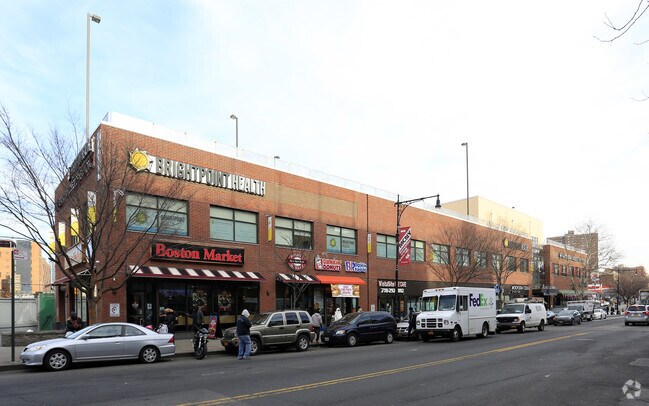
Property Detail
459 E 149Th St
02294-1003
Bronx
Officebuilding
New York
C4-4
1003
B and X Area of moderate flood hazard, usually the area between the limits of the 100-year and 500-year floods.
1.91 AC
0
Bronx
2025
Westchester/So Connecticut
007100
New York-Jersey City-White Plains, NY-NJ
26,041 SF
NEARBY LISTINGS FOR SALE OR LEASE
DEMOGRAPHICS near 459 E 149Th St
1 mile
3 mile
5 mile
2024 Total Population
168,550
1,235,438
2,787,906
2029 Population
166,777
1,248,609
2,818,383
Pop Growth 2024-2029
(1.05%)
+ 1.07%
+ 1.09%
Average Age
37
39
40
2024 Total Households
59,754
458,098
1,108,969
HH Growth 2024-2029
(1.49%)
+ 1.21%
+ 1.52%
Median Household Inc
$33,078
$46,336
$68,493
Avg Household Size
2.70
2.50
2.40
2024 Avg HH Vehicles
.00
.00
.00
Median Home Value
$355,960
$713,152
$783,122
Median Year Built
1966
1953
1953
Nearby Places
Map Layers
Map Styles
 Street
 Aerial
Transit
 Traffic
 Biking
Places
Listings with unknown addresses are not visible on the map
- Restaurants
- Banks
- Shops
- Fitness
- Groceries
PUBLIC TRANSPORTATION
TRANSIT/SUBWAY
3 Avenue-149 Street (2 - New York MTA Subway (The Subway), 5 - New York MTA Subway (The Subway))
Drive
Walk
Distance
3 Avenue-149 Street (2 - New York MTA Subway (The Subway), 5 - New York MTA Subway (The Subway))
1 min
4 min
0.2 mi
Jackson Avenue (2 - New York MTA Subway (The Subway), 5 - New York MTA Subway (The Subway))
Drive
Walk
Distance
Jackson Avenue (2 - New York MTA Subway (The Subway), 5 - New York MTA Subway (The Subway))
1 min
7 min
0.4 mi
Brook Avenue (6 - New York MTA Subway (The Subway))
Drive
Walk
Distance
Brook Avenue (6 - New York MTA Subway (The Subway))
2 min
12 min
0.6 mi
East 149 Street (6 - New York MTA Subway (The Subway))
Drive
Walk
Distance
East 149 Street (6 - New York MTA Subway (The Subway))
2 min
13 min
0.6 mi
East 143 Street-St Marys Street (6 - New York MTA Subway (The Subway))
Drive
Walk
Distance
East 143 Street-St Marys Street (6 - New York MTA Subway (The Subway))
3 min
15 min
0.8 mi
COMMUTER RAIL
Melrose Station (Harlem Line - Metro-North Commuter Railroad Company (Metro-North))
Drive
Walk
Distance
Melrose Station (Harlem Line - Metro-North Commuter Railroad Company (Metro-North))
5 min
18 min
0.9 mi
Harlem-125th Street Station (Harlem Line - Metro-North Commuter Railroad Company (Metro-North), Hudson Line - Metro-North Commuter Railroad Company (Metro-North), New Haven Line - Metro-North Commuter Railroad Company (Metro-North))
Drive
Walk
Distance
Harlem-125th Street Station (Harlem Line - Metro-North Commuter Railroad Company (Metro-North), Hudson Line - Metro-North Commuter Railroad Company (Metro-North), New Haven Line - Metro-North Commuter Railroad Company (Metro-North))
6 min
1.7 mi
AIRPORT
LaGuardia
Drive
Walk
Distance
LaGuardia
15 min
6.4 mi
John F Kennedy International
Drive
Walk
Distance
John F Kennedy International
28 min
17.6 mi
Newark Liberty International
Drive
Walk
Distance
Newark Liberty International
32 min
23.7 mi
Freight Ports
NY - Red Hook Container Terminal
Drive
Walk
Distance
NY - Red Hook Container Terminal
27 min
14.6 mi
SALE & LEASE HISTORY
LISTING DATE
SALE/LEASE

Oct 24, 2017
For Lease
Jan 11, 2018
For Lease
Nearby Properties
Address
Land Use
TOTAL SIZE
Lot Size
Zoning
Address
Land Use
TOTAL SIZE
Lot Size
Zoning
5,519,372 SF
409.21 AC
C8-2
Address
Land Use
TOTAL SIZE
Lot Size
Zoning
3,693,539 SF
8.37 AC
R8
Address
Land Use
TOTAL SIZE
Lot Size
Zoning
400,160 SF
10.96 AC
R7-2
Address
Land Use
TOTAL SIZE
Lot Size
Zoning
2,215,000 SF
6.43 AC
R9
Address
Land Use
TOTAL SIZE
Lot Size
Zoning
1,368,870 SF
16.86 AC
R8
Address
Land Use
TOTAL SIZE
Lot Size
Zoning
2,278,432 SF
5.99 AC
R7-2
Address
Land Use
TOTAL SIZE
Lot Size
Zoning
755,000 SF
1.85 AC
R7-2
Address
Land Use
TOTAL SIZE
Lot Size
Zoning
873,000 SF
9.95 AC
R7-2
Address
Land Use
TOTAL SIZE
Lot Size
Zoning
1,670,868 SF
9.14 AC
R8
Address
Land Use
TOTAL SIZE
Lot Size
Zoning
0.06 AC
R8
Address
Land Use
TOTAL SIZE
Lot Size
Zoning
1,651,267 SF
1.23 AC
R8
Address
Land Use
TOTAL SIZE
Lot Size
Zoning
1,075,000 SF
6.74 AC
R7-2
Address
Land Use
TOTAL SIZE
Lot Size
Zoning
478,842 SF
3.56 AC
C6-1
Address
Land Use
TOTAL SIZE
Lot Size
Zoning
891,040 SF
5.63 AC
R8
Address
Land Use
TOTAL SIZE
Lot Size
Zoning
0.36 AC
R8
Address
Land Use
TOTAL SIZE
Lot Size
Zoning
1,311,800 SF
9.89 AC
C4-4
Address
Land Use
TOTAL SIZE
Lot Size
Zoning
908,799 SF
2.13 AC
R10
Address
Land Use
TOTAL SIZE
Lot Size
Zoning
23.12 AC
PARK
Address
Land Use
TOTAL SIZE
Lot Size
Zoning
698,122 SF
3.47 AC
R8
Address
Land Use
TOTAL SIZE
Lot Size
Zoning
207.09 AC
PARK
Address
Land Use
TOTAL SIZE
Lot Size
Zoning
422,000 SF
0.86 AC
R9
Address
Land Use
TOTAL SIZE
Lot Size
Zoning
1,390,324 SF
6.87 AC
R8
Address
Land Use
TOTAL SIZE
Lot Size
Zoning
807,327 SF
0.60 AC
R8
Address
Land Use
TOTAL SIZE
Lot Size
Zoning
507,265 SF
4.04 AC
C4-4
Address
Land Use
TOTAL SIZE
Lot Size
Zoning
892,550 SF
2.93 AC
M13R8
Address
Land Use
TOTAL SIZE
Lot Size
Zoning
948 SF
282.37 AC
PARK
Address
Land Use
TOTAL SIZE
Lot Size
Zoning
2,531,670 SF
17.15 AC
R7-2
Address
Land Use
TOTAL SIZE
Lot Size
Zoning
710,600 SF
2.71 AC
R8
Address
Land Use
TOTAL SIZE
Lot Size
Zoning
517,876 SF
1.83 AC
C6-1
Address
Land Use
TOTAL SIZE
Lot Size
Zoning
94,247 SF
8.63 AC
M1-4
The World's #1 Commercial Real Estate Marketplace
Connect with us
© 2026 CoStar Group
The information above has been obtained from sources believed reliable. While we do not doubt its accuracy we have not verified it and make no guarantee, warranty or representation about it. It is your responsibility to independently confirm its accuracy and completeness. Any projections, opinions, assumptions, or estimates used are for example only and do not represent the current or future performance of the property. The value of this transaction to you depends on tax and other factors which should be evaluated by your tax, financial, and legal advisors. You and your advisors should conduct a careful, independent investigation of the property to determine to your satisfaction the suitability of the property for your needs.