Property Record
459 Jackson Rd, Atco, NJ 08004


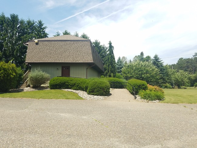
Property Detail
459 Jackson Rd
35-01502-0000-00003
2
Commercialnec
Camden
NB
New Jersey
B and X Area of moderate flood hazard, usually the area between the limits of the 100-year and 500-year floods.
3
2025
1 AC
2025
South Camden County
608901
Philadelphia
2,200 SF
Philadelphia-Camden-Wilmington, PA-NJ-DE-MD
NEARBY LISTINGS FOR SALE OR LEASE
DEMOGRAPHICS near 459 Jackson Rd
1 mile
3 mile
5 mile
2025 Total Population
3,379
22,140
51,458
2030 Population
3,455
22,800
52,731
Pop Growth 2025-2030
+ 2.25%
+ 2.98%
+ 2.47%
Average Age
42
43
43
2025 Total Households
1,132
8,322
19,240
HH Growth 2025-2030
+ 2.39%
+ 3.20%
+ 2.62%
Median Household Inc
$108,005
$106,857
$114,311
Avg Household Size
2.70
2.60
2.60
2025 Avg HH Vehicles
2.00
2.00
2.00
Median Home Value
$286,335
$307,273
$346,652
Median Year Built
1976
1977
1979
Nearby Places
Map Layers
Map Styles
 Street
 Aerial
Transit
 Traffic
 Biking
Places
Listings with unknown addresses are not visible on the map
- Restaurants
- Banks
- Shops
- Fitness
- Groceries
PUBLIC TRANSPORTATION
COMMUTER RAIL
Atco (Atlantic City Line - NJ Transit Commuter Rail (NJ Transit))
Drive
Walk
Distance
Atco (Atlantic City Line - NJ Transit Commuter Rail (NJ Transit))
6 min
3.4 mi
Lindenwold (NJT) (Atlantic City Line - NJ Transit Commuter Rail (NJ Transit))
Drive
Walk
Distance
Lindenwold (NJT) (Atlantic City Line - NJ Transit Commuter Rail (NJ Transit))
13 min
8.3 mi
AIRPORT
Philadelphia International
Drive
Walk
Distance
Philadelphia International
42 min
27.0 mi
Atlantic City International
Drive
Walk
Distance
Atlantic City International
63 min
33.0 mi
Trenton Mercer
Drive
Walk
Distance
Trenton Mercer
66 min
46.7 mi
SALE & LEASE HISTORY
LISTING DATE
SALE/LEASE

Jun 21, 2019
For Lease
Nearby Properties
Address
Land Use
TOTAL SIZE
Lot Size
Zoning
Address
Land Use
TOTAL SIZE
Lot Size
Zoning
6,208 SF
30.73 AC
PARC
Address
Land Use
TOTAL SIZE
Lot Size
Zoning
137.33 AC
PR3
Address
Land Use
TOTAL SIZE
Lot Size
Zoning
4,480 SF
88.36 AC
PR4
Address
Land Use
TOTAL SIZE
Lot Size
Zoning
27.18 AC
PR4
Address
Land Use
TOTAL SIZE
Lot Size
Zoning
69,324 SF
20.26 AC
Address
Land Use
TOTAL SIZE
Lot Size
Zoning
59,361 SF
19.21 AC
INST
Address
Land Use
TOTAL SIZE
Lot Size
Zoning
22.93 AC
PC-2
Address
Land Use
TOTAL SIZE
Lot Size
Zoning
14.10 AC
RD-1
Address
Land Use
TOTAL SIZE
Lot Size
Zoning
8.16 AC
I1
Address
Land Use
TOTAL SIZE
Lot Size
Zoning
8.56 AC
PARC
Address
Land Use
TOTAL SIZE
Lot Size
Zoning
5.06 AC
PF
Address
Land Use
TOTAL SIZE
Lot Size
Zoning
15.84 AC
RPF
Address
Land Use
TOTAL SIZE
Lot Size
Zoning
23.77 AC
RPF
Address
Land Use
TOTAL SIZE
Lot Size
Zoning
7.07 AC
PF
Address
Land Use
TOTAL SIZE
Lot Size
Zoning
20.99 AC
C-2
Address
Land Use
TOTAL SIZE
Lot Size
Zoning
5,702 SF
3.28 AC
C-3
Address
Land Use
TOTAL SIZE
Lot Size
Zoning
1,341 SF
1.98 AC
PHB
Address
Land Use
TOTAL SIZE
Lot Size
Zoning
Address
Land Use
TOTAL SIZE
Lot Size
Zoning
38.85 AC
PHB
Address
Land Use
TOTAL SIZE
Lot Size
Zoning
1.64 AC
INS
Address
Land Use
TOTAL SIZE
Lot Size
Zoning
18,934 SF
5.99 AC
C2RG
Address
Land Use
TOTAL SIZE
Lot Size
Zoning
21,116 SF
4.67 AC
PC2
Address
Land Use
TOTAL SIZE
Lot Size
Zoning
2.23 AC
Address
Land Use
TOTAL SIZE
Lot Size
Zoning
9,900 SF
154 AC
RPF
Address
Land Use
TOTAL SIZE
Lot Size
Zoning
2.66 AC
R-3
Address
Land Use
TOTAL SIZE
Lot Size
Zoning
38,854 SF
5.73 AC
I1
Address
Land Use
TOTAL SIZE
Lot Size
Zoning
69,370 SF
2.09 AC
I1
Address
Land Use
TOTAL SIZE
Lot Size
Zoning
14,594 SF
1.67 AC
PHB
Address
Land Use
TOTAL SIZE
Lot Size
Zoning
5.76 AC
PHB
Address
Land Use
TOTAL SIZE
Lot Size
Zoning
3.91 AC
I1
The World's #1 Commercial Real Estate Marketplace
Connect with us
© 2026 CoStar Group
The information above has been obtained from sources believed reliable. While we do not doubt its accuracy we have not verified it and make no guarantee, warranty or representation about it. It is your responsibility to independently confirm its accuracy and completeness. Any projections, opinions, assumptions, or estimates used are for example only and do not represent the current or future performance of the property. The value of this transaction to you depends on tax and other factors which should be evaluated by your tax, financial, and legal advisors. You and your advisors should conduct a careful, independent investigation of the property to determine to your satisfaction the suitability of the property for your needs.