Property Record
459 Sw 9Th St, Dundee, OR 97115
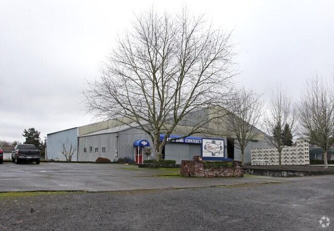


Property Detail
459 Sw 9Th St
Portland-Vancouver-Hillsboro, OR-WA
PARCEL 1 P2021-18
81020
Yamhill
Industrialgeneral
Oregon
LI
1
B and X Area of moderate flood hazard, usually the area between the limits of the 100-year and 500-year floods.
1.30 AC
2025
Yamhill County
2025
Portland
030303
NEARBY LISTINGS FOR SALE OR LEASE
DEMOGRAPHICS near 459 Sw 9Th St
1 mile
3 mile
5 mile
2025 Total Population
3,531
14,286
41,758
2030 Population
3,556
14,553
42,946
Pop Growth 2025-2030
+ 0.71%
+ 1.87%
+ 2.84%
Average Age
42
39
40
2025 Total Households
1,279
5,035
14,857
HH Growth 2025-2030
+ 0.86%
+ 2.05%
+ 3.12%
Median Household Inc
$118,181
$91,621
$99,610
Avg Household Size
2.80
2.70
2.70
2025 Avg HH Vehicles
3.00
2.00
2.00
Median Home Value
$563,943
$497,164
$511,327
Median Year Built
1991
1984
1992
Nearby Places
Map Layers
Map Styles
 Street
 Aerial
Transit
 Traffic
 Biking
Places
Listings with unknown addresses are not visible on the map
- Restaurants
- Banks
- Shops
- Fitness
- Groceries
PUBLIC TRANSPORTATION
AIRPORT
Portland International
Drive
Walk
Distance
Portland International
65 min
38.0 mi
Freight Ports
Port of Portland
Drive
Walk
Distance
Port of Portland
52 min
29.2 mi
Nearby Properties
Address
Land Use
TOTAL SIZE
Lot Size
Zoning
Address
Land Use
TOTAL SIZE
Lot Size
Zoning
38.84 AC
EF-80
Address
Land Use
TOTAL SIZE
Lot Size
Zoning
8,477 SF
72.03 AC
EF-80
Address
Land Use
TOTAL SIZE
Lot Size
Zoning
Address
Land Use
TOTAL SIZE
Lot Size
Zoning
1,282 SF
19.39 AC
EF-20
Address
Land Use
TOTAL SIZE
Lot Size
Zoning
14.28 AC
R-2
Address
Land Use
TOTAL SIZE
Lot Size
Zoning
26,820 SF
46.60 AC
EF-80
Address
Land Use
TOTAL SIZE
Lot Size
Zoning
Address
Land Use
TOTAL SIZE
Lot Size
Zoning
4,578 SF
38.05 AC
I
Address
Land Use
TOTAL SIZE
Lot Size
Zoning
7,148 SF
18.89 AC
EF-40
Address
Land Use
TOTAL SIZE
Lot Size
Zoning
792 SF
4.26 AC
R-3
Address
Land Use
TOTAL SIZE
Lot Size
Zoning
1,010 SF
8.55 AC
Address
Land Use
TOTAL SIZE
Lot Size
Zoning
Address
Land Use
TOTAL SIZE
Lot Size
Zoning
2.38 AC
LI
Address
Land Use
TOTAL SIZE
Lot Size
Zoning
0.48 AC
CBD
Address
Land Use
TOTAL SIZE
Lot Size
Zoning
30 AC
EF-20
Address
Land Use
TOTAL SIZE
Lot Size
Zoning
3.40 AC
R-1
Address
Land Use
TOTAL SIZE
Lot Size
Zoning
Address
Land Use
TOTAL SIZE
Lot Size
Zoning
4.99 AC
RI
Address
Land Use
TOTAL SIZE
Lot Size
Zoning
2.92 AC
R-3
Address
Land Use
TOTAL SIZE
Lot Size
Zoning
Address
Land Use
TOTAL SIZE
Lot Size
Zoning
2.02 AC
R-2
Address
Land Use
TOTAL SIZE
Lot Size
Zoning
5.59 AC
M-2
Address
Land Use
TOTAL SIZE
Lot Size
Zoning
1,632 SF
0.96 AC
R-3
Address
Land Use
TOTAL SIZE
Lot Size
Zoning
0.28 AC
C-3
Address
Land Use
TOTAL SIZE
Lot Size
Zoning
1,952 SF
1.98 AC
R-3
Address
Land Use
TOTAL SIZE
Lot Size
Zoning
1,564 SF
2.30 AC
R-2
Address
Land Use
TOTAL SIZE
Lot Size
Zoning
Address
Land Use
TOTAL SIZE
Lot Size
Zoning
118.85 AC
HI
Address
Land Use
TOTAL SIZE
Lot Size
Zoning
1.38 AC
LI
Address
Land Use
TOTAL SIZE
Lot Size
Zoning
1.34 AC
C-3
The World's #1 Commercial Real Estate Marketplace
Connect with us
© 2026 CoStar Group
The information above has been obtained from sources believed reliable. While we do not doubt its accuracy we have not verified it and make no guarantee, warranty or representation about it. It is your responsibility to independently confirm its accuracy and completeness. Any projections, opinions, assumptions, or estimates used are for example only and do not represent the current or future performance of the property. The value of this transaction to you depends on tax and other factors which should be evaluated by your tax, financial, and legal advisors. You and your advisors should conduct a careful, independent investigation of the property to determine to your satisfaction the suitability of the property for your needs.