Property Record
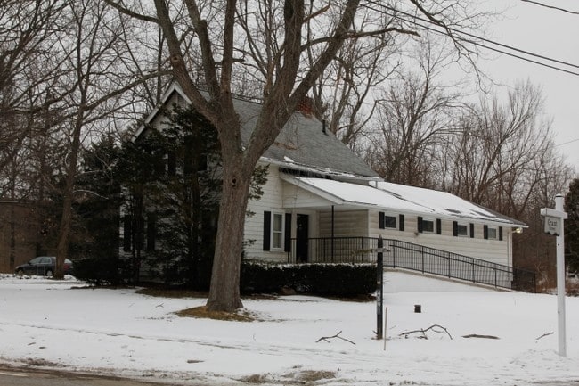
4591 W Streetsboro Rd, Richfield, OH 44286

NEARBY LISTINGS FOR SALE OR LEASE
Property Detail
4591 W Streetsboro Rd
50-00651
TR 1 LOT 22 SW SUB 4 .250A
Medicalbuilding
Summit
X
Ohio
39153C0085F
22
2023
0.25 AC
2025
Akron
532501
Cleveland
2,104 SF
Akron, OH
DEMOGRAPHICS near 4591 W Streetsboro Rd
1 Mile
3 Mile
5 Mile
2024 Total Population
1,394
7,768
24,140
2029 Population
1,364
7,658
23,684
Pop Growth 2024-2029
(2.15%)
(1.42%)
(1.89%)
Average Age
47
45
44
2024 Total Households
521
2,890
9,181
HH Growth 2024-2029
(2.30%)
(1.45%)
(2.06%)
Median Household Inc
$140,889
$128,519
$126,352
Avg Household Size
2.50
2.60
2.60
2024 Avg HH Vehicles
2.00
2.00
2.00
Median Home Value
$462,025
$403,643
$376,511
Median Year Built
1978
1978
1985
Nearby Places
Map Layers
Map Styles
 Street
 Aerial
- Restaurants
- Banks
- Shops
- Fitness
- Groceries
PUBLIC TRANSPORTATION
COMMUTER RAIL
DRIVE
WALK
Distance
11 min
5.8 mi
DRIVE
WALK
Distance
13 min
6.3 mi
AIRPORT
Cleveland-Hopkins International
DRIVE
WALK
Distance
Cleveland-Hopkins International
36 min
22.9 mi
Akron-Canton Regional
DRIVE
WALK
Distance
Akron-Canton Regional
41 min
31.6 mi
SALE & LEASE HISTORY
LISTING DATE
SALE/LEASE

Sep 24, 2016
For Sale
Nearby Properties
Address
Land Use
TOTAL SIZE
Lot Size
Zoning
Address
Land Use
TOTAL SIZE
Lot Size
Zoning
Address
Land Use
TOTAL SIZE
Lot Size
Zoning
216,612 SF
16.89 AC
Address
Land Use
TOTAL SIZE
Lot Size
Zoning
72,796 SF
11.49 AC
Address
Land Use
TOTAL SIZE
Lot Size
Zoning
Address
Land Use
TOTAL SIZE
Lot Size
Zoning
49,530 SF
8.28 AC
Address
Land Use
TOTAL SIZE
Lot Size
Zoning
207,280 SF
18.60 AC
M-D
Address
Land Use
TOTAL SIZE
Lot Size
Zoning
54,750 SF
8.88 AC
Address
Land Use
TOTAL SIZE
Lot Size
Zoning
131,001 SF
13.47 AC
Address
Land Use
TOTAL SIZE
Lot Size
Zoning
183.35 AC
Address
Land Use
TOTAL SIZE
Lot Size
Zoning
99,468 SF
10.04 AC
Address
Land Use
TOTAL SIZE
Lot Size
Zoning
Address
Land Use
TOTAL SIZE
Lot Size
Zoning
Address
Land Use
TOTAL SIZE
Lot Size
Zoning
Address
Land Use
TOTAL SIZE
Lot Size
Zoning
Address
Land Use
TOTAL SIZE
Lot Size
Zoning
48,928 SF
5.33 AC
Address
Land Use
TOTAL SIZE
Lot Size
Zoning
58,977 SF
2.19 AC
Address
Land Use
TOTAL SIZE
Lot Size
Zoning
Address
Land Use
TOTAL SIZE
Lot Size
Zoning
105,120 SF
8.34 AC
Address
Land Use
TOTAL SIZE
Lot Size
Zoning
42,306 SF
2.82 AC
Address
Land Use
TOTAL SIZE
Lot Size
Zoning
55,070 SF
7 AC
Address
Land Use
TOTAL SIZE
Lot Size
Zoning
Address
Land Use
TOTAL SIZE
Lot Size
Zoning
Address
Land Use
TOTAL SIZE
Lot Size
Zoning
2,016 SF
156 AC
Address
Land Use
TOTAL SIZE
Lot Size
Zoning
120,153 SF
12.06 AC
M-D
Address
Land Use
TOTAL SIZE
Lot Size
Zoning
59,852 SF
7 AC
Address
Land Use
TOTAL SIZE
Lot Size
Zoning
28,087 SF
184.46 AC
Address
Land Use
TOTAL SIZE
Lot Size
Zoning
37,356 SF
4.41 AC
Address
Land Use
TOTAL SIZE
Lot Size
Zoning
81,134 SF
61.23 AC
Address
Land Use
TOTAL SIZE
Lot Size
Zoning
45,231 SF
11.93 AC
Address
Land Use
TOTAL SIZE
Lot Size
Zoning
The World's #1 Commercial Real Estate Marketplace
Connect with us
© 2026 CoStar Group
The information above has been obtained from sources believed reliable. While we do not doubt its accuracy we have not verified it and make no guarantee, warranty or representation about it. It is your responsibility to independently confirm its accuracy and completeness. Any projections, opinions, assumptions, or estimates used are for example only and do not represent the current or future performance of the property. The value of this transaction to you depends on tax and other factors which should be evaluated by your tax, financial, and legal advisors. You and your advisors should conduct a careful, independent investigation of the property to determine to your satisfaction the suitability of the property for your needs.