Property Record
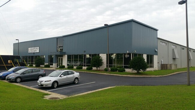
4595 Sandesara Dr, Prince George, VA 23875


NEARBY LISTINGS FOR SALE OR LEASE
Property Detail
4595 Sandesara Dr
340-21-00-00A-0
LT: A BK: SEC:1; SUB:SANDERSARA BUSINESS PARK; ACRES:2.753;
Distributionwarehouseregional
Prince George
X
Virginia
51149C0155C
a
0
2.75 AC
2025
Prince George
850502
Richmond VA
44,250 SF
Richmond, VA
DEMOGRAPHICS near 4595 Sandesara Dr
1 Mile
3 Mile
5 Mile
2024 Total Population
442
15,042
45,780
2029 Population
445
15,063
45,788
Pop Growth 2024-2029
+ 0.68%
+ 0.14%
+ 0.02%
Average Age
42
35
37
2024 Total Households
165
5,466
16,368
HH Growth 2024-2029
+ 0.61%
(0.64%)
(0.36%)
Median Household Inc
$83,482
$68,401
$58,101
Avg Household Size
2.60
2.60
2.40
2024 Avg HH Vehicles
2.00
2.00
2.00
Median Home Value
$222,727
$173,364
$188,074
Median Year Built
1977
1993
1980
Nearby Places
Map Layers
Map Styles
 Street
 Aerial
- Restaurants
- Banks
- Shops
- Fitness
- Groceries
PUBLIC TRANSPORTATION
COMMUTER RAIL
DRIVE
WALK
Distance
14 min
8.8 mi
AIRPORT
Richmond International
DRIVE
WALK
Distance
Richmond International
39 min
30.0 mi
Freight Ports
Virginia Port Authority - Richmond
DRIVE
WALK
Distance
Virginia Port Authority - Richmond
36 min
25.1 mi
SALE & LEASE HISTORY
LISTING DATE
SALE/LEASE

Sep 25, 2016
For Lease
Oct 30, 2019
For Lease
Nearby Properties
Address
Land Use
TOTAL SIZE
Lot Size
Zoning
Address
Land Use
TOTAL SIZE
Lot Size
Zoning
24.02 AC
B-2C
Address
Land Use
TOTAL SIZE
Lot Size
Zoning
28.17 AC
PUD
Address
Land Use
TOTAL SIZE
Lot Size
Zoning
816,246 SF
71.25 AC
I1
Address
Land Use
TOTAL SIZE
Lot Size
Zoning
778,367 SF
155.40 AC
Address
Land Use
TOTAL SIZE
Lot Size
Zoning
157.15 AC
I1
Address
Land Use
TOTAL SIZE
Lot Size
Zoning
17.09 AC
PUD
Address
Land Use
TOTAL SIZE
Lot Size
Zoning
138,804 SF
74.15 AC
M2
Address
Land Use
TOTAL SIZE
Lot Size
Zoning
264,335 SF
70 AC
M-2
Address
Land Use
TOTAL SIZE
Lot Size
Zoning
11.57 AC
PUD
Address
Land Use
TOTAL SIZE
Lot Size
Zoning
58,054 SF
14.19 AC
11
Address
Land Use
TOTAL SIZE
Lot Size
Zoning
205,626 SF
151.04 AC
M-2
Address
Land Use
TOTAL SIZE
Lot Size
Zoning
407,650 SF
136.67 AC
M-2
Address
Land Use
TOTAL SIZE
Lot Size
Zoning
76,614 SF
16.16 AC
RA
Address
Land Use
TOTAL SIZE
Lot Size
Zoning
252,133 SF
14.59 AC
Address
Land Use
TOTAL SIZE
Lot Size
Zoning
51,463 SF
15.18 AC
I1
Address
Land Use
TOTAL SIZE
Lot Size
Zoning
62,104 SF
20 AC
I1
Address
Land Use
TOTAL SIZE
Lot Size
Zoning
42,561 SF
6.91 AC
B-2C
Address
Land Use
TOTAL SIZE
Lot Size
Zoning
151,980 SF
23.12 AC
PUD
Address
Land Use
TOTAL SIZE
Lot Size
Zoning
149,472 SF
14.68 AC
R-4
Address
Land Use
TOTAL SIZE
Lot Size
Zoning
8.72 AC
PUD
Address
Land Use
TOTAL SIZE
Lot Size
Zoning
1.09 AC
PUD
Address
Land Use
TOTAL SIZE
Lot Size
Zoning
102,424 SF
14.71 AC
PUD
Address
Land Use
TOTAL SIZE
Lot Size
Zoning
278,833 SF
806.30 AC
I1
Address
Land Use
TOTAL SIZE
Lot Size
Zoning
20.47 AC
I1
Address
Land Use
TOTAL SIZE
Lot Size
Zoning
84,064 SF
15.54 AC
PUD
Address
Land Use
TOTAL SIZE
Lot Size
Zoning
128,816 SF
26.11 AC
I1
Address
Land Use
TOTAL SIZE
Lot Size
Zoning
84 AC
I1
Address
Land Use
TOTAL SIZE
Lot Size
Zoning
33,360 SF
0.45 AC
B-2C
Address
Land Use
TOTAL SIZE
Lot Size
Zoning
25,994 SF
3.75 AC
11
Address
Land Use
TOTAL SIZE
Lot Size
Zoning
960 SF
13.24 AC
B-1
The World's #1 Commercial Real Estate Marketplace
Connect with us
© 2025 CoStar Group
The information above has been obtained from sources believed reliable. While we do not doubt its accuracy we have not verified it and make no guarantee, warranty or representation about it. It is your responsibility to independently confirm its accuracy and completeness. Any projections, opinions, assumptions, or estimates used are for example only and do not represent the current or future performance of the property. The value of this transaction to you depends on tax and other factors which should be evaluated by your tax, financial, and legal advisors. You and your advisors should conduct a careful, independent investigation of the property to determine to your satisfaction the suitability of the property for your needs.