Property Record
46 Derry St, Hudson, NH 03051

Save to a Folder
{{folder.Name}}
{{folder.ListingIds.length}} Properties
{{folder.ListingIds.length}} Property
Create a New Folder
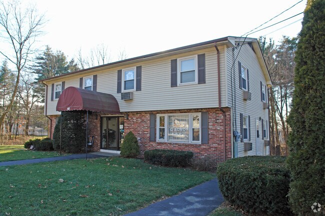
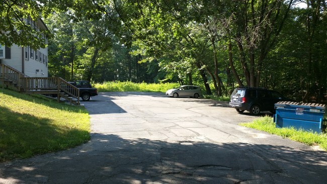
Property Detail
46 Derry St
Officebuilding
Hillsborough
BD
New Hampshire
B and X Area of moderate flood hazard, usually the area between the limits of the 100-year and 500-year floods.
0.38 AC
2025
Hillsborough
2025
Boston
012202
Manchester-Nashua, NH
2,976 SF
HDSO-000173-000034
NEARBY LISTINGS FOR SALE OR LEASE
DEMOGRAPHICS near 46 Derry St
1 mile
3 mile
5 mile
2025 Total Population
10,407
66,882
124,475
2030 Population
10,565
67,756
126,091
Pop Growth 2025-2030
+ 1.52%
+ 1.31%
+ 1.30%
Average Age
41
41
42
2025 Total Households
4,397
27,099
50,864
HH Growth 2025-2030
+ 1.50%
+ 1.39%
+ 1.37%
Median Household Inc
$83,209
$98,517
$106,761
Avg Household Size
2.30
2.40
2.40
2025 Avg HH Vehicles
2.00
2.00
2.00
Median Home Value
$380,324
$417,173
$436,295
Median Year Built
1965
1967
1977
Nearby Places
Map Layers
Map Styles
 Street
 Aerial
Layers
 Traffic
 Biking
Places
Listings with unknown addresses are not visible on the map
- Restaurants
- Banks
- Shops
- Fitness
- Groceries
PUBLIC TRANSPORTATION
AIRPORT
Manchester Boston Regional
Drive
Walk
Distance
Manchester Boston Regional
29 min
16.4 mi
SALE & LEASE HISTORY
LISTING DATE
SALE/LEASE

Sep 25, 2016
For Lease
Sep 24, 2016
For Sale
Feb 17, 2017
For Lease
Nearby Properties
Address
Land Use
TOTAL SIZE
Lot Size
Zoning
Address
Land Use
TOTAL SIZE
Lot Size
Zoning
19.70 AC
RB
Address
Land Use
TOTAL SIZE
Lot Size
Zoning
27.98 AC
GI
Address
Land Use
TOTAL SIZE
Lot Size
Zoning
522,476 SF
74.89 AC
ID
Address
Land Use
TOTAL SIZE
Lot Size
Zoning
60.25 AC
PI
Address
Land Use
TOTAL SIZE
Lot Size
Zoning
220,295 SF
4.34 AC
D1MU
Address
Land Use
TOTAL SIZE
Lot Size
Zoning
26.55 AC
INDUST
Address
Land Use
TOTAL SIZE
Lot Size
Zoning
5.30 AC
GIMU
Address
Land Use
TOTAL SIZE
Lot Size
Zoning
133,390 SF
97.42 AC
B
Address
Land Use
TOTAL SIZE
Lot Size
Zoning
231,216 SF
1.88 AC
GIMU
Address
Land Use
TOTAL SIZE
Lot Size
Zoning
2.77 AC
GIMU
Address
Land Use
TOTAL SIZE
Lot Size
Zoning
16.12 AC
RC
Address
Land Use
TOTAL SIZE
Lot Size
Zoning
188,520 SF
111.12 AC
GD
Address
Land Use
TOTAL SIZE
Lot Size
Zoning
37.57 AC
R9
Address
Land Use
TOTAL SIZE
Lot Size
Zoning
8.87 AC
RC
Address
Land Use
TOTAL SIZE
Lot Size
Zoning
21.16 AC
D3MU
Address
Land Use
TOTAL SIZE
Lot Size
Zoning
312,738 SF
25.84 AC
ID
Address
Land Use
TOTAL SIZE
Lot Size
Zoning
471,525 SF
28.76 AC
INDUST
Address
Land Use
TOTAL SIZE
Lot Size
Zoning
261,381 SF
3.78 AC
GIMU
Address
Land Use
TOTAL SIZE
Lot Size
Zoning
185,242 SF
35.75 AC
ID
Address
Land Use
TOTAL SIZE
Lot Size
Zoning
180,284 SF
16.13 AC
RB
Address
Land Use
TOTAL SIZE
Lot Size
Zoning
162,400 SF
3.60 AC
GIMU
Address
Land Use
TOTAL SIZE
Lot Size
Zoning
129,441 SF
18.90 AC
R9
Address
Land Use
TOTAL SIZE
Lot Size
Zoning
141,816 SF
21.33 AC
R18
Address
Land Use
TOTAL SIZE
Lot Size
Zoning
13.02 AC
R9
Address
Land Use
TOTAL SIZE
Lot Size
Zoning
243,335 SF
2.71 AC
GIMU
Address
Land Use
TOTAL SIZE
Lot Size
Zoning
127,825 SF
D1MU
Address
Land Use
TOTAL SIZE
Lot Size
Zoning
8.07 AC
RC
Address
Land Use
TOTAL SIZE
Lot Size
Zoning
148,042 SF
28.53 AC
R2
Address
Land Use
TOTAL SIZE
Lot Size
Zoning
140,258 SF
8.02 AC
PI
Address
Land Use
TOTAL SIZE
Lot Size
Zoning
124,205 SF
19.38 AC
R9
The World's #1 Commercial Real Estate Marketplace
Connect with us
© 2026 CoStar Group
The information above has been obtained from sources believed reliable. While we do not doubt its accuracy we have not verified it and make no guarantee, warranty or representation about it. It is your responsibility to independently confirm its accuracy and completeness. Any projections, opinions, assumptions, or estimates used are for example only and do not represent the current or future performance of the property. The value of this transaction to you depends on tax and other factors which should be evaluated by your tax, financial, and legal advisors. You and your advisors should conduct a careful, independent investigation of the property to determine to your satisfaction the suitability of the property for your needs.