Property Record
46 Esco Way, Carrollton, GA 30116
NEARBY LISTINGS FOR SALE OR LEASE
-
-
View all Carrollton listings for sale on LoopNet.com
Property Detail
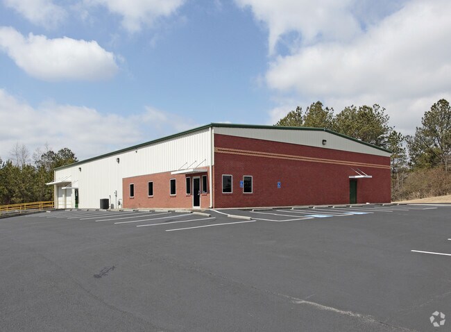
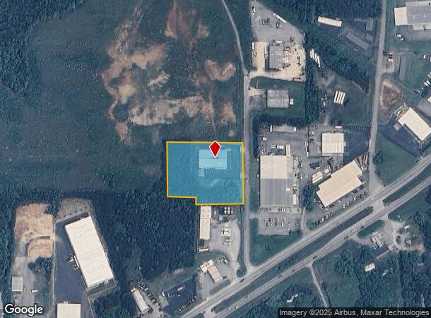
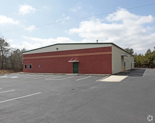
46 Esco Way
C04-0220049
COMM BLDG/LOT/ESCO WAY
Warehouse
Carroll
X
Georgia
13045C0256D
2.14 AC
2025
I-20 W/Douglasville
2025
Atlanta
910708
Atlanta-Sandy Springs-Roswell, GA
10,000 SF
DEMOGRAPHICS near 46 Esco Way
1 Mile
3 Mile
5 Mile
2024 Total Population
2,442
22,017
46,567
2029 Population
2,685
24,429
51,699
Pop Growth 2024-2029
+ 9.95%
+ 10.96%
+ 11.02%
Average Age
37
37
36
2024 Total Households
966
8,140
16,755
HH Growth 2024-2029
+ 10.04%
+ 11.01%
+ 11.20%
Median Household Inc
$46,924
$51,609
$48,209
Avg Household Size
2.50
2.60
2.60
2024 Avg HH Vehicles
2.00
2.00
2.00
Median Home Value
$151,045
$181,174
$212,120
Median Year Built
1984
1985
1987
Nearby Places
Map Layers
Map Styles
 Street
 Aerial
- Restaurants
- Banks
- Shops
- Fitness
- Groceries
PUBLIC TRANSPORTATION
AIRPORT
Hartsfield - Jackson Atlanta International
DRIVE
WALK
Distance
Hartsfield - Jackson Atlanta International
66 min
44.0 mi
SALE & LEASE HISTORY
LISTING DATE
SALE/LEASE

Apr 16, 2020
For Sale
Nearby Properties
Address
Land Use
TOTAL SIZE
Lot Size
Zoning
Address
Land Use
TOTAL SIZE
Lot Size
Zoning
152,962 SF
108.90 AC
OI
Address
Land Use
TOTAL SIZE
Lot Size
Zoning
134,113 SF
2.80 AC
OI
Address
Land Use
TOTAL SIZE
Lot Size
Zoning
73,900 SF
10.57 AC
C2
Address
Land Use
TOTAL SIZE
Lot Size
Zoning
44,708 SF
9.92 AC
RESIDENTIA
Address
Land Use
TOTAL SIZE
Lot Size
Zoning
56,458 SF
21.87 AC
R3
Address
Land Use
TOTAL SIZE
Lot Size
Zoning
276,510 SF
6.78 AC
M1
Address
Land Use
TOTAL SIZE
Lot Size
Zoning
56,288 SF
4.69 AC
C2
Address
Land Use
TOTAL SIZE
Lot Size
Zoning
163,568 SF
16.80 AC
C2
Address
Land Use
TOTAL SIZE
Lot Size
Zoning
90,800 SF
10.89 AC
C2
Address
Land Use
TOTAL SIZE
Lot Size
Zoning
42,905 SF
9.76 AC
002
Address
Land Use
TOTAL SIZE
Lot Size
Zoning
90,485 SF
10.35 AC
C2
Address
Land Use
TOTAL SIZE
Lot Size
Zoning
28,554 SF
0.74 AC
002
Address
Land Use
TOTAL SIZE
Lot Size
Zoning
13,299 SF
226.96 AC
R20
Address
Land Use
TOTAL SIZE
Lot Size
Zoning
3.23 AC
C1
Address
Land Use
TOTAL SIZE
Lot Size
Zoning
45,480 SF
62.18 AC
R20
Address
Land Use
TOTAL SIZE
Lot Size
Zoning
58,085 SF
4.10 AC
M1
Address
Land Use
TOTAL SIZE
Lot Size
Zoning
29,561 SF
5.89 AC
C2
Address
Land Use
TOTAL SIZE
Lot Size
Zoning
50,300 SF
6.48 AC
R2
Address
Land Use
TOTAL SIZE
Lot Size
Zoning
40,000 SF
3.12 AC
C1
Address
Land Use
TOTAL SIZE
Lot Size
Zoning
16,743 SF
10.92 AC
R2
Address
Land Use
TOTAL SIZE
Lot Size
Zoning
31,588 SF
2.39 AC
OI
Address
Land Use
TOTAL SIZE
Lot Size
Zoning
100.74 AC
PUD
Address
Land Use
TOTAL SIZE
Lot Size
Zoning
63,888 SF
8.40 AC
I
Address
Land Use
TOTAL SIZE
Lot Size
Zoning
96.23 AC
M1
Address
Land Use
TOTAL SIZE
Lot Size
Zoning
46,146 SF
5.74 AC
C
Address
Land Use
TOTAL SIZE
Lot Size
Zoning
25,341 SF
3.54 AC
C2
Address
Land Use
TOTAL SIZE
Lot Size
Zoning
39,147 SF
9 AC
R2
Address
Land Use
TOTAL SIZE
Lot Size
Zoning
27,572 SF
1.71 AC
C2
Address
Land Use
TOTAL SIZE
Lot Size
Zoning
22,580 SF
9.71 AC
R2
Address
Land Use
TOTAL SIZE
Lot Size
Zoning
32,390 SF
9.84 AC
R2
The World's #1 Commercial Real Estate Marketplace
Connect with us
© 2025 CoStar Group
The information above has been obtained from sources believed reliable. While we do not doubt its accuracy we have not verified it and make no guarantee, warranty or representation about it. It is your responsibility to independently confirm its accuracy and completeness. Any projections, opinions, assumptions, or estimates used are for example only and do not represent the current or future performance of the property. The value of this transaction to you depends on tax and other factors which should be evaluated by your tax, financial, and legal advisors. You and your advisors should conduct a careful, independent investigation of the property to determine to your satisfaction the suitability of the property for your needs.