Property Record
46 Main St, Kingston, MA 02364
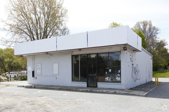


Property Detail
46 Main St
KING-000068-000123
Plymouth
Officebuilding
Massachusetts
B and X Area of moderate flood hazard, usually the area between the limits of the 100-year and 500-year floods.
0.46 AC
2025
Route 3 South
2025
Boston
509101
Boston-Cambridge-Newton, MA-NH
2,630 SF
NEARBY LISTINGS FOR SALE OR LEASE
-
-
-
-
No Photo
-
-
-
-
View all Kingston listings for lease on LoopNet.com
DEMOGRAPHICS near 46 Main St
1 mile
3 mile
5 mile
2025 Total Population
4,299
27,142
54,860
2030 Population
4,437
27,846
56,086
Pop Growth 2025-2030
+ 3.21%
+ 2.59%
+ 2.23%
Average Age
41
43
44
2025 Total Households
1,762
11,433
21,335
HH Growth 2025-2030
+ 3.29%
+ 2.54%
+ 2.21%
Median Household Inc
$108,847
$101,151
$109,941
Avg Household Size
2.40
2.30
2.50
2025 Avg HH Vehicles
2.00
2.00
2.00
Median Home Value
$640,983
$656,657
$664,356
Median Year Built
1970
1971
1975
Nearby Places
Map Layers
Map Styles
 Street
 Aerial
Transit
 Traffic
 Biking
Places
Listings with unknown addresses are not visible on the map
- Restaurants
- Banks
- Shops
- Fitness
- Groceries
PUBLIC TRANSPORTATION
COMMUTER RAIL
Kingston/Route 3 (Kingston/Plymouth Line - Massachusetts Bay Transportation Authority Commuter Rail (Purple Line))
Drive
Walk
Distance
Kingston/Route 3 (Kingston/Plymouth Line - Massachusetts Bay Transportation Authority Commuter Rail (Purple Line))
6 min
1.9 mi
Halifax (Kingston/Plymouth Line - Massachusetts Bay Transportation Authority Commuter Rail (Purple Line))
Drive
Walk
Distance
Halifax (Kingston/Plymouth Line - Massachusetts Bay Transportation Authority Commuter Rail (Purple Line))
19 min
9.1 mi
AIRPORT
General Edward Lawrence Logan International
Drive
Walk
Distance
General Edward Lawrence Logan International
54 min
38.6 mi
SALE & LEASE HISTORY
LISTING DATE
SALE/LEASE

Jun 12, 2017
For Sale
Dec 28, 2017
For Lease
Dec 28, 2017
For Sale
Nearby Properties
Address
Land Use
TOTAL SIZE
Lot Size
Zoning
Address
Land Use
TOTAL SIZE
Lot Size
Zoning
14.60 AC
MC
Address
Land Use
TOTAL SIZE
Lot Size
Zoning
375,020 SF
10.07 AC
Address
Land Use
TOTAL SIZE
Lot Size
Zoning
90,790 SF
16.04 AC
Address
Land Use
TOTAL SIZE
Lot Size
Zoning
205,540 SF
8.16 AC
LI
Address
Land Use
TOTAL SIZE
Lot Size
Zoning
4.67 AC
LI
Address
Land Use
TOTAL SIZE
Lot Size
Zoning
26.16 AC
MC
Address
Land Use
TOTAL SIZE
Lot Size
Zoning
27.31 AC
MC
Address
Land Use
TOTAL SIZE
Lot Size
Zoning
18.38 AC
AC
Address
Land Use
TOTAL SIZE
Lot Size
Zoning
214,442 SF
21.50 AC
MC
Address
Land Use
TOTAL SIZE
Lot Size
Zoning
122,558 SF
17.44 AC
GC
Address
Land Use
TOTAL SIZE
Lot Size
Zoning
18.33 AC
LI
Address
Land Use
TOTAL SIZE
Lot Size
Zoning
233,971 SF
14.93 AC
R20M
Address
Land Use
TOTAL SIZE
Lot Size
Zoning
28.68 AC
OS
Address
Land Use
TOTAL SIZE
Lot Size
Zoning
62,502 SF
0.92 AC
R20S
Address
Land Use
TOTAL SIZE
Lot Size
Zoning
12.71 AC
LI
Address
Land Use
TOTAL SIZE
Lot Size
Zoning
4.58 AC
R20M
Address
Land Use
TOTAL SIZE
Lot Size
Zoning
28.58 AC
Address
Land Use
TOTAL SIZE
Lot Size
Zoning
9.41 AC
MC
Address
Land Use
TOTAL SIZE
Lot Size
Zoning
16.30 AC
GC
Address
Land Use
TOTAL SIZE
Lot Size
Zoning
97,390 SF
16.25 AC
LI
Address
Land Use
TOTAL SIZE
Lot Size
Zoning
13.88 AC
LI
Address
Land Use
TOTAL SIZE
Lot Size
Zoning
3.13 AC
R20M
Address
Land Use
TOTAL SIZE
Lot Size
Zoning
99,759 SF
13.11 AC
Address
Land Use
TOTAL SIZE
Lot Size
Zoning
138,240 SF
16.70 AC
Address
Land Use
TOTAL SIZE
Lot Size
Zoning
89,568 SF
3.52 AC
R20S
Address
Land Use
TOTAL SIZE
Lot Size
Zoning
118,602 SF
10.49 AC
AC
Address
Land Use
TOTAL SIZE
Lot Size
Zoning
120,727 SF
30.61 AC
Address
Land Use
TOTAL SIZE
Lot Size
Zoning
4.87 AC
NB
Address
Land Use
TOTAL SIZE
Lot Size
Zoning
110,760 SF
2.09 AC
MC
Address
Land Use
TOTAL SIZE
Lot Size
Zoning
46,674 SF
9.26 AC
The World's #1 Commercial Real Estate Marketplace
Connect with us
© 2026 CoStar Group
The information above has been obtained from sources believed reliable. While we do not doubt its accuracy we have not verified it and make no guarantee, warranty or representation about it. It is your responsibility to independently confirm its accuracy and completeness. Any projections, opinions, assumptions, or estimates used are for example only and do not represent the current or future performance of the property. The value of this transaction to you depends on tax and other factors which should be evaluated by your tax, financial, and legal advisors. You and your advisors should conduct a careful, independent investigation of the property to determine to your satisfaction the suitability of the property for your needs.