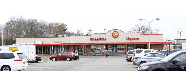
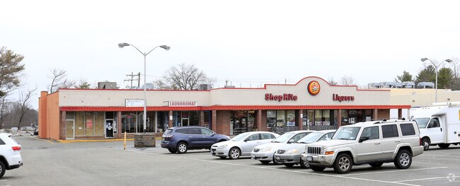
Property Record
46 N Middletown Rd, Pearl River, NY 10965
NEARBY LISTINGS FOR SALE OR LEASE
Property Detail
46 N Middletown Rd
392489-069-013-0001-006-000-0000
40/14/134/54
Commercialnec
Rockland
X
New York
34003C0092H
6.0
2023
2.30 AC
2024
Orangetown
012800
Northern New Jersey
17,140 SF
New York-Jersey City-White Plains, NY-NJ
DEMOGRAPHICS near 46 N Middletown Rd
1 Mile
3 Mile
5 Mile
2024 Total Population
11,850
65,046
222,448
2029 Population
11,800
65,022
221,378
Pop Growth 2024-2029
(0.42%)
(0.04%)
(0.48%)
Average Age
42
42
39
2024 Total Households
4,316
22,262
70,018
HH Growth 2024-2029
(0.53%)
(0.04%)
(0.45%)
Median Household Inc
$117,401
$136,891
$113,233
Avg Household Size
2.70
2.80
3.00
2024 Avg HH Vehicles
2.00
2.00
2.00
Median Home Value
$525,016
$641,980
$648,219
Median Year Built
1957
1965
1967
Nearby Places
- Restaurants
- Banks
- Shops
- Fitness
- Groceries
PUBLIC TRANSPORTATION
TRANSIT/SUBWAY
Pearl River (Pascack Valley Line - NJ Transit Commuter Rail (NJ Transit))
DRIVE
WALK
Distance
Pearl River (Pascack Valley Line - NJ Transit Commuter Rail (NJ Transit))
3 min
15 min
0.8 mi
COMMUTER RAIL
Pearl River (Pascack Valley Line - NJ Transit Commuter Rail (NJ Transit))
DRIVE
WALK
Distance
Pearl River (Pascack Valley Line - NJ Transit Commuter Rail (NJ Transit))
3 min
15 min
0.8 mi
Montvale (Pascack Valley Line - NJ Transit Commuter Rail (NJ Transit))
DRIVE
WALK
Distance
Montvale (Pascack Valley Line - NJ Transit Commuter Rail (NJ Transit))
4 min
2.2 mi
AIRPORT
Westchester County
DRIVE
WALK
Distance
Westchester County
37 min
24.4 mi
LaGuardia
DRIVE
WALK
Distance
LaGuardia
48 min
29.1 mi
Newark Liberty International
DRIVE
WALK
Distance
Newark Liberty International
43 min
31.8 mi
Freight Ports
NY - Red Hook Container Terminal
DRIVE
WALK
Distance
NY - Red Hook Container Terminal
57 min
33.0 mi
SALE & LEASE HISTORY
LISTING DATE
SALE/LEASE

Sep 25, 2016
For Lease
Nearby Properties
Address
Land Use
TOTAL SIZE
Lot Size
Zoning
Address
Land Use
TOTAL SIZE
Lot Size
Zoning
402,385 SF
23.10 AC
LI
Address
Land Use
TOTAL SIZE
Lot Size
Zoning
63,621 SF
180.20 AC
LI
Address
Land Use
TOTAL SIZE
Lot Size
Zoning
Address
Land Use
TOTAL SIZE
Lot Size
Zoning
Address
Land Use
TOTAL SIZE
Lot Size
Zoning
22.75 AC
Address
Land Use
TOTAL SIZE
Lot Size
Zoning
11.48 AC
OR-3
Address
Land Use
TOTAL SIZE
Lot Size
Zoning
237,408 SF
14.97 AC
R-40
Address
Land Use
TOTAL SIZE
Lot Size
Zoning
37,600 SF
31.41 AC
Address
Land Use
TOTAL SIZE
Lot Size
Zoning
24.45 AC
R40
Address
Land Use
TOTAL SIZE
Lot Size
Zoning
1,295,615 SF
93.54 AC
OP
Address
Land Use
TOTAL SIZE
Lot Size
Zoning
440 SF
98.43 AC
EO
Address
Land Use
TOTAL SIZE
Lot Size
Zoning
8.02 AC
BUS2
Address
Land Use
TOTAL SIZE
Lot Size
Zoning
11.45 AC
A
Address
Land Use
TOTAL SIZE
Lot Size
Zoning
114,520 SF
6.71 AC
R4
Address
Land Use
TOTAL SIZE
Lot Size
Zoning
50,280 SF
24.37 AC
Address
Land Use
TOTAL SIZE
Lot Size
Zoning
132,614 SF
15.74 AC
OR3
Address
Land Use
TOTAL SIZE
Lot Size
Zoning
11.94 AC
ORL
Address
Land Use
TOTAL SIZE
Lot Size
Zoning
11.50 AC
OR1
Address
Land Use
TOTAL SIZE
Lot Size
Zoning
107,043 SF
11 AC
OR3
Address
Land Use
TOTAL SIZE
Lot Size
Zoning
Address
Land Use
TOTAL SIZE
Lot Size
Zoning
119,025 SF
16.57 AC
OR3
Address
Land Use
TOTAL SIZE
Lot Size
Zoning
13 AC
R40
Address
Land Use
TOTAL SIZE
Lot Size
Zoning
11.24 AC
SED
Address
Land Use
TOTAL SIZE
Lot Size
Zoning
8.50 AC
R20
Address
Land Use
TOTAL SIZE
Lot Size
Zoning
10.66 AC
R15
Address
Land Use
TOTAL SIZE
Lot Size
Zoning
270,962 SF
21.80 AC
CS
Address
Land Use
TOTAL SIZE
Lot Size
Zoning
9.29 AC
OR3
Address
Land Use
TOTAL SIZE
Lot Size
Zoning
33.50 AC
Address
Land Use
TOTAL SIZE
Lot Size
Zoning
6,810 SF
120.70 AC
R-40
Address
Land Use
TOTAL SIZE
Lot Size
Zoning
67,962 SF
8.30 AC
02 - SINGL
The World's #1 Commercial Real Estate Marketplace
Connect with us
© 2025 CoStar Group
The information above has been obtained from sources believed reliable. While we do not doubt its accuracy we have not verified it and make no guarantee, warranty or representation about it. It is your responsibility to independently confirm its accuracy and completeness. Any projections, opinions, assumptions, or estimates used are for example only and do not represent the current or future performance of the property. The value of this transaction to you depends on tax and other factors which should be evaluated by your tax, financial, and legal advisors. You and your advisors should conduct a careful, independent investigation of the property to determine to your satisfaction the suitability of the property for your needs.