Property Record
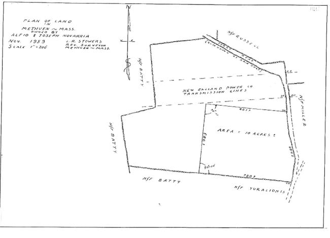
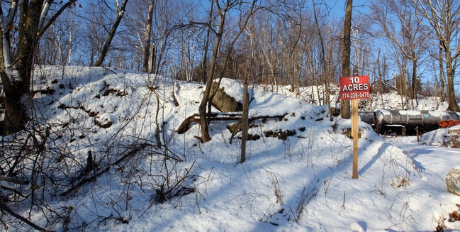
46 Old Ferry Rd, Methuen, MA 01844

Property Detail
46 Old Ferry Rd
METH-001010-000079-000017
ESSEX
Warehouse
Massachusetts
IL
17
B and X Area of moderate flood hazard, usually the area between the limits of the 100-year and 500-year floods.
19.80 AC
2025
Lawrence/Andover
2025
Boston
252502
Boston-Cambridge-Newton, MA-NH
147,840 SF
NEARBY LISTINGS FOR SALE OR LEASE
DEMOGRAPHICS near 46 Old Ferry Rd
1 mile
3 mile
5 mile
2025 Total Population
5,301
88,424
228,144
2030 Population
5,397
89,342
230,752
Pop Growth 2025-2030
+ 1.81%
+ 1.04%
+ 1.14%
Average Age
43
39
40
2025 Total Households
2,117
30,836
83,714
HH Growth 2025-2030
+ 1.51%
+ 1.15%
+ 1.30%
Median Household Inc
$94,917
$80,680
$78,015
Avg Household Size
2.50
2.70
2.60
2025 Avg HH Vehicles
2.00
2.00
2.00
Median Home Value
$523,286
$474,640
$469,060
Median Year Built
1983
1969
1962
Nearby Places
Map Layers
Map Styles
 Street
 Aerial
Layers
 Traffic
 Biking
Places
Listings with unknown addresses are not visible on the map
- Restaurants
- Banks
- Shops
- Fitness
- Groceries
PUBLIC TRANSPORTATION
COMMUTER RAIL
Haverhill (Haverhill Line - Massachusetts Bay Transportation Authority Commuter Rail (Purple Line))
Drive
Walk
Distance
Haverhill (Haverhill Line - Massachusetts Bay Transportation Authority Commuter Rail (Purple Line))
12 min
6.1 mi
Bradford (Haverhill Line - Massachusetts Bay Transportation Authority Commuter Rail (Purple Line))
Drive
Walk
Distance
Bradford (Haverhill Line - Massachusetts Bay Transportation Authority Commuter Rail (Purple Line))
12 min
6.4 mi
AIRPORT
Manchester Boston Regional
Drive
Walk
Distance
Manchester Boston Regional
43 min
26.7 mi
General Edward Lawrence Logan International
Drive
Walk
Distance
General Edward Lawrence Logan International
48 min
34.3 mi
Portsmouth International at Pease
Drive
Walk
Distance
Portsmouth International at Pease
50 min
35.5 mi
Freight Ports
Port of Boston
Drive
Walk
Distance
Port of Boston
49 min
34.1 mi
SALE & LEASE HISTORY
LISTING DATE
SALE/LEASE

Feb 13, 2017
For Sale
Feb 01, 2017
For Sale
Nearby Properties
Address
Land Use
TOTAL SIZE
Lot Size
Zoning
Address
Land Use
TOTAL SIZE
Lot Size
Zoning
110.12 AC
I2
Address
Land Use
TOTAL SIZE
Lot Size
Zoning
395,328 SF
49.52 AC
CN
Address
Land Use
TOTAL SIZE
Lot Size
Zoning
347,539 SF
45.99 AC
BH
Address
Land Use
TOTAL SIZE
Lot Size
Zoning
10.38 AC
Address
Land Use
TOTAL SIZE
Lot Size
Zoning
3,000 SF
44.13 AC
IL
Address
Land Use
TOTAL SIZE
Lot Size
Zoning
9.28 AC
I2
Address
Land Use
TOTAL SIZE
Lot Size
Zoning
204,300 SF
5.48 AC
Address
Land Use
TOTAL SIZE
Lot Size
Zoning
240,639 SF
2.65 AC
Address
Land Use
TOTAL SIZE
Lot Size
Zoning
472,045 SF
72.30 AC
HD
Address
Land Use
TOTAL SIZE
Lot Size
Zoning
184,307 SF
7.87 AC
BH
Address
Land Use
TOTAL SIZE
Lot Size
Zoning
172,396 SF
34.80 AC
CN
Address
Land Use
TOTAL SIZE
Lot Size
Zoning
226,309 SF
19.33 AC
R3
Address
Land Use
TOTAL SIZE
Lot Size
Zoning
185,046 SF
3.06 AC
Address
Land Use
TOTAL SIZE
Lot Size
Zoning
9,920 SF
3.24 AC
B2
Address
Land Use
TOTAL SIZE
Lot Size
Zoning
260,720 SF
57.68 AC
I2
Address
Land Use
TOTAL SIZE
Lot Size
Zoning
187,600 SF
19.31 AC
Address
Land Use
TOTAL SIZE
Lot Size
Zoning
173,788 SF
16.30 AC
Address
Land Use
TOTAL SIZE
Lot Size
Zoning
912 SF
8.63 AC
RR
Address
Land Use
TOTAL SIZE
Lot Size
Zoning
19.90 AC
Address
Land Use
TOTAL SIZE
Lot Size
Zoning
248,592 SF
27.74 AC
I2
Address
Land Use
TOTAL SIZE
Lot Size
Zoning
21,752 SF
5.28 AC
Address
Land Use
TOTAL SIZE
Lot Size
Zoning
4.92 AC
MB
Address
Land Use
TOTAL SIZE
Lot Size
Zoning
26.60 AC
Address
Land Use
TOTAL SIZE
Lot Size
Zoning
91,266 SF
26 AC
RUR
Address
Land Use
TOTAL SIZE
Lot Size
Zoning
201,526 SF
24 AC
Address
Land Use
TOTAL SIZE
Lot Size
Zoning
101,834 SF
3.02 AC
Address
Land Use
TOTAL SIZE
Lot Size
Zoning
11.44 AC
CIC
Address
Land Use
TOTAL SIZE
Lot Size
Zoning
72,228 SF
1.23 AC
Address
Land Use
TOTAL SIZE
Lot Size
Zoning
119,425 SF
2.56 AC
CBD
Address
Land Use
TOTAL SIZE
Lot Size
Zoning
2.40 AC
The World's #1 Commercial Real Estate Marketplace
Connect with us
© 2026 CoStar Group
The information above has been obtained from sources believed reliable. While we do not doubt its accuracy we have not verified it and make no guarantee, warranty or representation about it. It is your responsibility to independently confirm its accuracy and completeness. Any projections, opinions, assumptions, or estimates used are for example only and do not represent the current or future performance of the property. The value of this transaction to you depends on tax and other factors which should be evaluated by your tax, financial, and legal advisors. You and your advisors should conduct a careful, independent investigation of the property to determine to your satisfaction the suitability of the property for your needs.