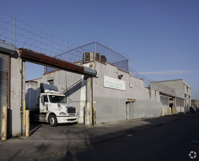
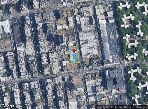
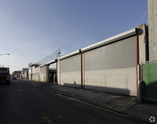
Property Record
46 Walworth St, Brooklyn, NY 11205
NEARBY LISTINGS FOR SALE OR LEASE
Property Detail
46 Walworth St
01716-0050
Kings
Warehouse
New York
X
50
3604970204F
0.57 AC
2024
North Brooklyn
2025
Long Island (New York)
123700
New York-Jersey City-White Plains, NY-NJ
9,000 SF
DEMOGRAPHICS near 46 Walworth St
1 Mile
3 Mile
5 Mile
2024 Total Population
212,234
1,296,689
2,960,451
2029 Population
203,429
1,224,340
2,778,600
Pop Growth 2024-2029
(4.15%)
(5.58%)
(6.14%)
Average Age
34
38
39
2024 Total Households
73,693
537,418
1,226,360
HH Growth 2024-2029
(4.74%)
(6.02%)
(6.39%)
Median Household Inc
$58,507
$81,944
$84,154
Avg Household Size
2.70
2.30
2.30
2024 Avg HH Vehicles
.00
.00
.00
Median Home Value
$896,785
$1,004,588
$872,599
Median Year Built
1958
1948
1949
Nearby Places
Map Layers
Map Styles
 Street
 Aerial
- Restaurants
- Banks
- Shops
- Fitness
- Groceries
PUBLIC TRANSPORTATION
TRANSIT/SUBWAY
Flushing Avenue (G Line) (G - New York MTA Subway (The Subway))
DRIVE
WALK
Distance
Flushing Avenue (G Line) (G - New York MTA Subway (The Subway))
2 min
9 min
0.4 mi
Myrtle-Willoughby Avenues (G - New York MTA Subway (The Subway))
DRIVE
WALK
Distance
Myrtle-Willoughby Avenues (G - New York MTA Subway (The Subway))
3 min
10 min
0.5 mi
Bedford-Nostrand Avenues (G - New York MTA Subway (The Subway))
DRIVE
WALK
Distance
Bedford-Nostrand Avenues (G - New York MTA Subway (The Subway))
4 min
14 min
0.7 mi
Broadway (G Line) (G - New York MTA Subway (The Subway))
DRIVE
WALK
Distance
Broadway (G Line) (G - New York MTA Subway (The Subway))
3 min
14 min
0.7 mi
Hewes Street (J - New York MTA Subway (The Subway), M - New York MTA Subway (The Subway))
DRIVE
WALK
Distance
Hewes Street (J - New York MTA Subway (The Subway), M - New York MTA Subway (The Subway))
3 min
17 min
0.9 mi
COMMUTER RAIL
Nostrand Avenue Station (Far Rockaway Branch - Long Island Rail Road, Hempstead Branch - Long Island Rail Road, Long Beach Branch - Long Island Rail Road, West Hempstead Branch - Long Island Rail Road)
DRIVE
WALK
Distance
Nostrand Avenue Station (Far Rockaway Branch - Long Island Rail Road, Hempstead Branch - Long Island Rail Road, Long Beach Branch - Long Island Rail Road, West Hempstead Branch - Long Island Rail Road)
6 min
1.8 mi
DRIVE
WALK
Distance
7 min
2.6 mi
AIRPORT
LaGuardia
DRIVE
WALK
Distance
LaGuardia
16 min
8.5 mi
John F Kennedy International
DRIVE
WALK
Distance
John F Kennedy International
26 min
11.7 mi
Newark Liberty International
DRIVE
WALK
Distance
Newark Liberty International
28 min
15.6 mi
Freight Ports
NY - Red Hook Container Terminal
DRIVE
WALK
Distance
NY - Red Hook Container Terminal
9 min
3.9 mi
Nearby Properties
Address
Land Use
TOTAL SIZE
Lot Size
Zoning
Address
Land Use
TOTAL SIZE
Lot Size
Zoning
8,462,176 SF
61.41 AC
R7-2
Address
Land Use
TOTAL SIZE
Lot Size
Zoning
2,812,739 SF
2.10 AC
C5-3
Address
Land Use
TOTAL SIZE
Lot Size
Zoning
1,104,505 SF
2.32 AC
C4-7
Address
Land Use
TOTAL SIZE
Lot Size
Zoning
940,000 SF
1.44 AC
C6-2
Address
Land Use
TOTAL SIZE
Lot Size
Zoning
7,058,736 SF
147.61 AC
M3-1
Address
Land Use
TOTAL SIZE
Lot Size
Zoning
869,038 SF
1.53 AC
M1-1
Address
Land Use
TOTAL SIZE
Lot Size
Zoning
3,122,165 SF
19.02 AC
R7-2
Address
Land Use
TOTAL SIZE
Lot Size
Zoning
2,210,200 SF
2.58 AC
C5-5
Address
Land Use
TOTAL SIZE
Lot Size
Zoning
1,653,794 SF
3.15 AC
C6-4
Address
Land Use
TOTAL SIZE
Lot Size
Zoning
1,385,425 SF
6.43 AC
R8
Address
Land Use
TOTAL SIZE
Lot Size
Zoning
1,617,206 SF
1.23 AC
C5-5
Address
Land Use
TOTAL SIZE
Lot Size
Zoning
1,503,150 SF
20.47 AC
R5
Address
Land Use
TOTAL SIZE
Lot Size
Zoning
1,075,808 SF
1.12 AC
C5-5
Address
Land Use
TOTAL SIZE
Lot Size
Zoning
1,503,235 SF
5.28 AC
C2-7
Address
Land Use
TOTAL SIZE
Lot Size
Zoning
1,141,276 SF
1.21 AC
C5-5
Address
Land Use
TOTAL SIZE
Lot Size
Zoning
393.54 AC
PARK
Address
Land Use
TOTAL SIZE
Lot Size
Zoning
1,289,243 SF
1.14 AC
C5-5
Address
Land Use
TOTAL SIZE
Lot Size
Zoning
2,948,300 SF
27.71 AC
R7-2
Address
Land Use
TOTAL SIZE
Lot Size
Zoning
577,381 SF
3.19 AC
R6
Address
Land Use
TOTAL SIZE
Lot Size
Zoning
890,142 SF
2.22 AC
R7-1
Address
Land Use
TOTAL SIZE
Lot Size
Zoning
1,079,361 SF
1.07 AC
C5-3
Address
Land Use
TOTAL SIZE
Lot Size
Zoning
385,831 SF
0.83 AC
C6-3
Address
Land Use
TOTAL SIZE
Lot Size
Zoning
943,802 SF
0.97 AC
C6-9
Address
Land Use
TOTAL SIZE
Lot Size
Zoning
1,258,851 SF
2.20 AC
C6-4
Address
Land Use
TOTAL SIZE
Lot Size
Zoning
1,658,649 SF
15.93 AC
R7-2
Address
Land Use
TOTAL SIZE
Lot Size
Zoning
830,879 SF
1 AC
C5-4
Address
Land Use
TOTAL SIZE
Lot Size
Zoning
1,000,000 SF
1 AC
C6-4
Address
Land Use
TOTAL SIZE
Lot Size
Zoning
1,106,962 SF
3.98 AC
C6-4
Address
Land Use
TOTAL SIZE
Lot Size
Zoning
835,231 SF
11.32 AC
R6
Address
Land Use
TOTAL SIZE
Lot Size
Zoning
1,021,351 SF
1.24 AC
C5-5
The World's #1 Commercial Real Estate Marketplace
Connect with us
© 2026 CoStar Group
The information above has been obtained from sources believed reliable. While we do not doubt its accuracy we have not verified it and make no guarantee, warranty or representation about it. It is your responsibility to independently confirm its accuracy and completeness. Any projections, opinions, assumptions, or estimates used are for example only and do not represent the current or future performance of the property. The value of this transaction to you depends on tax and other factors which should be evaluated by your tax, financial, and legal advisors. You and your advisors should conduct a careful, independent investigation of the property to determine to your satisfaction the suitability of the property for your needs.