Property Record
460 Amherst Rd, South Hadley, MA 01075


NEARBY LISTINGS FOR SALE OR LEASE
Property Detail
460 Amherst Rd
SHAD-000058-000080
Hampshire
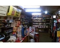
Departmentstore
Massachusetts
2025
0.69 AC
2025
Hampshire County
821300
Hartford
1,300 SF
Springfield, MA
DEMOGRAPHICS near 460 Amherst Rd
1 Mile
3 Mile
5 Mile
2024 Total Population
895
10,571
40,959
2029 Population
704
8,778
33,556
Pop Growth 2024-2029
(21.34%)
(16.96%)
(18.07%)
Average Age
44
40
42
2024 Total Households
348
3,513
16,700
HH Growth 2024-2029
(21.84%)
(21.61%)
(20.18%)
Median Household Inc
$98,275
$103,195
$78,238
Avg Household Size
2.30
2.30
2.20
2024 Avg HH Vehicles
2.00
2.00
2.00
Median Home Value
$328,231
$338,075
$333,276
Median Year Built
1955
1962
1960
Nearby Places
Map Layers
Map Styles
 Street
 Aerial
- Restaurants
- Banks
- Shops
- Fitness
- Groceries
PUBLIC TRANSPORTATION
COMMUTER RAIL
Holyoke Amtrak (Valley Flyer - Amtrak, Vermonter - Amtrak)
DRIVE
WALK
Distance
Holyoke Amtrak (Valley Flyer - Amtrak, Vermonter - Amtrak)
13 min
6.2 mi
AIRPORT
Bradley International
DRIVE
WALK
Distance
Bradley International
54 min
27.5 mi
Freight Ports
Albany, NY Port
DRIVE
WALK
Distance
Albany, NY Port
114 min
89.9 mi
SALE & LEASE HISTORY
LISTING DATE
SALE/LEASE

May 12, 2022
For Sale
Feb 05, 2020
For Sale
Nearby Properties
Address
Land Use
TOTAL SIZE
Lot Size
Zoning
Address
Land Use
TOTAL SIZE
Lot Size
Zoning
16.30 AC
RA2
Address
Land Use
TOTAL SIZE
Lot Size
Zoning
4.50 AC
RA2
Address
Land Use
TOTAL SIZE
Lot Size
Zoning
52 AC
RA1
Address
Land Use
TOTAL SIZE
Lot Size
Zoning
9 AC
RA2
Address
Land Use
TOTAL SIZE
Lot Size
Zoning
26.35 AC
RA2
Address
Land Use
TOTAL SIZE
Lot Size
Zoning
3.30 AC
RA2
Address
Land Use
TOTAL SIZE
Lot Size
Zoning
61,808 SF
8.53 AC
RA2
Address
Land Use
TOTAL SIZE
Lot Size
Zoning
2.44 AC
RA2
Address
Land Use
TOTAL SIZE
Lot Size
Zoning
16.36 AC
RA1
Address
Land Use
TOTAL SIZE
Lot Size
Zoning
1.09 AC
RA2
Address
Land Use
TOTAL SIZE
Lot Size
Zoning
1,361.42 AC
Address
Land Use
TOTAL SIZE
Lot Size
Zoning
2.20 AC
RA2
Address
Land Use
TOTAL SIZE
Lot Size
Zoning
6.20 AC
RA2
Address
Land Use
TOTAL SIZE
Lot Size
Zoning
55,376 SF
3.20 AC
RA1
Address
Land Use
TOTAL SIZE
Lot Size
Zoning
13.10 AC
RA1
Address
Land Use
TOTAL SIZE
Lot Size
Zoning
123,515 SF
28.10 AC
RA1
Address
Land Use
TOTAL SIZE
Lot Size
Zoning
7,700 SF
238.16 AC
AR
Address
Land Use
TOTAL SIZE
Lot Size
Zoning
39,602 SF
3.80 AC
RA2
Address
Land Use
TOTAL SIZE
Lot Size
Zoning
7 AC
RA2
Address
Land Use
TOTAL SIZE
Lot Size
Zoning
34,610 SF
8 AC
Address
Land Use
TOTAL SIZE
Lot Size
Zoning
27,230 SF
0.87 AC
RA2
Address
Land Use
TOTAL SIZE
Lot Size
Zoning
2 AC
BA
Address
Land Use
TOTAL SIZE
Lot Size
Zoning
2.20 AC
Address
Land Use
TOTAL SIZE
Lot Size
Zoning
34,968 SF
1.61 AC
BL
Address
Land Use
TOTAL SIZE
Lot Size
Zoning
47,890 SF
5.97 AC
BA1
Address
Land Use
TOTAL SIZE
Lot Size
Zoning
6.63 AC
Address
Land Use
TOTAL SIZE
Lot Size
Zoning
19,048 SF
5.90 AC
BA1
Address
Land Use
TOTAL SIZE
Lot Size
Zoning
3.85 AC
BA1
Address
Land Use
TOTAL SIZE
Lot Size
Zoning
57,788 SF
12 AC
RA1
Address
Land Use
TOTAL SIZE
Lot Size
Zoning
7,400 SF
1.05 AC
RB
The World's #1 Commercial Real Estate Marketplace
Connect with us
© 2025 CoStar Group
The information above has been obtained from sources believed reliable. While we do not doubt its accuracy we have not verified it and make no guarantee, warranty or representation about it. It is your responsibility to independently confirm its accuracy and completeness. Any projections, opinions, assumptions, or estimates used are for example only and do not represent the current or future performance of the property. The value of this transaction to you depends on tax and other factors which should be evaluated by your tax, financial, and legal advisors. You and your advisors should conduct a careful, independent investigation of the property to determine to your satisfaction the suitability of the property for your needs.