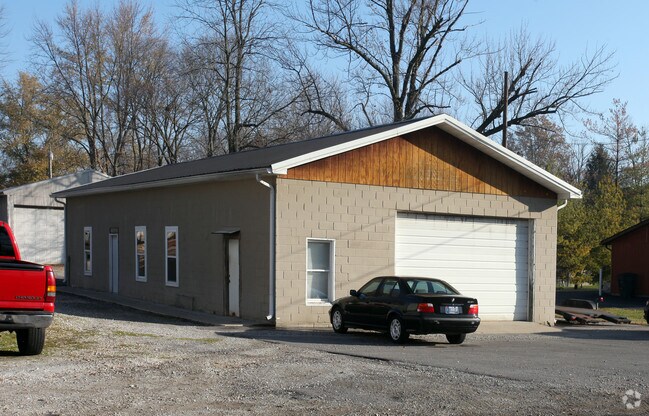
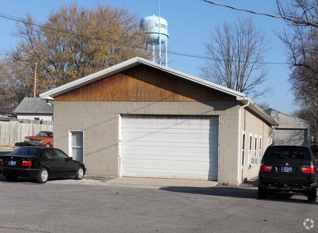
Property Record
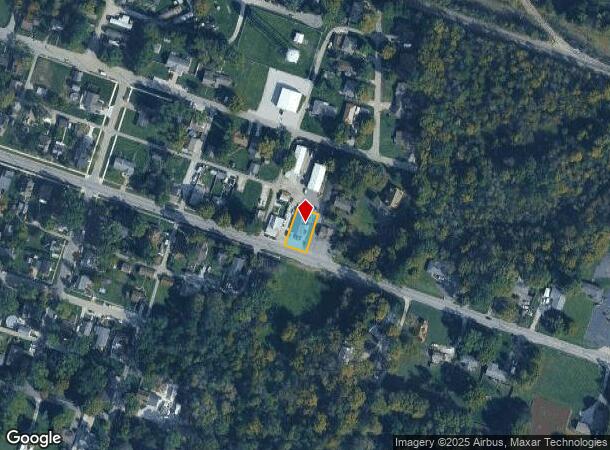
460 E Main St, Morristown, IN 46161
NEARBY LISTINGS FOR SALE OR LEASE
Property Detail
460 E Main St
Indianapolis-Carmel-Anderson, IN
Rezin Davis Addition
73-03-12-400-146.000-008
R DAVIS MAIN LT 23
Autorepair
Shelby
X
Indiana
18139C0125C
23
2024
0.18 AC
2024
Shelby County
710100
Indianapolis
1,885 SF
DEMOGRAPHICS near 460 E Main St
1 Mile
3 Mile
5 Mile
2024 Total Population
922
2,061
3,973
2029 Population
886
2,029
3,995
Pop Growth 2024-2029
(3.90%)
(1.55%)
+ 0.55%
Average Age
39
42
42
2024 Total Households
373
788
1,519
HH Growth 2024-2029
(4.02%)
(1.78%)
+ 0.53%
Median Household Inc
$44,870
$68,499
$80,398
Avg Household Size
2.40
2.50
2.50
2024 Avg HH Vehicles
2.00
2.00
3.00
Median Home Value
$131,845
$157,384
$193,684
Median Year Built
1960
1962
1963
Nearby Places
Map Layers
Map Styles
 Street
 Aerial
- Restaurants
- Banks
- Shops
- Fitness
- Groceries
PUBLIC TRANSPORTATION
AIRPORT
Indianapolis International
DRIVE
WALK
Distance
Indianapolis International
63 min
37.8 mi
Nearby Properties
Address
Land Use
TOTAL SIZE
Lot Size
Zoning
Address
Land Use
TOTAL SIZE
Lot Size
Zoning
16,524 SF
67.02 AC
Address
Land Use
TOTAL SIZE
Lot Size
Zoning
64,266 SF
4.59 AC
Address
Land Use
TOTAL SIZE
Lot Size
Zoning
198,449 SF
22.66 AC
Address
Land Use
TOTAL SIZE
Lot Size
Zoning
89,452 SF
13.10 AC
Address
Land Use
TOTAL SIZE
Lot Size
Zoning
55,385 SF
3.76 AC
Address
Land Use
TOTAL SIZE
Lot Size
Zoning
4,180 SF
26.90 AC
Address
Land Use
TOTAL SIZE
Lot Size
Zoning
54,750 SF
6 AC
Address
Land Use
TOTAL SIZE
Lot Size
Zoning
21,300 SF
21.02 AC
Address
Land Use
TOTAL SIZE
Lot Size
Zoning
960 SF
11.52 AC
Address
Land Use
TOTAL SIZE
Lot Size
Zoning
11,818 SF
1.46 AC
Address
Land Use
TOTAL SIZE
Lot Size
Zoning
62,868 SF
9.86 AC
Address
Land Use
TOTAL SIZE
Lot Size
Zoning
19,816 SF
2.21 AC
Address
Land Use
TOTAL SIZE
Lot Size
Zoning
8,020 SF
10.31 AC
Address
Land Use
TOTAL SIZE
Lot Size
Zoning
13,358 SF
1.16 AC
Address
Land Use
TOTAL SIZE
Lot Size
Zoning
3,500 SF
10 AC
Address
Land Use
TOTAL SIZE
Lot Size
Zoning
Address
Land Use
TOTAL SIZE
Lot Size
Zoning
393.88 AC
Address
Land Use
TOTAL SIZE
Lot Size
Zoning
10.34 AC
Address
Land Use
TOTAL SIZE
Lot Size
Zoning
35,000 SF
4.48 AC
Address
Land Use
TOTAL SIZE
Lot Size
Zoning
9,100 SF
1.01 AC
Address
Land Use
TOTAL SIZE
Lot Size
Zoning
11,520 SF
4.79 AC
Address
Land Use
TOTAL SIZE
Lot Size
Zoning
5,504 SF
11.32 AC
Address
Land Use
TOTAL SIZE
Lot Size
Zoning
4,800 SF
15 AC
Address
Land Use
TOTAL SIZE
Lot Size
Zoning
11,436 SF
1.78 AC
Address
Land Use
TOTAL SIZE
Lot Size
Zoning
169.28 AC
Address
Land Use
TOTAL SIZE
Lot Size
Zoning
8,500 SF
1.52 AC
Address
Land Use
TOTAL SIZE
Lot Size
Zoning
2.54 AC
Address
Land Use
TOTAL SIZE
Lot Size
Zoning
3,464 SF
0.52 AC
Address
Land Use
TOTAL SIZE
Lot Size
Zoning
5,120 SF
1.49 AC
Address
Land Use
TOTAL SIZE
Lot Size
Zoning
161.33 AC
The World's #1 Commercial Real Estate Marketplace
Connect with us
© 2025 CoStar Group
The information above has been obtained from sources believed reliable. While we do not doubt its accuracy we have not verified it and make no guarantee, warranty or representation about it. It is your responsibility to independently confirm its accuracy and completeness. Any projections, opinions, assumptions, or estimates used are for example only and do not represent the current or future performance of the property. The value of this transaction to you depends on tax and other factors which should be evaluated by your tax, financial, and legal advisors. You and your advisors should conduct a careful, independent investigation of the property to determine to your satisfaction the suitability of the property for your needs.