Property Record
460 State Rd, North Dartmouth, MA 02747
NEARBY LISTINGS FOR SALE OR LEASE
Property Detail
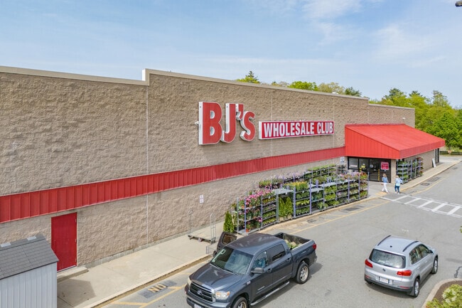
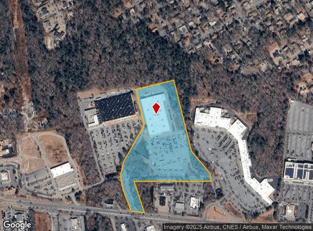
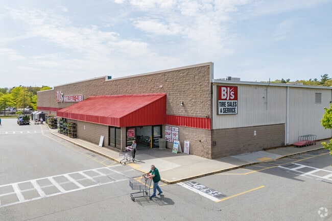
460 State Rd
DART-000166-000143-000002
Bj S Wholesle Club Inc
Departmentstore
Bristol
X
Massachusetts
25005C0388G
2
2025
17.01 AC
2025
Attleboro/New Bedford
653101
Boston
106,755 SF
Providence-Warwick, RI-MA
DEMOGRAPHICS near 460 State Rd
1 Mile
3 Mile
5 Mile
2024 Total Population
3,495
26,079
121,270
2029 Population
3,511
25,778
118,927
Pop Growth 2024-2029
+ 0.46%
(1.15%)
(1.93%)
Average Age
43
43
41
2024 Total Households
1,380
9,948
49,341
HH Growth 2024-2029
+ 0.43%
(1.16%)
(1.99%)
Median Household Inc
$82,379
$81,305
$56,239
Avg Household Size
2.30
2.40
2.30
2024 Avg HH Vehicles
2.00
2.00
2.00
Median Home Value
$382,087
$363,944
$348,785
Median Year Built
1976
1969
1949
Nearby Places
Map Layers
Map Styles
 Street
 Aerial
- Restaurants
- Banks
- Shops
- Fitness
- Groceries
PUBLIC TRANSPORTATION
AIRPORT
Rhode Island Tf Green International
DRIVE
WALK
Distance
Rhode Island Tf Green International
52 min
34.4 mi
Freight Ports
Port of New Bedford Harbor
DRIVE
WALK
Distance
Port of New Bedford Harbor
14 min
5.1 mi
Nearby Properties
Address
Land Use
TOTAL SIZE
Lot Size
Zoning
Address
Land Use
TOTAL SIZE
Lot Size
Zoning
120,000 SF
705.15 AC
SRB
Address
Land Use
TOTAL SIZE
Lot Size
Zoning
40.61 AC
GB
Address
Land Use
TOTAL SIZE
Lot Size
Zoning
23.71 AC
RA
Address
Land Use
TOTAL SIZE
Lot Size
Zoning
252,482 SF
11.56 AC
RA
Address
Land Use
TOTAL SIZE
Lot Size
Zoning
104.64 AC
LI
Address
Land Use
TOTAL SIZE
Lot Size
Zoning
102,826 SF
15.15 AC
OI
Address
Land Use
TOTAL SIZE
Lot Size
Zoning
74.70 AC
SRA
Address
Land Use
TOTAL SIZE
Lot Size
Zoning
30.28 AC
GB
Address
Land Use
TOTAL SIZE
Lot Size
Zoning
40.65 AC
GB
Address
Land Use
TOTAL SIZE
Lot Size
Zoning
194,474 SF
11.57 AC
RA
Address
Land Use
TOTAL SIZE
Lot Size
Zoning
284,742 SF
17.14 AC
RB
Address
Land Use
TOTAL SIZE
Lot Size
Zoning
120,533 SF
13.83 AC
OI
Address
Land Use
TOTAL SIZE
Lot Size
Zoning
3,792 SF
33 AC
GB
Address
Land Use
TOTAL SIZE
Lot Size
Zoning
14,840 SF
26.26 AC
SRA
Address
Land Use
TOTAL SIZE
Lot Size
Zoning
12.94 AC
GB
Address
Land Use
TOTAL SIZE
Lot Size
Zoning
116,441 SF
11.74 AC
OFD
Address
Land Use
TOTAL SIZE
Lot Size
Zoning
15.97 AC
GB
Address
Land Use
TOTAL SIZE
Lot Size
Zoning
111,337 SF
11.30 AC
RB
Address
Land Use
TOTAL SIZE
Lot Size
Zoning
126,745 SF
15.82 AC
GB
Address
Land Use
TOTAL SIZE
Lot Size
Zoning
130,060 SF
18.34 AC
SRA
Address
Land Use
TOTAL SIZE
Lot Size
Zoning
111,708 SF
17 AC
GB
Address
Land Use
TOTAL SIZE
Lot Size
Zoning
146,599 SF
22.98 AC
GB
Address
Land Use
TOTAL SIZE
Lot Size
Zoning
59,778 SF
14.95 AC
OI
Address
Land Use
TOTAL SIZE
Lot Size
Zoning
5,616 SF
132.66 AC
RA
Address
Land Use
TOTAL SIZE
Lot Size
Zoning
48.78 AC
RA
Address
Land Use
TOTAL SIZE
Lot Size
Zoning
244,374 SF
25.43 AC
LI
Address
Land Use
TOTAL SIZE
Lot Size
Zoning
17.54 AC
GB
Address
Land Use
TOTAL SIZE
Lot Size
Zoning
57,705 SF
9.54 AC
RA
Address
Land Use
TOTAL SIZE
Lot Size
Zoning
70,167 SF
4.84 AC
RC
The World's #1 Commercial Real Estate Marketplace
Connect with us
© 2026 CoStar Group
The information above has been obtained from sources believed reliable. While we do not doubt its accuracy we have not verified it and make no guarantee, warranty or representation about it. It is your responsibility to independently confirm its accuracy and completeness. Any projections, opinions, assumptions, or estimates used are for example only and do not represent the current or future performance of the property. The value of this transaction to you depends on tax and other factors which should be evaluated by your tax, financial, and legal advisors. You and your advisors should conduct a careful, independent investigation of the property to determine to your satisfaction the suitability of the property for your needs.