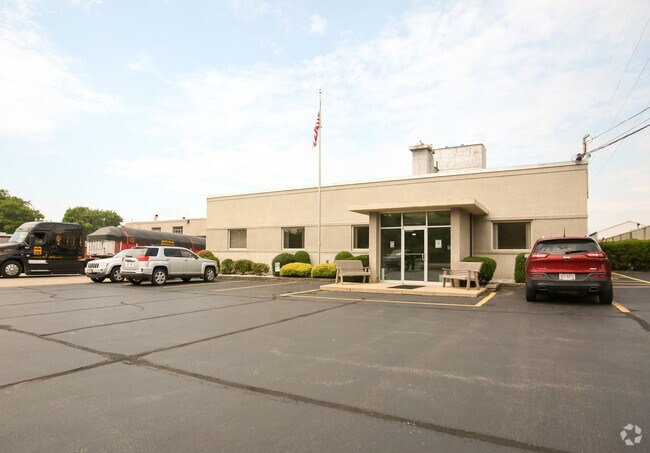
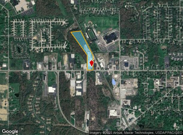
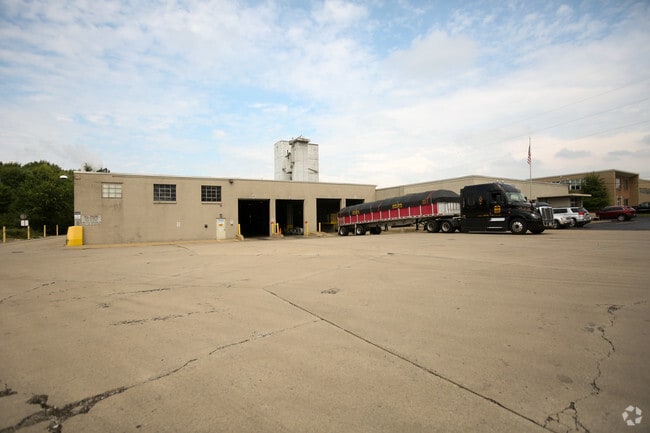
Property Record
460 W Main St, Canfield, OH 44406
NEARBY LISTINGS FOR SALE OR LEASE
-
-
View all Canfield listings for sale on LoopNet.com
Property Detail
460 W Main St
Youngstown/Warren/Boardman
Canfield Village
Youngstown-Warren-Boardman, OH-PA
OL 30
28-022-0-008.00-0
Mahoning
Industrialgeneral
Ohio
2024
970
2024
9.75 AC
812200
Mahoning County
29,266 SF
DEMOGRAPHICS near 460 W Main St
1 Mile
3 Mile
5 Mile
2024 Total Population
3,339
13,317
49,727
2029 Population
3,252
12,931
48,255
Pop Growth 2024-2029
(2.61%)
(2.90%)
(2.96%)
Average Age
44
45
45
2024 Total Households
1,344
5,458
22,002
HH Growth 2024-2029
(2.68%)
(2.97%)
(2.99%)
Median Household Inc
$95,445
$93,041
$66,582
Avg Household Size
2.40
2.40
2.20
2024 Avg HH Vehicles
2.00
2.00
2.00
Median Home Value
$205,471
$253,953
$183,885
Median Year Built
1966
1978
1972
Nearby Places
Map Layers
Map Styles
 Street
 Aerial
- Restaurants
- Banks
- Shops
- Fitness
- Groceries
Nearby Properties
Address
Land Use
TOTAL SIZE
Lot Size
Zoning
Address
Land Use
TOTAL SIZE
Lot Size
Zoning
326,658 SF
78.41 AC
S
Address
Land Use
TOTAL SIZE
Lot Size
Zoning
Address
Land Use
TOTAL SIZE
Lot Size
Zoning
161,184 SF
29.51 AC
S
Address
Land Use
TOTAL SIZE
Lot Size
Zoning
213,207 SF
18.39 AC
M1
Address
Land Use
TOTAL SIZE
Lot Size
Zoning
Address
Land Use
TOTAL SIZE
Lot Size
Zoning
33,854 SF
3.36 AC
R1
Address
Land Use
TOTAL SIZE
Lot Size
Zoning
2.10 AC
Address
Land Use
TOTAL SIZE
Lot Size
Zoning
332.96 AC
A
Address
Land Use
TOTAL SIZE
Lot Size
Zoning
69,651 SF
2.82 AC
Address
Land Use
TOTAL SIZE
Lot Size
Zoning
163,207 SF
9.19 AC
S
Address
Land Use
TOTAL SIZE
Lot Size
Zoning
46,813 SF
8.40 AC
Address
Land Use
TOTAL SIZE
Lot Size
Zoning
59,999 SF
6.07 AC
B
Address
Land Use
TOTAL SIZE
Lot Size
Zoning
56,432 SF
8.42 AC
B3
Address
Land Use
TOTAL SIZE
Lot Size
Zoning
54,832 SF
2.01 AC
R2
Address
Land Use
TOTAL SIZE
Lot Size
Zoning
58,972 SF
23.65 AC
S
Address
Land Use
TOTAL SIZE
Lot Size
Zoning
133,122 SF
39.19 AC
R1
Address
Land Use
TOTAL SIZE
Lot Size
Zoning
4,014 SF
22.66 AC
AG
Address
Land Use
TOTAL SIZE
Lot Size
Zoning
48,546 SF
1.75 AC
B
Address
Land Use
TOTAL SIZE
Lot Size
Zoning
43,236 SF
13.30 AC
S
Address
Land Use
TOTAL SIZE
Lot Size
Zoning
26,649 SF
23.60 AC
A
Address
Land Use
TOTAL SIZE
Lot Size
Zoning
19,348 SF
3.40 AC
B
Address
Land Use
TOTAL SIZE
Lot Size
Zoning
39,684 SF
4.48 AC
B3
Address
Land Use
TOTAL SIZE
Lot Size
Zoning
33,912 SF
1.45 AC
Address
Land Use
TOTAL SIZE
Lot Size
Zoning
31,542 SF
7.83 AC
B2
Address
Land Use
TOTAL SIZE
Lot Size
Zoning
18,391 SF
2.69 AC
R2
Address
Land Use
TOTAL SIZE
Lot Size
Zoning
38,244 SF
178.14 AC
A
Address
Land Use
TOTAL SIZE
Lot Size
Zoning
55,109 SF
13.97 AC
S
Address
Land Use
TOTAL SIZE
Lot Size
Zoning
100,460 SF
10.22 AC
I
Address
Land Use
TOTAL SIZE
Lot Size
Zoning
6,687 SF
1.99 AC
B
Address
Land Use
TOTAL SIZE
Lot Size
Zoning
36,316 SF
0.50 AC
R2
The World's #1 Commercial Real Estate Marketplace
Connect with us
© 2025 CoStar Group
The information above has been obtained from sources believed reliable. While we do not doubt its accuracy we have not verified it and make no guarantee, warranty or representation about it. It is your responsibility to independently confirm its accuracy and completeness. Any projections, opinions, assumptions, or estimates used are for example only and do not represent the current or future performance of the property. The value of this transaction to you depends on tax and other factors which should be evaluated by your tax, financial, and legal advisors. You and your advisors should conduct a careful, independent investigation of the property to determine to your satisfaction the suitability of the property for your needs.