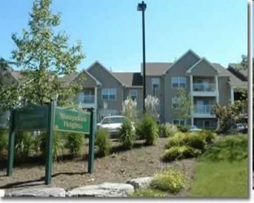
Property Record
460 Waupelani Dr, State College, PA 16801

NEARBY LISTINGS FOR SALE OR LEASE
Property Detail
460 Waupelani Dr
36-025-007-0000
Centre
Apartment
Pennsylvania
X
1.97 AC
42027C0638F
Orchard Park
2025
Other Market Areas
2025
State College, PA
012800
DEMOGRAPHICS near 460 Waupelani Dr
1 Mile
3 Mile
5 Mile
2024 Total Population
13,508
63,630
88,043
2029 Population
13,608
63,759
87,961
Pop Growth 2024-2029
+ 0.74%
+ 0.20%
(0.09%)
Average Age
37
32
34
2024 Total Households
6,537
21,761
32,153
HH Growth 2024-2029
+ 0.69%
+ 0.28%
(0.16%)
Median Household Inc
$56,037
$51,825
$62,864
Avg Household Size
2.00
2.20
2.20
2024 Avg HH Vehicles
1.00
1.00
2.00
Median Home Value
$328,924
$378,691
$365,010
Median Year Built
1976
1981
1983
Nearby Places
Map Layers
Map Styles
 Street
 Aerial
- Restaurants
- Banks
- Shops
- Fitness
- Groceries
PUBLIC TRANSPORTATION
AIRPORT
State College Regional
DRIVE
WALK
Distance
State College Regional
18 min
7.3 mi
Freight Ports
Port of Baltimore
DRIVE
WALK
Distance
Port of Baltimore
226 min
167.4 mi
Nearby Properties
Address
Land Use
TOTAL SIZE
Lot Size
Zoning
Address
Land Use
TOTAL SIZE
Lot Size
Zoning
1,607.06 AC
Address
Land Use
TOTAL SIZE
Lot Size
Zoning
27.86 AC
Address
Land Use
TOTAL SIZE
Lot Size
Zoning
59.65 AC
Address
Land Use
TOTAL SIZE
Lot Size
Zoning
60.26 AC
Address
Land Use
TOTAL SIZE
Lot Size
Zoning
Address
Land Use
TOTAL SIZE
Lot Size
Zoning
Address
Land Use
TOTAL SIZE
Lot Size
Zoning
Address
Land Use
TOTAL SIZE
Lot Size
Zoning
Address
Land Use
TOTAL SIZE
Lot Size
Zoning
Address
Land Use
TOTAL SIZE
Lot Size
Zoning
Address
Land Use
TOTAL SIZE
Lot Size
Zoning
56.73 AC
Address
Land Use
TOTAL SIZE
Lot Size
Zoning
Address
Land Use
TOTAL SIZE
Lot Size
Zoning
The World's #1 Commercial Real Estate Marketplace
Connect with us
© 2026 CoStar Group
The information above has been obtained from sources believed reliable. While we do not doubt its accuracy we have not verified it and make no guarantee, warranty or representation about it. It is your responsibility to independently confirm its accuracy and completeness. Any projections, opinions, assumptions, or estimates used are for example only and do not represent the current or future performance of the property. The value of this transaction to you depends on tax and other factors which should be evaluated by your tax, financial, and legal advisors. You and your advisors should conduct a careful, independent investigation of the property to determine to your satisfaction the suitability of the property for your needs.