Property Record
4600 Barbara Rd, River Oaks, TX 76114


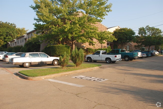

Property Detail
4600 Barbara Rd
Dallas-Fort Worth-Arlington, TX
WEATHERFORD, R W SUBDIVISION BLOCK 1 LOT A B C & D
03320901
TARRANT
Multifamilydwelling
Texas
B and X Area of moderate flood hazard, usually the area between the limits of the 100-year and 500-year floods.
a
2024
2.54 AC
2025
West Fort Worth
110500
Dallas/Ft Worth
58,000 SF
NEARBY LISTINGS FOR SALE OR LEASE
DEMOGRAPHICS near 4600 Barbara Rd
1 mile
3 mile
5 mile
2025 Total Population
11,440
99,757
255,480
2030 Population
12,171
106,769
272,340
Pop Growth 2025-2030
+ 6.39%
+ 7.03%
+ 6.60%
Average Age
38
38
37
2025 Total Households
4,213
38,089
96,570
HH Growth 2025-2030
+ 6.74%
+ 7.05%
+ 6.95%
Median Household Inc
$70,665
$67,994
$66,510
Avg Household Size
2.70
2.50
2.50
2025 Avg HH Vehicles
2.00
2.00
2.00
Median Home Value
$251,159
$290,082
$293,239
Median Year Built
1958
1971
1978
Nearby Places
Map Layers
Map Styles
 Street
 Aerial
Transit
 Traffic
 Biking
Places
Listings with unknown addresses are not visible on the map
- Restaurants
- Banks
- Shops
- Fitness
- Groceries
PUBLIC TRANSPORTATION
COMMUTER RAIL
Fort Worth (Heartland Flyer - Amtrak, Texas Eagle - Amtrak)
Drive
Walk
Distance
Fort Worth (Heartland Flyer - Amtrak, Texas Eagle - Amtrak)
11 min
5.1 mi
Fort Worth Intermodal Transit Center (TRINITY RAILWAY - Dallas Area Rapid Transit (DART))
Drive
Walk
Distance
Fort Worth Intermodal Transit Center (TRINITY RAILWAY - Dallas Area Rapid Transit (DART))
11 min
5.1 mi
AIRPORT
Dallas-Fort Worth International
Drive
Walk
Distance
Dallas-Fort Worth International
41 min
28.8 mi
Freight Ports
Port of Shreveport
Drive
Walk
Distance
Port of Shreveport
258 min
235.4 mi
Nearby Properties
Address
Land Use
TOTAL SIZE
Lot Size
Zoning
Address
Land Use
TOTAL SIZE
Lot Size
Zoning
802,865 SF
17.38 AC
Address
Land Use
TOTAL SIZE
Lot Size
Zoning
616,686 SF
2.82 AC
Address
Land Use
TOTAL SIZE
Lot Size
Zoning
508,378 SF
6.02 AC
Address
Land Use
TOTAL SIZE
Lot Size
Zoning
205,807 SF
3.19 AC
Address
Land Use
TOTAL SIZE
Lot Size
Zoning
774,327 SF
11.86 AC
Address
Land Use
TOTAL SIZE
Lot Size
Zoning
537,395 SF
2.82 AC
Address
Land Use
TOTAL SIZE
Lot Size
Zoning
788,621 SF
6.39 AC
Address
Land Use
TOTAL SIZE
Lot Size
Zoning
765,141 SF
56.28 AC
Address
Land Use
TOTAL SIZE
Lot Size
Zoning
336,310 SF
2.85 AC
Address
Land Use
TOTAL SIZE
Lot Size
Zoning
487,426 SF
4.18 AC
Address
Land Use
TOTAL SIZE
Lot Size
Zoning
469,191 SF
4.20 AC
Address
Land Use
TOTAL SIZE
Lot Size
Zoning
581,601 SF
3.77 AC
Address
Land Use
TOTAL SIZE
Lot Size
Zoning
462,036 SF
5.40 AC
Address
Land Use
TOTAL SIZE
Lot Size
Zoning
437,641 SF
6.60 AC
Address
Land Use
TOTAL SIZE
Lot Size
Zoning
627,866 SF
6.85 AC
Address
Land Use
TOTAL SIZE
Lot Size
Zoning
411,395 SF
12.24 AC
Address
Land Use
TOTAL SIZE
Lot Size
Zoning
378,038 SF
7.01 AC
Address
Land Use
TOTAL SIZE
Lot Size
Zoning
401,487 SF
6.16 AC
Address
Land Use
TOTAL SIZE
Lot Size
Zoning
595,372 SF
12.24 AC
Address
Land Use
TOTAL SIZE
Lot Size
Zoning
220,000 SF
9.92 AC
Address
Land Use
TOTAL SIZE
Lot Size
Zoning
180,612 SF
Address
Land Use
TOTAL SIZE
Lot Size
Zoning
424,333 SF
12.59 AC
Address
Land Use
TOTAL SIZE
Lot Size
Zoning
183,899 SF
9.23 AC
Address
Land Use
TOTAL SIZE
Lot Size
Zoning
225,140 SF
11.68 AC
Address
Land Use
TOTAL SIZE
Lot Size
Zoning
436,844 SF
1.25 AC
Address
Land Use
TOTAL SIZE
Lot Size
Zoning
232,014 SF
2.83 AC
Address
Land Use
TOTAL SIZE
Lot Size
Zoning
352,131 SF
2.15 AC
Address
Land Use
TOTAL SIZE
Lot Size
Zoning
155,269 SF
Address
Land Use
TOTAL SIZE
Lot Size
Zoning
174,093 SF
0.14 AC
Address
Land Use
TOTAL SIZE
Lot Size
Zoning
2,300 SF
18.83 AC
The World's #1 Commercial Real Estate Marketplace
Connect with us
© 2026 CoStar Group
The information above has been obtained from sources believed reliable. While we do not doubt its accuracy we have not verified it and make no guarantee, warranty or representation about it. It is your responsibility to independently confirm its accuracy and completeness. Any projections, opinions, assumptions, or estimates used are for example only and do not represent the current or future performance of the property. The value of this transaction to you depends on tax and other factors which should be evaluated by your tax, financial, and legal advisors. You and your advisors should conduct a careful, independent investigation of the property to determine to your satisfaction the suitability of the property for your needs.