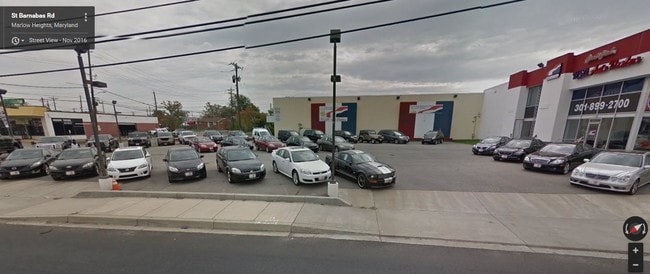
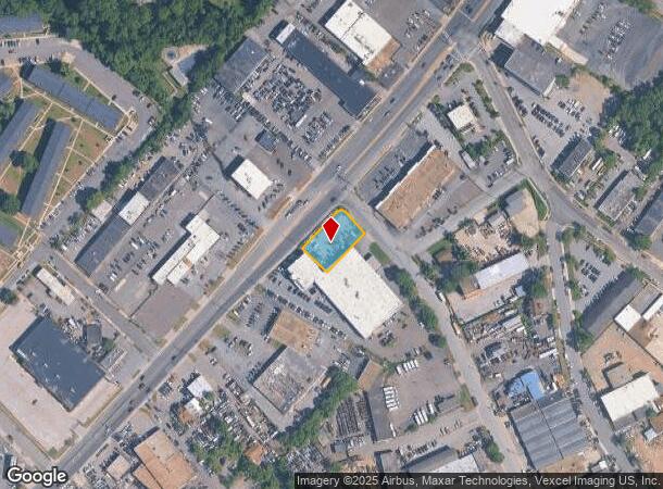
Property Record
4600 Saint Barnabas Rd, Temple Hills, MD 20748

NEARBY LISTINGS FOR SALE OR LEASE
Property Detail
4600 Saint Barnabas Rd
06-0570697
PARCEL A
Commercialnec
Prince George's
X
Maryland
24033C0230E
0.35 AC
2023
Branch Avenue Corridor
2025
Washington, DC
801907
Washington-Arlington-Alexandria, DC-VA-MD-WV
1,290 SF
DEMOGRAPHICS near 4600 Saint Barnabas Rd
1 Mile
3 Mile
5 Mile
2024 Total Population
13,859
155,657
363,945
2029 Population
13,491
149,058
346,079
Pop Growth 2024-2029
(2.66%)
(4.24%)
(4.91%)
Average Age
42
39
39
2024 Total Households
5,875
62,919
148,588
HH Growth 2024-2029
(2.72%)
(4.50%)
(5.39%)
Median Household Inc
$63,639
$64,275
$70,177
Avg Household Size
2.30
2.40
2.30
2024 Avg HH Vehicles
1.00
1.00
1.00
Median Home Value
$296,662
$318,961
$350,472
Median Year Built
1966
1968
1968
Nearby Places
Map Layers
Map Styles
 Street
 Aerial
- Restaurants
- Banks
- Shops
- Fitness
- Groceries
PUBLIC TRANSPORTATION
COMMUTER RAIL
L'enfant (Fredericksburg Line - Virginia Railway Express, Manassas Line - Virginia Railway Express)
DRIVE
WALK
Distance
L'enfant (Fredericksburg Line - Virginia Railway Express, Manassas Line - Virginia Railway Express)
15 min
7.2 mi
4 (Fredericksburg Line - Virginia Railway Express, Manassas Line - Virginia Railway Express)
DRIVE
WALK
Distance
4 (Fredericksburg Line - Virginia Railway Express, Manassas Line - Virginia Railway Express)
15 min
7.2 mi
AIRPORT
Ronald Reagan Washington Ntl
DRIVE
WALK
Distance
Ronald Reagan Washington Ntl
22 min
11.3 mi
Baltimore/Washington International Thurgood Marshall
DRIVE
WALK
Distance
Baltimore/Washington International Thurgood Marshall
53 min
34.0 mi
Washington Dulles International
DRIVE
WALK
Distance
Washington Dulles International
60 min
35.7 mi
Freight Ports
Port of Baltimore
DRIVE
WALK
Distance
Port of Baltimore
63 min
40.6 mi
SALE & LEASE HISTORY
LISTING DATE
SALE/LEASE

Jun 21, 2017
For Sale
Jun 14, 2023
For Sale
Jun 14, 2023
For Sale
Jun 14, 2023
For Sale
Jun 14, 2023
For Sale
Jun 14, 2023
For Sale
Feb 14, 2018
For Lease
Feb 14, 2018
For Sale
Feb 10, 2021
For Lease
Apr 04, 2017
For Lease
Nearby Properties
Address
Land Use
TOTAL SIZE
Lot Size
Zoning
Address
Land Use
TOTAL SIZE
Lot Size
Zoning
2,131,229 SF
144.34 AC
AG
Address
Land Use
TOTAL SIZE
Lot Size
Zoning
450,000 SF
37.35 AC
UNZONED
Address
Land Use
TOTAL SIZE
Lot Size
Zoning
963,250 SF
10.71 AC
RTOLE
Address
Land Use
TOTAL SIZE
Lot Size
Zoning
417 SF
7.66 AC
RTOLE
Address
Land Use
TOTAL SIZE
Lot Size
Zoning
274,244 SF
6.24 AC
RA-1
Address
Land Use
TOTAL SIZE
Lot Size
Zoning
26.64 AC
RMF20
Address
Land Use
TOTAL SIZE
Lot Size
Zoning
68,992 SF
3.19 AC
STE-12;STE
Address
Land Use
TOTAL SIZE
Lot Size
Zoning
450 SF
20.72 AC
RMF20
Address
Land Use
TOTAL SIZE
Lot Size
Zoning
374,097 SF
36.22 AC
NAC
Address
Land Use
TOTAL SIZE
Lot Size
Zoning
6 AC
RTOLE
Address
Land Use
TOTAL SIZE
Lot Size
Zoning
348,525 SF
11 AC
STE-11
Address
Land Use
TOTAL SIZE
Lot Size
Zoning
473,030 SF
3.08 AC
RA-1
Address
Land Use
TOTAL SIZE
Lot Size
Zoning
29.24 AC
RMF20
Address
Land Use
TOTAL SIZE
Lot Size
Zoning
73.26 AC
IE
Address
Land Use
TOTAL SIZE
Lot Size
Zoning
45.36 AC
MU-1;RA-1
Address
Land Use
TOTAL SIZE
Lot Size
Zoning
232,095 SF
8.25 AC
RA-2
Address
Land Use
TOTAL SIZE
Lot Size
Zoning
701 SF
29.42 AC
RMF20
Address
Land Use
TOTAL SIZE
Lot Size
Zoning
450 SF
21.14 AC
RMF20
Address
Land Use
TOTAL SIZE
Lot Size
Zoning
40.63 AC
RA-1
Address
Land Use
TOTAL SIZE
Lot Size
Zoning
336,465 SF
1.38 AC
CSC
Address
Land Use
TOTAL SIZE
Lot Size
Zoning
13.21 AC
RMF48
Address
Land Use
TOTAL SIZE
Lot Size
Zoning
29.49 AC
RSFA
Address
Land Use
TOTAL SIZE
Lot Size
Zoning
17.90 AC
RMF20
Address
Land Use
TOTAL SIZE
Lot Size
Zoning
21.48 AC
RMF20
Address
Land Use
TOTAL SIZE
Lot Size
Zoning
22.67 AC
RMF20
Address
Land Use
TOTAL SIZE
Lot Size
Zoning
138,912 SF
4.59 AC
RA-1
Address
Land Use
TOTAL SIZE
Lot Size
Zoning
192,777 SF
20.65 AC
RA-1
Address
Land Use
TOTAL SIZE
Lot Size
Zoning
383,961 SF
2.90 AC
MU-7B
Address
Land Use
TOTAL SIZE
Lot Size
Zoning
17.08 AC
RMF20
Address
Land Use
TOTAL SIZE
Lot Size
Zoning
245,767 SF
13.88 AC
CGO
The World's #1 Commercial Real Estate Marketplace
Connect with us
© 2025 CoStar Group
The information above has been obtained from sources believed reliable. While we do not doubt its accuracy we have not verified it and make no guarantee, warranty or representation about it. It is your responsibility to independently confirm its accuracy and completeness. Any projections, opinions, assumptions, or estimates used are for example only and do not represent the current or future performance of the property. The value of this transaction to you depends on tax and other factors which should be evaluated by your tax, financial, and legal advisors. You and your advisors should conduct a careful, independent investigation of the property to determine to your satisfaction the suitability of the property for your needs.