Property Record
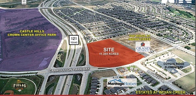
4600 State Highway 121, Carrollton, TX 75010

Property Detail
4600 State Highway 121
Dallas-Fort Worth-Arlington, TX
DPS CARROLLTON BLK 1 LOT 1
R702062
Denton
Commercialnec
Texas
B and X Area of moderate flood hazard, usually the area between the limits of the 100-year and 500-year floods.
1
2024
11.41 AC
2025
Lewisville
021650
Dallas/Ft Worth
27,296 SF
NEARBY LISTINGS FOR SALE OR LEASE
DEMOGRAPHICS near 4600 State Highway 121
1 mile
3 mile
5 mile
2024 Total Population
16,186
93,532
260,151
2029 Population
19,512
113,211
308,693
Pop Growth 2024-2029
+ 20.55%
+ 21.04%
+ 18.66%
Average Age
37
38
38
2024 Total Households
5,706
35,399
104,824
HH Growth 2024-2029
+ 21.01%
+ 21.59%
+ 19.39%
Median Household Inc
$105,444
$102,044
$87,822
Avg Household Size
2.80
2.60
2.40
2024 Avg HH Vehicles
2.00
2.00
2.00
Median Home Value
$495,620
$390,893
$349,663
Median Year Built
2008
2001
1994
Nearby Places
Map Layers
Map Styles
 Street
 Aerial
Transit
 Traffic
 Biking
Places
Listings with unknown addresses are not visible on the map
- Restaurants
- Banks
- Shops
- Fitness
- Groceries
PUBLIC TRANSPORTATION
COMMUTER RAIL
Hebron Station (A-train - Denton County Transportation Authority)
Drive
Walk
Distance
Hebron Station (A-train - Denton County Transportation Authority)
7 min
3.7 mi
Old Town Station (A-train - Denton County Transportation Authority)
Drive
Walk
Distance
Old Town Station (A-train - Denton County Transportation Authority)
10 min
5.8 mi
AIRPORT
Dallas-Fort Worth International
Drive
Walk
Distance
Dallas-Fort Worth International
16 min
14.0 mi
Dallas Love Field
Drive
Walk
Distance
Dallas Love Field
28 min
20.1 mi
Freight Ports
Port of Shreveport
Drive
Walk
Distance
Port of Shreveport
235 min
217.7 mi
Nearby Properties
Address
Land Use
TOTAL SIZE
Lot Size
Zoning
Address
Land Use
TOTAL SIZE
Lot Size
Zoning
578,457 SF
31.79 AC
Address
Land Use
TOTAL SIZE
Lot Size
Zoning
559,657 SF
30.49 AC
Address
Land Use
TOTAL SIZE
Lot Size
Zoning
389,014 SF
20.91 AC
Address
Land Use
TOTAL SIZE
Lot Size
Zoning
462,692 SF
30.77 AC
2G
Address
Land Use
TOTAL SIZE
Lot Size
Zoning
452,167 SF
5.80 AC
Address
Land Use
TOTAL SIZE
Lot Size
Zoning
448,915 SF
20.37 AC
Address
Land Use
TOTAL SIZE
Lot Size
Zoning
346,269 SF
15.14 AC
Address
Land Use
TOTAL SIZE
Lot Size
Zoning
434,639 SF
16.20 AC
Address
Land Use
TOTAL SIZE
Lot Size
Zoning
343,234 SF
32.41 AC
Address
Land Use
TOTAL SIZE
Lot Size
Zoning
462,429 SF
5.70 AC
Address
Land Use
TOTAL SIZE
Lot Size
Zoning
354,546 SF
19.38 AC
3B
Address
Land Use
TOTAL SIZE
Lot Size
Zoning
424,064 SF
22.15 AC
2B
Address
Land Use
TOTAL SIZE
Lot Size
Zoning
364,000 SF
8.11 AC
Address
Land Use
TOTAL SIZE
Lot Size
Zoning
961,306 SF
44.52 AC
Address
Land Use
TOTAL SIZE
Lot Size
Zoning
97,750 SF
69.90 AC
Address
Land Use
TOTAL SIZE
Lot Size
Zoning
262,879 SF
11.97 AC
Address
Land Use
TOTAL SIZE
Lot Size
Zoning
267,413 SF
5.25 AC
Address
Land Use
TOTAL SIZE
Lot Size
Zoning
350,292 SF
7.75 AC
Address
Land Use
TOTAL SIZE
Lot Size
Zoning
189,500 SF
53.90 AC
Address
Land Use
TOTAL SIZE
Lot Size
Zoning
392,646 SF
19.65 AC
3B
Address
Land Use
TOTAL SIZE
Lot Size
Zoning
335,257 SF
12.83 AC
Address
Land Use
TOTAL SIZE
Lot Size
Zoning
298,991 SF
15.72 AC
Address
Land Use
TOTAL SIZE
Lot Size
Zoning
270,969 SF
13.03 AC
Address
Land Use
TOTAL SIZE
Lot Size
Zoning
337,409 SF
5.25 AC
Address
Land Use
TOTAL SIZE
Lot Size
Zoning
265,038 SF
12.56 AC
Address
Land Use
TOTAL SIZE
Lot Size
Zoning
297,932 SF
14.05 AC
Address
Land Use
TOTAL SIZE
Lot Size
Zoning
315,578 SF
16.53 AC
Address
Land Use
TOTAL SIZE
Lot Size
Zoning
659,218 SF
34.29 AC
Address
Land Use
TOTAL SIZE
Lot Size
Zoning
318,477 SF
18.79 AC
Address
Land Use
TOTAL SIZE
Lot Size
Zoning
300,958 SF
16.61 AC
The World's #1 Commercial Real Estate Marketplace
Connect with us
© 2026 CoStar Group
The information above has been obtained from sources believed reliable. While we do not doubt its accuracy we have not verified it and make no guarantee, warranty or representation about it. It is your responsibility to independently confirm its accuracy and completeness. Any projections, opinions, assumptions, or estimates used are for example only and do not represent the current or future performance of the property. The value of this transaction to you depends on tax and other factors which should be evaluated by your tax, financial, and legal advisors. You and your advisors should conduct a careful, independent investigation of the property to determine to your satisfaction the suitability of the property for your needs.