Property Record
4600 Sundt Rd Ne, Rio Rancho, NM 87124

Property Detail
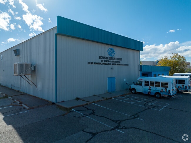
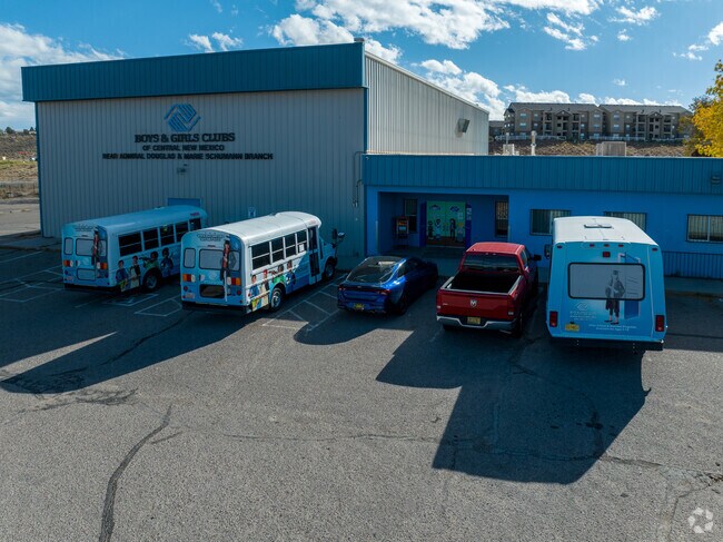
4600 Sundt Rd Ne
Albuquerque, NM
LEGAL: S: 20 T: 12N R: 3E SUBD: VISTA HILLS 1A BLOCK: A LOT: 1A RECREATION CENTER
1-014-069-298-438
SANDOVAL
Vacantlandnec
New Mexico
B and X Area of moderate flood hazard, usually the area between the limits of the 100-year and 500-year floods.
1a
2024
2.08 AC
2025
Rio Rancho
010729
Albuquerque
10,391 SF
NEARBY LISTINGS FOR SALE OR LEASE
DEMOGRAPHICS near 4600 Sundt Rd Ne
1 mile
3 mile
5 mile
2025 Total Population
9,607
51,814
119,118
2030 Population
9,946
53,870
122,428
Pop Growth 2025-2030
+ 3.53%
+ 3.97%
+ 2.78%
Average Age
42
44
42
2025 Total Households
3,554
20,259
46,153
HH Growth 2025-2030
+ 3.71%
+ 4.06%
+ 2.64%
Median Household Inc
$83,355
$88,473
$86,378
Avg Household Size
2.60
2.50
2.50
2025 Avg HH Vehicles
2.00
2.00
2.00
Median Home Value
$280,703
$353,533
$342,636
Median Year Built
1986
1991
1995
Nearby Places
Map Layers
Map Styles
 Street
 Aerial
Transit
 Traffic
 Biking
Places
Listings with unknown addresses are not visible on the map
- Restaurants
- Banks
- Shops
- Fitness
- Groceries
PUBLIC TRANSPORTATION
COMMUTER RAIL
Drive
Walk
Distance
18 min
8.7 mi
Drive
Walk
Distance
18 min
9.4 mi
AIRPORT
Albuquerque International Sunport
Drive
Walk
Distance
Albuquerque International Sunport
48 min
22.4 mi
Santa Fe Regional
Drive
Walk
Distance
Santa Fe Regional
57 min
47.2 mi
SALE & LEASE HISTORY
LISTING DATE
SALE/LEASE

Jul 15, 2022
For Sale
Nearby Properties
Address
Land Use
TOTAL SIZE
Lot Size
Zoning
Address
Land Use
TOTAL SIZE
Lot Size
Zoning
2,095,144 SF
123.59 AC
Address
Land Use
TOTAL SIZE
Lot Size
Zoning
1,087,991 SF
55.76 AC
Address
Land Use
TOTAL SIZE
Lot Size
Zoning
381,500 SF
111.32 AC
Address
Land Use
TOTAL SIZE
Lot Size
Zoning
256,916 SF
12.06 AC
Address
Land Use
TOTAL SIZE
Lot Size
Zoning
67,905 SF
4.25 AC
Address
Land Use
TOTAL SIZE
Lot Size
Zoning
228,746 SF
66.75 AC
Address
Land Use
TOTAL SIZE
Lot Size
Zoning
Address
Land Use
TOTAL SIZE
Lot Size
Zoning
66,000 SF
85.14 AC
Address
Land Use
TOTAL SIZE
Lot Size
Zoning
307,481 SF
17.50 AC
Address
Land Use
TOTAL SIZE
Lot Size
Zoning
137,071 SF
8.30 AC
Address
Land Use
TOTAL SIZE
Lot Size
Zoning
62,881 SF
4.67 AC
Address
Land Use
TOTAL SIZE
Lot Size
Zoning
124,106 SF
30.54 AC
Address
Land Use
TOTAL SIZE
Lot Size
Zoning
68,123 SF
6.81 AC
Address
Land Use
TOTAL SIZE
Lot Size
Zoning
75,911 SF
6.80 AC
Address
Land Use
TOTAL SIZE
Lot Size
Zoning
73,234 SF
16.50 AC
Address
Land Use
TOTAL SIZE
Lot Size
Zoning
94,354 SF
7.96 AC
Address
Land Use
TOTAL SIZE
Lot Size
Zoning
65,668 SF
3.03 AC
Address
Land Use
TOTAL SIZE
Lot Size
Zoning
204,442 SF
9.24 AC
Address
Land Use
TOTAL SIZE
Lot Size
Zoning
64,749 SF
6.21 AC
Address
Land Use
TOTAL SIZE
Lot Size
Zoning
50,213 SF
7.84 AC
Address
Land Use
TOTAL SIZE
Lot Size
Zoning
97,174 SF
8.53 AC
Address
Land Use
TOTAL SIZE
Lot Size
Zoning
117,926 SF
3 AC
Address
Land Use
TOTAL SIZE
Lot Size
Zoning
143,738 SF
10 AC
Address
Land Use
TOTAL SIZE
Lot Size
Zoning
46,756 SF
10 AC
Address
Land Use
TOTAL SIZE
Lot Size
Zoning
220,626 SF
10.75 AC
Address
Land Use
TOTAL SIZE
Lot Size
Zoning
141,350 SF
14.01 AC
Address
Land Use
TOTAL SIZE
Lot Size
Zoning
76,872 SF
12.65 AC
Address
Land Use
TOTAL SIZE
Lot Size
Zoning
121,674 SF
9.63 AC
Address
Land Use
TOTAL SIZE
Lot Size
Zoning
112,319 SF
21.03 AC
Address
Land Use
TOTAL SIZE
Lot Size
Zoning
The World's #1 Commercial Real Estate Marketplace
Connect with us
© 2026 CoStar Group
The information above has been obtained from sources believed reliable. While we do not doubt its accuracy we have not verified it and make no guarantee, warranty or representation about it. It is your responsibility to independently confirm its accuracy and completeness. Any projections, opinions, assumptions, or estimates used are for example only and do not represent the current or future performance of the property. The value of this transaction to you depends on tax and other factors which should be evaluated by your tax, financial, and legal advisors. You and your advisors should conduct a careful, independent investigation of the property to determine to your satisfaction the suitability of the property for your needs.