Property Record
4601 Braselton Hwy, Hoschton, GA 30548

Property Detail
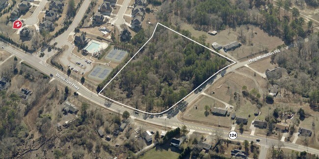
4601 Braselton Hwy
3-003-079
HOG MTN BRASELTON RD
Supermarket
GWINNETT
C2
Georgia
B and X Area of moderate flood hazard, usually the area between the limits of the 100-year and 500-year floods.
2
2025
2.57 AC
2025
Lawrenceville/Lilburn
050619
Atlanta
7,360 SF
Atlanta-Sandy Springs-Roswell, GA
NEARBY LISTINGS FOR SALE OR LEASE
DEMOGRAPHICS near 4601 Braselton Hwy
1 mile
3 mile
5 mile
2025 Total Population
5,948
38,018
106,695
2030 Population
6,337
40,559
114,417
Pop Growth 2025-2030
+ 6.54%
+ 6.68%
+ 7.24%
Average Age
37
39
39
2025 Total Households
1,787
11,758
34,096
HH Growth 2025-2030
+ 6.72%
+ 6.96%
+ 7.52%
Median Household Inc
$133,854
$122,195
$112,929
Avg Household Size
3.30
3.20
3.10
2025 Avg HH Vehicles
2.00
2.00
2.00
Median Home Value
$483,836
$492,362
$440,093
Median Year Built
2001
2004
2004
Nearby Places
Map Layers
Map Styles
 Street
 Aerial
Transit
 Traffic
 Biking
Places
Listings with unknown addresses are not visible on the map
- Restaurants
- Banks
- Shops
- Fitness
- Groceries
SALE & LEASE HISTORY
LISTING DATE
SALE/LEASE

Sep 27, 2019
For Sale
Aug 15, 2018
For Sale
Nearby Properties
Address
Land Use
TOTAL SIZE
Lot Size
Zoning
Address
Land Use
TOTAL SIZE
Lot Size
Zoning
473,883 SF
85.71 AC
RA200
Address
Land Use
TOTAL SIZE
Lot Size
Zoning
891.66 AC
R100
Address
Land Use
TOTAL SIZE
Lot Size
Zoning
379,680 SF
76.71 AC
R100
Address
Land Use
TOTAL SIZE
Lot Size
Zoning
372,813 SF
172.70 AC
RA200
Address
Land Use
TOTAL SIZE
Lot Size
Zoning
404,091 SF
58.20 AC
RA200
Address
Land Use
TOTAL SIZE
Lot Size
Zoning
30,720 SF
12.28 AC
G-C
Address
Land Use
TOTAL SIZE
Lot Size
Zoning
263,400 SF
8.65 AC
PRD
Address
Land Use
TOTAL SIZE
Lot Size
Zoning
134,673 SF
29.74 AC
RA200
Address
Land Use
TOTAL SIZE
Lot Size
Zoning
138,229 SF
7.97 AC
OI
Address
Land Use
TOTAL SIZE
Lot Size
Zoning
23,126 SF
88.56 AC
RA200
Address
Land Use
TOTAL SIZE
Lot Size
Zoning
93,702 SF
5.66 AC
C2
Address
Land Use
TOTAL SIZE
Lot Size
Zoning
84,890 SF
20.02 AC
RA200
Address
Land Use
TOTAL SIZE
Lot Size
Zoning
41,757 SF
19.66 AC
RA200
Address
Land Use
TOTAL SIZE
Lot Size
Zoning
117,207 SF
12.97 AC
C2
Address
Land Use
TOTAL SIZE
Lot Size
Zoning
82,604 SF
13.11 AC
G-C
Address
Land Use
TOTAL SIZE
Lot Size
Zoning
89,487 SF
11.15 AC
C2
Address
Land Use
TOTAL SIZE
Lot Size
Zoning
71,951 SF
8.78 AC
PRD
Address
Land Use
TOTAL SIZE
Lot Size
Zoning
24,490 SF
8.30 AC
C2
Address
Land Use
TOTAL SIZE
Lot Size
Zoning
15,000 SF
7.53 AC
G-C
Address
Land Use
TOTAL SIZE
Lot Size
Zoning
35,318 SF
6.72 AC
G-C
Address
Land Use
TOTAL SIZE
Lot Size
Zoning
33,048 SF
2.50 AC
C1
Address
Land Use
TOTAL SIZE
Lot Size
Zoning
17,900 SF
21.18 AC
RA200
Address
Land Use
TOTAL SIZE
Lot Size
Zoning
8,204 SF
5.25 AC
G-C
Address
Land Use
TOTAL SIZE
Lot Size
Zoning
50,388 SF
12 AC
C2
Address
Land Use
TOTAL SIZE
Lot Size
Zoning
27,655 SF
2.95 AC
C2
Address
Land Use
TOTAL SIZE
Lot Size
Zoning
43,930 SF
6.93 AC
C2
Address
Land Use
TOTAL SIZE
Lot Size
Zoning
24,500 SF
10.71 AC
RA200
Address
Land Use
TOTAL SIZE
Lot Size
Zoning
191.82 AC
PUD
Address
Land Use
TOTAL SIZE
Lot Size
Zoning
93,158 SF
2.04 AC
PRD
Address
Land Use
TOTAL SIZE
Lot Size
Zoning
17,110 SF
5.73 AC
PCD
The World's #1 Commercial Real Estate Marketplace
Connect with us
© 2026 CoStar Group
The information above has been obtained from sources believed reliable. While we do not doubt its accuracy we have not verified it and make no guarantee, warranty or representation about it. It is your responsibility to independently confirm its accuracy and completeness. Any projections, opinions, assumptions, or estimates used are for example only and do not represent the current or future performance of the property. The value of this transaction to you depends on tax and other factors which should be evaluated by your tax, financial, and legal advisors. You and your advisors should conduct a careful, independent investigation of the property to determine to your satisfaction the suitability of the property for your needs.