Property Record
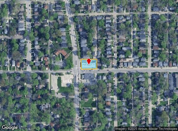
4601 N College Ave, Indianapolis, IN 46205

NEARBY LISTINGS FOR SALE OR LEASE
Property Detail
4601 N College Ave
Indianapolis-Carmel-Anderson, IN
Northcroft
49-06-13-121-004.000-801
NORTHCROFT L1 & L2 (APPROX 16,082 SF)
Storebuilding
Marion
X
Indiana
18097C0134F
1
2023
0.37 AC
2024
Uptown
322300
Indianapolis
9,565 SF
DEMOGRAPHICS near 4601 N College Ave
1 Mile
3 Mile
5 Mile
2024 Total Population
15,579
99,932
263,482
2029 Population
15,346
100,156
264,227
Pop Growth 2024-2029
(1.50%)
+ 0.22%
+ 0.28%
Average Age
37
37
37
2024 Total Households
7,006
43,908
114,475
HH Growth 2024-2029
(1.61%)
+ 0.06%
+ 0.23%
Median Household Inc
$83,312
$62,174
$58,804
Avg Household Size
2.20
2.10
2.20
2024 Avg HH Vehicles
2.00
2.00
2.00
Median Home Value
$311,653
$258,704
$230,234
Median Year Built
1946
1952
1959
Nearby Places
Map Layers
Map Styles
 Street
 Aerial
- Restaurants
- Banks
- Shops
- Fitness
- Groceries
PUBLIC TRANSPORTATION
COMMUTER RAIL
Indianapolis (Cardinal - Amtrak)
DRIVE
WALK
Distance
Indianapolis (Cardinal - Amtrak)
13 min
6.1 mi
AIRPORT
Indianapolis International
DRIVE
WALK
Distance
Indianapolis International
37 min
19.2 mi
Freight Ports
Port of Toledo
DRIVE
WALK
Distance
Port of Toledo
262 min
220.5 mi
SALE & LEASE HISTORY
LISTING DATE
SALE/LEASE

Dec 12, 2017
For Lease
Nearby Properties
Address
Land Use
TOTAL SIZE
Lot Size
Zoning
Address
Land Use
TOTAL SIZE
Lot Size
Zoning
296,086 SF
6.19 AC
ZO01
Address
Land Use
TOTAL SIZE
Lot Size
Zoning
866 SF
14.33 AC
ZO01
Address
Land Use
TOTAL SIZE
Lot Size
Zoning
76,657 SF
9.45 AC
ZO01
Address
Land Use
TOTAL SIZE
Lot Size
Zoning
207,800 SF
2.23 AC
ZO01
Address
Land Use
TOTAL SIZE
Lot Size
Zoning
4,808 SF
5.76 AC
ZO01
Address
Land Use
TOTAL SIZE
Lot Size
Zoning
2,505 SF
13.80 AC
ZO01
Address
Land Use
TOTAL SIZE
Lot Size
Zoning
2,156 SF
0.46 AC
ZO01
Address
Land Use
TOTAL SIZE
Lot Size
Zoning
2,142 SF
9.91 AC
ZO01
Address
Land Use
TOTAL SIZE
Lot Size
Zoning
2,288 SF
6 AC
ZO01
Address
Land Use
TOTAL SIZE
Lot Size
Zoning
2.81 AC
ZO01
Address
Land Use
TOTAL SIZE
Lot Size
Zoning
23,195 SF
31.18 AC
Address
Land Use
TOTAL SIZE
Lot Size
Zoning
13,789 SF
3.93 AC
ZO01
Address
Land Use
TOTAL SIZE
Lot Size
Zoning
42,611 SF
151.50 AC
ZO01
Address
Land Use
TOTAL SIZE
Lot Size
Zoning
61,534 SF
5.35 AC
Address
Land Use
TOTAL SIZE
Lot Size
Zoning
98,790 SF
0.18 AC
ZO01
Address
Land Use
TOTAL SIZE
Lot Size
Zoning
5,670 SF
25.69 AC
Address
Land Use
TOTAL SIZE
Lot Size
Zoning
20,746 SF
28.38 AC
ZO01
Address
Land Use
TOTAL SIZE
Lot Size
Zoning
1,903 SF
20.77 AC
ZO01
Address
Land Use
TOTAL SIZE
Lot Size
Zoning
7,740 SF
2.04 AC
ZO01
Address
Land Use
TOTAL SIZE
Lot Size
Zoning
17,469 SF
0.87 AC
ZO01
Address
Land Use
TOTAL SIZE
Lot Size
Zoning
46,320 SF
14.93 AC
ZO01
Address
Land Use
TOTAL SIZE
Lot Size
Zoning
66,953 SF
10.87 AC
ZO01
Address
Land Use
TOTAL SIZE
Lot Size
Zoning
17,621 SF
3.20 AC
ZO01
Address
Land Use
TOTAL SIZE
Lot Size
Zoning
1,551 SF
1.23 AC
ZO01
Address
Land Use
TOTAL SIZE
Lot Size
Zoning
4,692 SF
25.76 AC
Address
Land Use
TOTAL SIZE
Lot Size
Zoning
188,212 SF
28.51 AC
Address
Land Use
TOTAL SIZE
Lot Size
Zoning
2,927 SF
8.75 AC
ZO01
Address
Land Use
TOTAL SIZE
Lot Size
Zoning
10,006 SF
8.89 AC
ZO01
Address
Land Use
TOTAL SIZE
Lot Size
Zoning
72,027 SF
0.80 AC
ZO01
Address
Land Use
TOTAL SIZE
Lot Size
Zoning
194,158 SF
19.29 AC
ZO01
The World's #1 Commercial Real Estate Marketplace
Connect with us
© 2025 CoStar Group
The information above has been obtained from sources believed reliable. While we do not doubt its accuracy we have not verified it and make no guarantee, warranty or representation about it. It is your responsibility to independently confirm its accuracy and completeness. Any projections, opinions, assumptions, or estimates used are for example only and do not represent the current or future performance of the property. The value of this transaction to you depends on tax and other factors which should be evaluated by your tax, financial, and legal advisors. You and your advisors should conduct a careful, independent investigation of the property to determine to your satisfaction the suitability of the property for your needs.