Property Record
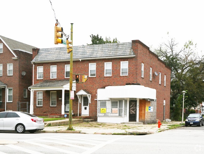
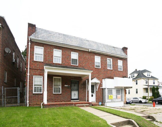
4603 Park Heights Ave, Baltimore, MD 21215

NEARBY LISTINGS FOR SALE OR LEASE
Property Detail
4603 Park Heights Ave
Baltimore
Ward 27 Sec 18
Baltimore-Columbia-Towson, MD
Baltimore City
4626A-011A
Maryland
Sfr
0.08 AC
X
Baltimore Northwest
2400100385G
DEMOGRAPHICS near 4603 Park Heights Ave
1 Mile
3 Mile
5 Mile
2024 Total Population
26,858
176,424
480,150
2029 Population
26,227
170,668
468,316
Pop Growth 2024-2029
(2.35%)
(3.26%)
(2.46%)
Average Age
43
40
40
2024 Total Households
11,062
73,246
203,387
HH Growth 2024-2029
(2.73%)
(3.51%)
(2.74%)
Median Household Inc
$41,854
$56,629
$56,044
Avg Household Size
2.30
2.20
2.20
2024 Avg HH Vehicles
1.00
1.00
1.00
Median Home Value
$145,562
$239,652
$229,458
Median Year Built
1949
1951
1953
Nearby Places
Map Layers
Map Styles
 Street
 Aerial
- Restaurants
- Banks
- Shops
- Fitness
- Groceries
PUBLIC TRANSPORTATION
TRANSIT/SUBWAY
West Cold Spring (Metro Subway - Maryland Transit Administration Metro Subway (Baltimore Metro))
DRIVE
WALK
Distance
West Cold Spring (Metro Subway - Maryland Transit Administration Metro Subway (Baltimore Metro))
4 min
16 min
0.8 mi
COMMUTER RAIL
West Baltimore (Penn Line - Maryland Area Regional Commuter Trains (The MARC))
DRIVE
WALK
Distance
West Baltimore (Penn Line - Maryland Area Regional Commuter Trains (The MARC))
11 min
4.0 mi
Penn Station (Penn Line - Maryland Area Regional Commuter Trains (The MARC))
DRIVE
WALK
Distance
Penn Station (Penn Line - Maryland Area Regional Commuter Trains (The MARC))
11 min
4.9 mi
AIRPORT
Baltimore/Washington International Thurgood Marshall
DRIVE
WALK
Distance
Baltimore/Washington International Thurgood Marshall
29 min
13.8 mi
Ronald Reagan Washington Ntl
DRIVE
WALK
Distance
Ronald Reagan Washington Ntl
75 min
46.1 mi
Freight Ports
Port of Baltimore
DRIVE
WALK
Distance
Port of Baltimore
14 min
6.5 mi
SALE & LEASE HISTORY
LISTING DATE
SALE/LEASE

Nov 17, 2021
For Sale
Nearby Properties
Address
Land Use
TOTAL SIZE
Lot Size
Zoning
Address
Land Use
TOTAL SIZE
Lot Size
Zoning
1,632,000 SF
106.32 AC
EC-2
Address
Land Use
TOTAL SIZE
Lot Size
Zoning
941,727 SF
36.89 AC
TOD-3
Address
Land Use
TOTAL SIZE
Lot Size
Zoning
810,716 SF
28.88 AC
H
Address
Land Use
TOTAL SIZE
Lot Size
Zoning
1,228,117 SF
9.43 AC
C-2
Address
Land Use
TOTAL SIZE
Lot Size
Zoning
256,816 SF
1.27 AC
EC-2
Address
Land Use
TOTAL SIZE
Lot Size
Zoning
599,187 SF
30.14 AC
EC-2
Address
Land Use
TOTAL SIZE
Lot Size
Zoning
743.89 AC
OS
Address
Land Use
TOTAL SIZE
Lot Size
Zoning
372,287 SF
0.98 AC
R-10
Address
Land Use
TOTAL SIZE
Lot Size
Zoning
34.99 AC
R-5
Address
Land Use
TOTAL SIZE
Lot Size
Zoning
567,521 SF
8.12 AC
R-9
Address
Land Use
TOTAL SIZE
Lot Size
Zoning
543,281 SF
7.28 AC
C-2
Address
Land Use
TOTAL SIZE
Lot Size
Zoning
366,234 SF
1.12 AC
R-10
Address
Land Use
TOTAL SIZE
Lot Size
Zoning
117,000 SF
71.11 AC
EC-2
Address
Land Use
TOTAL SIZE
Lot Size
Zoning
430,271 SF
56.35 AC
EC-2
Address
Land Use
TOTAL SIZE
Lot Size
Zoning
507,813 SF
4.94 AC
TOD-2
Address
Land Use
TOTAL SIZE
Lot Size
Zoning
457,289 SF
29.52 AC
TOD-2
Address
Land Use
TOTAL SIZE
Lot Size
Zoning
211,229 SF
7.46 AC
R-9
Address
Land Use
TOTAL SIZE
Lot Size
Zoning
173,057 SF
17.22 AC
Address
Land Use
TOTAL SIZE
Lot Size
Zoning
33.46 AC
DR16
Address
Land Use
TOTAL SIZE
Lot Size
Zoning
27.30 AC
DR16
Address
Land Use
TOTAL SIZE
Lot Size
Zoning
367,920 SF
2.87 AC
R-9
Address
Land Use
TOTAL SIZE
Lot Size
Zoning
54.25 AC
EC-1
Address
Land Use
TOTAL SIZE
Lot Size
Zoning
507 SF
3.58 AC
R-10
Address
Land Use
TOTAL SIZE
Lot Size
Zoning
245,951 SF
58.90 AC
EC-1
Address
Land Use
TOTAL SIZE
Lot Size
Zoning
1.15 AC
R-10
Address
Land Use
TOTAL SIZE
Lot Size
Zoning
814,033 SF
23.60 AC
OR-2
Address
Land Use
TOTAL SIZE
Lot Size
Zoning
117,680 SF
23.12 AC
H
Address
Land Use
TOTAL SIZE
Lot Size
Zoning
334,557 SF
52 AC
R-6
Address
Land Use
TOTAL SIZE
Lot Size
Zoning
24 AC
02
Address
Land Use
TOTAL SIZE
Lot Size
Zoning
13.26 AC
EC-2
The World's #1 Commercial Real Estate Marketplace
Connect with us
© 2025 CoStar Group
The information above has been obtained from sources believed reliable. While we do not doubt its accuracy we have not verified it and make no guarantee, warranty or representation about it. It is your responsibility to independently confirm its accuracy and completeness. Any projections, opinions, assumptions, or estimates used are for example only and do not represent the current or future performance of the property. The value of this transaction to you depends on tax and other factors which should be evaluated by your tax, financial, and legal advisors. You and your advisors should conduct a careful, independent investigation of the property to determine to your satisfaction the suitability of the property for your needs.